
Place · 2 mi away
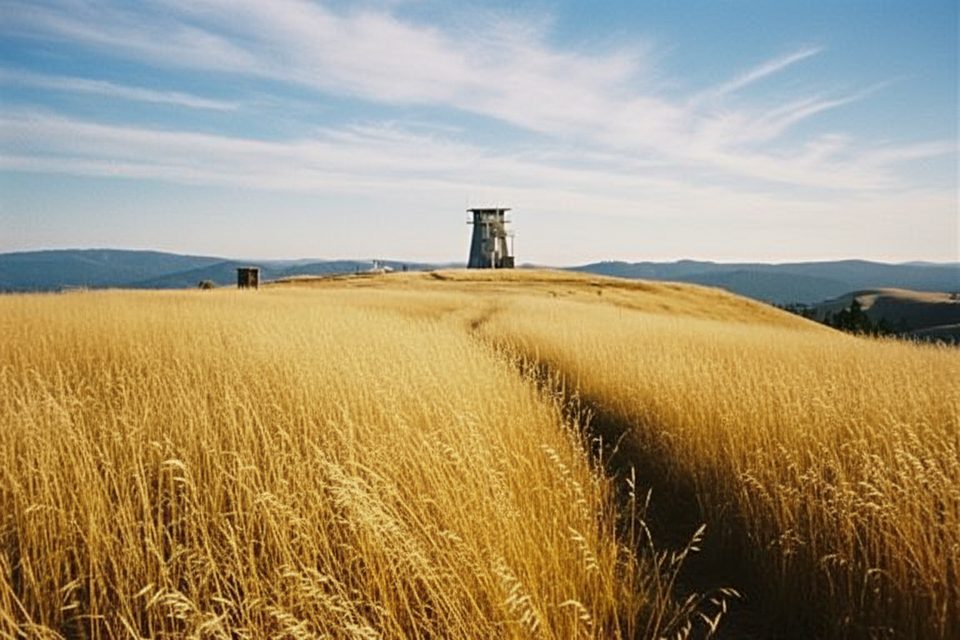
Schoolhouse Peak (3,097 ft) is the high point of the Bald Hills—where towering redwoods give way to open prairies and oak savanna. It’s a simple, rewarding destination: you’re here for the wide-open views over the Redwood Creek watershed and the sense of being above it all. The lookout tower itself is closed to climbing, but the panorama from the summit area is the star.
From Orick, head up Bald Hills Road for about 17.7 miles, then turn left on the signed spur for the lookout and continue roughly 0.4–0.5 mile. Expect narrow, winding pavement that transitions to rough gravel near the top; the final approach can be steep. A gate is commonly closed near the end—park off the road and walk about 200 yards to the lookout area. There are no facilities at the summit. The nearest restroom is at Lady Bird Johnson Grove, about 2.6 miles up Bald Hills Road from US‑101.
GPS can misroute in this park; bring the official park map and use Bald Hills Road as your primary navigator. Traffic is mixed, and occasional logging trucks use portions of the corridor—drive or ride predictably.
If you like a good grind, the classic out-and-back from Orick is about 38 miles with 4,500+ feet of climbing. The first 2.6 miles of Bald Hills Road are notably steep, and the upper approach includes gravel (historically the last ~2.3 miles to the lookout). The final half-mile can pitch to around 13% on a rough surface—many riders walk short sections. A gravel bike is most comfortable; sturdy road setups have done it with care. Use a bright rear light and ride predictably; bears are reported around Lyons Ranch, so make noise on blind bends and never approach wildlife.
Expect cool, dry summers and mild, wet winters. Winter often brings wind on the exposed summit and leafless oaks across the hills; summer is the most straightforward for dry-road conditions. This spot tends to stay quiet simply because it’s a long way up Bald Hills Road.
These hills sit in one of the most seismically active corners of the U.S., influenced by plate interactions at the offshore Mendocino Triple Junction. Uplift and frequent earthquakes have helped shape the rugged, landslide-prone terrain you’re looking across.
Summer and fair-weather days deliver the easiest conditions and the best chance for clear views. It’s typically low-crowd even on weekends thanks to the long, winding approach.
Place · 2 mi away
Place · 5.8 mi away
Place · 7.4 mi away
Place · 9.1 mi away
Moderate · 0.8 mi away
Challenging · 5.1 mi away
Challenging · 6.9 mi away
Easy · 12.6 mi away

Parkwolf Tour Guide
