
Place · 1.7 mi away
Moderate
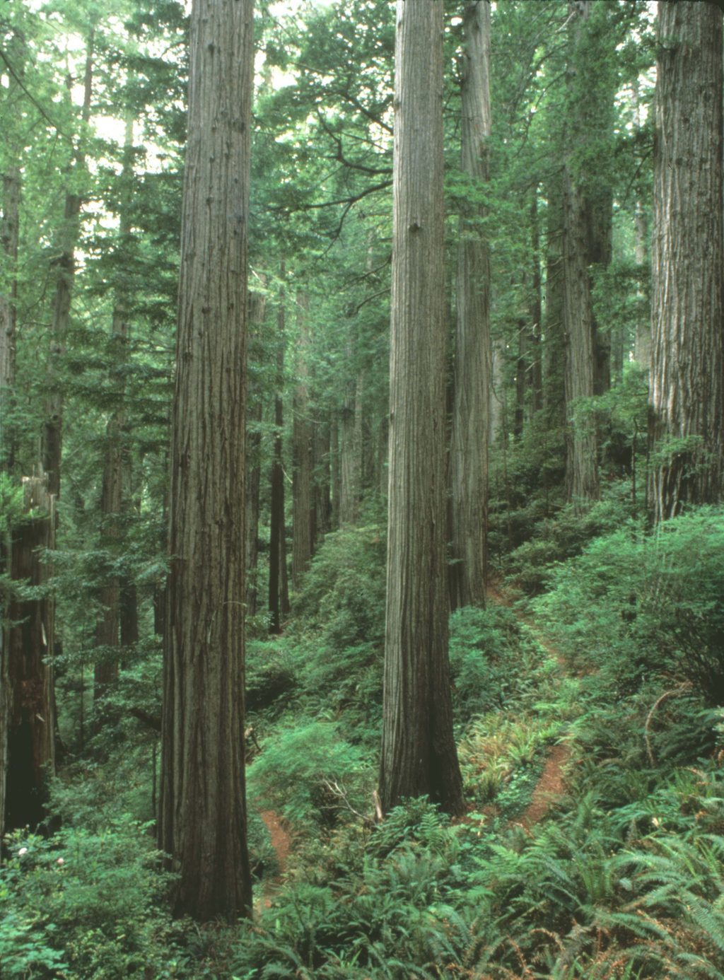
This is a quieter, work-for-it slice of the California Coastal Trail that trades crowds for atmosphere. The out-and-back route is 8.7 miles total with about 1,925 feet of elevation gain and typically takes around 4.5 hours. It starts near Marshall Pond and climbs from alder and spruce into a remnant of old-growth upland redwoods before dropping toward the coast and ending at Coastal Drive. Expect a steady grind and a surprisingly varied forest—plus the odd soundtrack swap from highway hum to ocean roar as you near the coast.
If you’re short on time or energy, the best redwoods are in the first couple miles of the climb. A turn-around at roughly the 2-mile mark makes for a rewarding ~4-mile “greatest hits” version with less effort.
From Alder Camp Road by Marshall Pond, walk a short way to the signed trail, skirt the pond, then at the dirt road go left and left again to follow the pond’s north shore as singletrack begins climbing. These early junctions are subtle—bring an offline map. The grade carries you through alder/spruce into old-growth with lush groundcover; near the ridge, the forest tightens and huckleberry shrubs get thick. On the west side, you’ll meet the spur toward Flint Ridge Camp and then finish at Coastal Drive. There’s an unofficial, steep, overgrown path down to the beach here—don’t plan on using it.
The charm is in the forest: a mix of big, characterful redwoods (the “best” are early), sorrel and salal carpeting the ground, and ferns everywhere. As you climb, look for the transition to denser huckleberry. Banana slugs are common. In season, you may spot woodland wildflowers like giant trillium and miner’s lettuce. This corridor also follows the line of a late-1800s wagon road that once hugged cliff edges to spare large redwoods—some segments in the region remain drivable while others slipped and became trail.
Parts can be overgrown, including stinging nettles and salmonberry in places—long pants help. The tread can be faint around the early road crossings, so download an offline map. Expect a distant Highway 101 hum over much of the route, especially on the east side; on the west side, the surf takes over. The start near Marshall Pond can get muddy after wet weather. Bugs can be active. If you’re hiking in late summer, layers are smart—coastal air is cool—and you might find blackberries by the pond edges.
This is a year-round option, but late spring through early fall is most comfortable. Summer brings cool, often foggy coastal air—great for climbing, less great for views—so start early for quiet and easier parking. After rains, expect mud and slick roots. For a quick fix, that 2-mile “best redwoods” out-and-back is lovely on a foggy morning.
Trailheads bookend the ridge: the primary start is at Alder Camp Road by Marshall Pond; the west end is on Coastal Drive near Flint Ridge Camp. Parking is limited at both ends, and access or small lots have closed at times—check current status before you go. Flint Ridge Camp sits about a quarter-mile from Coastal Drive and serves backpackers; permits are required for backcountry camping.
Primary parking is along Alder Camp Road by Marshall Pond; the west end has a small dirt pullout on Coastal Drive near Flint Ridge Camp. Space is limited and access/lot status has varied seasonally—verify before you go.
Long pants advised for overgrowth (nettles, salmonberry). Early junctions near Marshall Pond are subtle—carry an offline map. The beach path at the west end is unofficial, steep, and overgrown; don’t attempt it.
Place · 1.7 mi away
Place · 1.9 mi away
Place · 3 mi away
Place · 4.7 mi away
Moderate · 3 mi away
Moderate · 5.5 mi away
Easy · 5.5 mi away
Challenging · 9.3 mi away

Parkwolf Tour Guide
