
Place · 0.5 mi away
Challenging
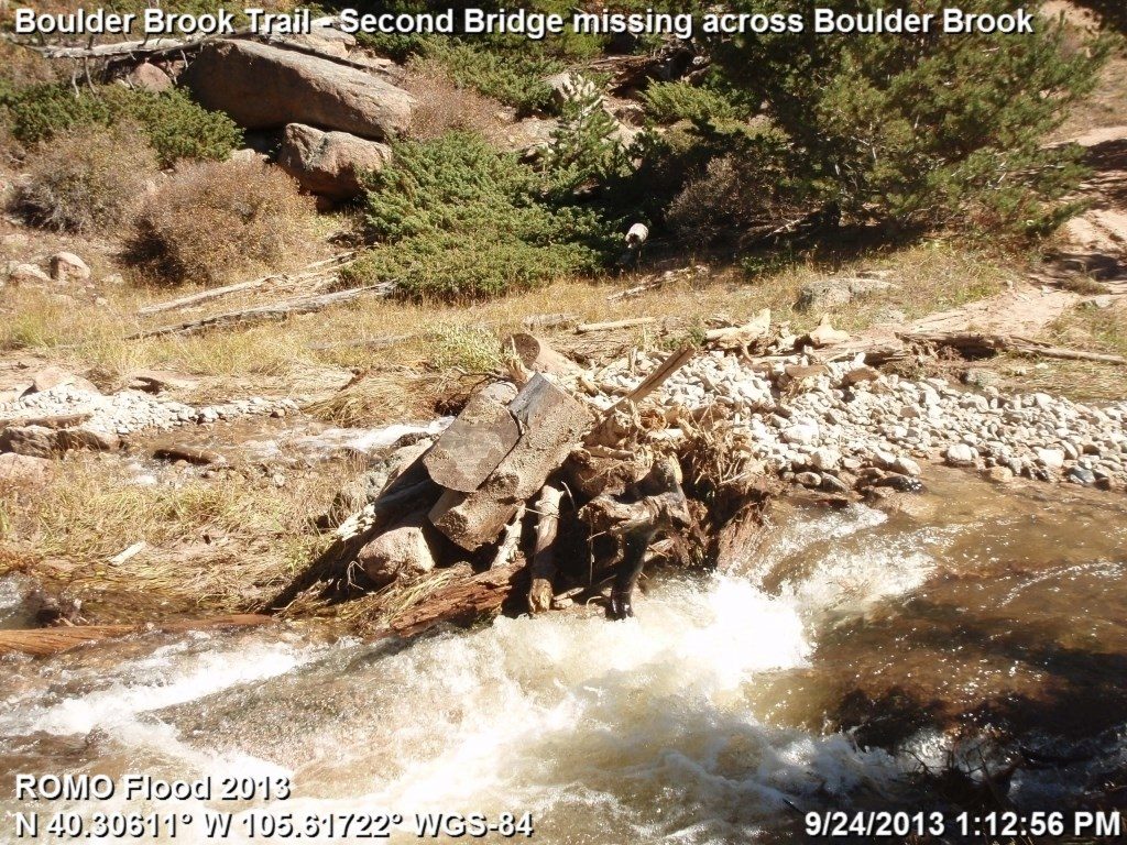
If you like water, you’ll love this one. Boulder Brook Trail climbs hard alongside its namesake creek through pine and spruce–fir forest, trading big vistas for nonstop cascades, shaded tread, and relative solitude. The standard out-and-back is about 4.8 miles total with roughly 1,496 feet of gain and takes most hikers around 3 hours. Expect sustained, rocky grades with a few stretches over 20%—not technical, but definitely a workout.
Most people hike to the junction with the North Longs Peak Trail and turn around—that keeps the experience focused on the brook. If you want more, there’s a longer loop (about 8.3–8.6 miles, 1,510–1,624 feet of gain, roughly 4–5 hours) that links Boulder Brook with the North Longs Peak and Glacier Creek trails. You’ll pass Glacier Knobs and Alberta Falls and snag occasional glimpses of Longs Peak, Mount Lady Washington, and Half Mountain. Pro tip: do the loop clockwise so you ascend the steep Boulder Brook side and descend the more forgiving North Longs/Glacier Creek side. The loop is not recommended in winter, and cell service is spotty—download an offline map.
There’s also a point‑to‑point option (about 6.3 miles) that connects Boulder Brook with Glacier Gorge, but note the park shuttle does not stop at Storm Pass; you’ll need to plan a pickup or walk to a shuttle stop.
Common starts are Glacier Gorge, Sprague Lake, or the tiny Storm Pass lot (only a handful of spaces). The Bear Lake Road shuttle serves Glacier Gorge and nearby stops, but it does not stop directly at Storm Pass—walk to Bierstadt Lake if you need the shuttle. Lots fill early; arrive at dawn if you want an easy parking day. No roadside parking near Glacier Gorge.
Late spring through fall is prime. Spring runoff supercharges the cascades; summer brings cool, forested shade; and fall lights up nearby aspen pockets with gold. Start early for cooler temps, softer light on the water, and fewer people near Alberta Falls. In winter and shoulder seasons, expect deep snow and ice—bring traction or snowshoes—and save the full loop for when it’s melted out.
Keep an eye out for elk and mule deer in the meadows and Steller’s jays chattering in the trees; chipmunks and squirrels are frequent trail companions. Water looks pristine, but treat anything you pull from the creek. Designated backcountry sites sit near 10,200 feet (two individual, one group). You’ll need a permit; campfires are prohibited; bear‑resistant canisters are required April 1–October 31; there’s no privy—pack out human waste. Pets are not allowed on park trails.
Underrated if you’re into creeks and cascades, overrated if you’re chasing alpine lakes and big‑vista summits. Come for the water and the quiet—just be ready for a stout climb and plan your parking/shuttle strategy.
Start from Glacier Gorge, Sprague Lake, or the very small Storm Pass trailhead. The Bear Lake Road shuttle serves Glacier Gorge but not Storm Pass; walk to Bierstadt Lake to catch it. Arrive early—lots fill quickly—and do not park along the road near Glacier Gorge.
Steep, rocky grades (over 20% in spots) can be slippery when wet, icy, or snowy—carry traction in cold seasons. Limited cell service; download offline maps. Treat all creek water. Backcountry campfires prohibited; bear canisters required Apr 1–Oct 31. The longer loop is not recommended in winter.
Place · 0.5 mi away
Place · 0.8 mi away
Place · 1.4 mi away
Place · 1.4 mi away
Challenging · 0 mi away
Moderate · 0.2 mi away
Easy · 0.8 mi away
Moderate · 1.3 mi away

Parkwolf Tour Guide
