Parking
Start at the Bear Lake Parking Area and Trailhead at the end of Bear Lake Road. The lot often fills early; use the park shuttle when it is operating.

Rocky Mountain National Park, CO
Four lakes and Alberta Falls on a high country loop
Overview
Map & elevation
Plan your hike

The highest, rockiest slopes around here are a summer buffet for grizzly bears.
Rocky Mountain Tour Guide
Parkwolf is a GPS audio tour guide for Rocky Mountain National Park. As you drive, it chimes in with what’s ahead: hidden gems, upcoming stops, history, geology, and wildlife, right through your car’s speakers.
See the Rocky Mountain audio tourRecorded for this trailhead
Bear Lake and a Shorter Mountain Walk“You're coming up on Bear Lake, where a short path from the parking area reaches the water beneath Hallett Peak. I'd stop even if you're not planning a hike.”
Plays as you drive up to this trailhead in the Parkwolf Rocky Mountain Tour Guide.
More stories near here in the app
“…No cell service for majority of the day but had continuous access to the app - the maps, the tour guide as you drive is amazing. Highly recommend purchasing the subscription.”


Trail guide
Four Lakes Loop is a 5.7-mile circuit from Bear Lake Trailhead through the Bear Lake stop, Nymph Lake, a short Dream Lake branch, Lake Haiyaha and the Glacier Gorge corridor past Alberta Falls, returning to the start. The distance covers the mapped loop, including the Dream and Haiyaha detours; it leaves out the separate Bear Lake shoreline circuit and Emerald Lake spur. Allow about four hours. Repeated climbs, high elevation and the rough approach to Haiyaha make this a more demanding half-day than the mileage alone suggests.
Start from Bear Lake Trailhead and follow the signed route toward Nymph rather than adding the separate shoreline circuit. The busy trail climbs through the forest; much of this lower approach is paved. Nymph Lake appears after about half a mile, a small pond edged with pond lilies. The short climb beyond it opens views toward Longs Peak, the Keyboard of the Winds and Hallett Peak. At the junction, take the brief branch to Dream Lake. The east shore frames Hallett Peak and Flattop Mountain across the water, with Tyndall Gorge between them; return to the junction for the Haiyaha route.
The branch toward Haiyaha climbs fairly steeply through dense pine, then levels near an opening with views across Glacier Basin and back toward Bear and Nymph lakes. The last roughly 50 yards to the shore cross rugged, uneven boulders. Lake Haiyaha sits among a much larger boulder field; the water and the surrounding high peaks make this the loop’s most distinctive stop. This short rough section is the main reason to turn around if scrambling over irregular rock is uncomfortable. Retrace the same branch to its junction.
From the Haiyaha junction, follow the Glacier Gorge route toward Mills Junction and then Alberta Falls. Trails to Mills Lake and The Loch are separate branches, so check signs and keep to the Bear Lake and Alberta Falls direction. The route descends to Alberta Falls, a roughly 30-foot cascade in a small gorge, then climbs from the Glacier Creek junction back to Bear Lake. That final uphill stretch closes the loop.
The trailhead is around 9,475 feet, and the route climbs above 10,000 feet. Take the altitude and the repeated ups and downs into account when choosing a pace. High-country weather changes quickly, and snow or ice can linger on higher trail sections; check the park’s current conditions before setting out. During the seasonal timed-entry period, choose the reservation option that includes Bear Lake Road and confirm the current dates and entry hours. The Bear Lake lot often fills early; the park shuttle is a useful alternative when operating. Pets are prohibited on park trails; service animals are allowed.
Wildlife
 3,124 sightingsElkMost seen around 6 PMSighting map
 1,601 sightingsMooseMost seen around 7 PMSighting map
 19 sightingsMountain GoatMost seen around 7 AMSighting map
 19 sightingsBald EagleMost seen around 8 AMSighting map
 30 sightingsGolden EagleMost seen around 10 AMSighting map
 270 sightingsBighorn SheepMost seen around 11 AMSighting map
Sighting maps show where each species has been reported across Rocky Mountain. Wildlife moves, so no sighting is guaranteed.
Keep exploring
 ModerateEmerald Lake Trail3.4 mi · 2.5 hr · At the trailheadThree alpine lakes, then Hallett Peak and a waterfall.
 EasyBear Lake Loop0.6 mi · 30 min · At the trailheadA short lakeside loop with Hallett Peak in view.
 ModerateLake Haiyaha Trail4.2 mi · 3.5 hr · At the trailheadA boulder-lined alpine lake beyond Nymph and Dream lakes.
 ChallengingBear Lake to Fern Lake Trailhead9.2 mi · 7 hr · At the trailheadTwo lake detours, then a long descent to Fern Falls.
 ModerateBear Lake to Two Rivers Lake and Lake Helene Trail6.3 mi · 3.5 hr · At the trailheadTwo high lakes, faint spurs, and a close view of Notchtop.ChallengingOdessa Lake Trail from Bear Lake8.2 mi · 5.5 hr · At the trailheadA long climb, then Odessa Gorge opens to the lake.
 ModerateBierstadt Lake from Bear Lake Trailhead4.4 mi · 3 hr · At the trailheadA Bear Lake climb to a lakeshore under the Continental Divide.ModerateDream Lake Trail2.2 mi · 1.5 hr · At the trailheadA steady climb to a classic alpine lake below Hallett Peak.
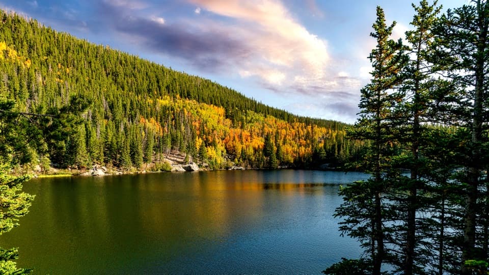 Sight · 0.2 mi awayBear LakeA classic alpine lake, with Hallett Peak just beyond the shore.
 Sight · 0.3 mi awayNymph LakeA short uphill walk to summer lily pads and mountain views.
 Sight · 0.7 mi awayDream LakeA mile from Bear Lake, Hallett Peak fills the skyline.
 Sight · 0.7 mi awayAlberta FallsA short, uphill hike ends at a thunderous waterfall.Sight · 1 mi awayLake HaiyahaA mountain lake tinted green by a 2022 rockslide.
 Sight · 1.2 mi awayEmerald LakeThree lakes in, the trail ends beneath steep mountain walls.
 Sight · 1.5 mi awayThe LochAfter a real climb, alpine peaks mirror across the lake.
 Sight · 1.5 mi awayBierstadt LakeMountain reflections reward the steep walk in.
Parkwolf’s Rocky Mountain ranking

The audio tour guide for the drive, plus offline maps, trails, and wildlife heatmaps for when the signal drops.

