
Place
Challenging
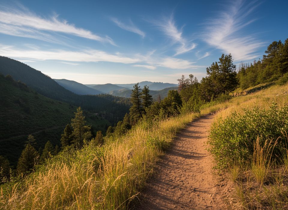
If you like your RMNP hikes quiet, steady, and earned, this is your corridor. Starting outside the park at the Dunraven Trailhead, the North Fork Trail follows the North Fork of the Big Thompson through forest and meadows before entering the park and climbing toward Lost Lake. It’s an out-and-back of about 18.4 miles total to Lost Lake, with roughly 3,100–3,300 feet of gain and well-built tread with footbridges.
From the trailhead the path drops into a canyon and parallels the river. Expect a burn-scar meadow section around the early miles that’s more exposed. You’ll reach the RMNP boundary at roughly 4–4.5 miles, then continue through lusher forest and meadows toward the high basin. The steepest work hits around miles 7–8 on the approach to Lost Lake before the grade eases. Don’t want the full haul? A popular shorter day is the river-and-meadows out-and-back at about 10.1 miles total.
Early miles serve up shaded river walking, then open burn-scar meadows with recovery underway, and finally mossy, lusher forest beyond the park boundary. Wildflowers can be abundant, with birds and hummingbirds working the blooms. Push into the upper basins and you’re in moose country—give them space. Beyond Lost Lake, experienced hikers sometimes venture cross-country to high tundra lakes with big views, but those side trips are unmaintained.
This is a long, steady climb that many describe as beautiful but taxing—especially with an overnight pack. It’s not a quick-hit vista hike; the payoff is a quieter backcountry feel, a classic river-to-alpine progression, and options to explore farther if you have the legs and the skills.
Summer is prime for snow-free travel to the alpine. Expect typical afternoon storms; start early and aim to be off exposed terrain by early afternoon. The burn-scar meadows can be hot and buggy (biting flies) in late summer. Early summer brings a lively wildflower-and-hummingbird show, and the corridor’s aspens make fall appealing too.
Park at the Dunraven Trailhead (gravel lot, vault toilet). Water is plentiful along the river—bring a filter. This corridor starts outside the park, so you bypass timed-entry checkpoints for access. Dogs are allowed only before the RMNP boundary; they are not permitted on park trails, so plan to turn around near mile 4–4.5 if you bring a pet. Overnighting at Lost Lake requires a wilderness camping permit; expect no campfires, mandatory bear-resistant storage, and simple amenities. Stock use is allowed; you may encounter horses and manure.
Arrive early—weekends can fill the lot. Sun and bug protection pay off in the burn-scar meadows; a rain shell is smart for fast-building storms. Stay on the signed trail near private property and note the post-flood reroute. Cell service is limited. Trail footing is generally good but can be muddy in spots.
Dunraven Trailhead via Dunraven Glade Road; gravel lot (~23 vehicles) with a vault toilet. Arrive early on weekends.
Exposed burn-scar sections (heat and biting flies), fast-building afternoon storms above treeline, brief segment near private property—stay on trail, no dogs beyond the park boundary (~mile 4–4.5), occasional mud and stock traffic, limited cell service.
Place
Place
Place
Place
Challenging
Moderate
Moderate
Challenging

Parkwolf Tour Guide
