Parking
Start at the Bear Lake Trailhead lot on Bear Lake Road. It can fill early in peak periods; when operating, the Bear Lake shuttle from Park & Ride also reaches the trailhead. Check current park access and shuttle arrangements before you go.

#7 of 136 trails in Rocky Mountain
Rocky Mountain National Park, CO
A steep, high-altitude climb to a broad tundra plateau.
Overview
Map & elevation
Plan your hike

The highest, rockiest slopes around here are a summer buffet for grizzly bears.
Rocky Mountain Tour Guide
Parkwolf is a GPS audio tour guide for Rocky Mountain National Park. As you drive, it chimes in with what’s ahead: hidden gems, upcoming stops, history, geology, and wildlife, right through your car’s speakers.
See the Rocky Mountain audio tourRecorded for this trailhead
Bear Lake and a Shorter Mountain Walk“You're coming up on Bear Lake, where a short path from the parking area reaches the water beneath Hallett Peak. I'd stop even if you're not planning a hike.”
Plays as you drive up to this trailhead in the Parkwolf Rocky Mountain Tour Guide.
More stories near here in the app
“…No cell service for majority of the day but had continuous access to the app - the maps, the tour guide as you drive is amazing. Highly recommend purchasing the subscription.”


Trail guide
Flattop Mountain Trail is an 8.8-mile out-and-back from Bear Lake to a broad, treeless plateau at 12,324 feet. The climb gains about 2,849 feet from an already high trailhead, so this is a hard summit day, not a short viewpoint walk. Allow about six hours and room to slow down at altitude. The route ends at the North Inlet–Tonahutu junction on Flattop; Hallett Peak is a separate, rougher continuation and is not included. If you have the legs and feel good at elevation, this is one of the park’s best big days.
Start along Bear Lake’s eastern shore, then keep toward Flattop at the junction for Bierstadt Lake and Mill Creek, about half a mile in. Just past a mile, take the Flattop Mountain Trail up the eastern slope. The steady climb follows the Bierstadt Moraine through aspen. Dream Lake Overlook, about 1.7 miles from the start, gives you a high view over Dream Lake with Longs Peak beyond it. Near 2.4 miles, the trees thin out and the views open east over Bierstadt and Sprague Lakes and south toward Longs Peak. If you want a shorter outing, Dream Lake makes a sensible turnaround before the exposed high country.
Around three miles in, Emerald Lake Overlook sits more than 1,200 feet above the lake. It’s one of the route’s best photo stops: frame the lake with Hallett Peak behind it to show how far above the basin you are. From there the trail crosses open, rocky tundra, where wind and direct sun feel stronger and there’s little shelter. A horse hitch rack near 3.9 miles marks the final stretch; the last third of a mile eases into a shallow grade, but you’re still climbing at altitude.
At about 4.4 miles one way, the trail reaches the broad plateau at the North Inlet and Tonahutu Creek junction. There’s no summit sign or single pointed peak here; this flat high point is the usual Flattop turnaround. Look south to Hallett Peak, north to Notchtop and the Mummy Range, and northwest toward Ptarmigan Point and the Never Summer Range. Tyndall Glacier and Tyndall Gorge are visible from the upper route; stay on the trail rather than approaching glacier terrain. The Hallett Peak scramble continues beyond the junction and adds a different, more rugged objective.
Flattop is also part of an older east–west crossing. Historical accounts say Arapaho and Ute people likely used this corridor to reach traditional hunting grounds on the Great Plains; the Arapaho name reported for it is “The Big Trail.” The formal trail was built in 1925 and rehabilitated by the Civilian Conservation Corps in 1940. That history fits the route itself: this is a high crossing over the Continental Divide, not just a path to one viewpoint.
The mileage understates the effort: you start at 9,475 feet and gain nearly 2,850 feet before returning. The lower climb is sustained, and the altitude makes breaks and a slower pace worthwhile. A typical outing takes about six hours; some strong, acclimated hikers move faster, but don’t plan around the quickest reports. If you feel the elevation before Dream Lake, turning around there still makes a worthwhile walk.
Wildlife
 3,124 sightingsElkMost seen around 6 PMSighting map
 1,601 sightingsMooseMost seen around 7 PMSighting map
 19 sightingsMountain GoatMost seen around 7 AMSighting map
 19 sightingsBald EagleMost seen around 8 AMSighting map
 30 sightingsGolden EagleMost seen around 10 AMSighting map
 270 sightingsBighorn SheepMost seen around 11 AMSighting map
Sighting maps show where each species has been reported across Rocky Mountain. Wildlife moves, so no sighting is guaranteed.
Keep exploring
 ModerateDream Lake Trail2.2 mi · 1.5 hr · At the trailheadA steady climb to a classic alpine lake below Hallett Peak.ModerateFour Lakes Loop5.7 mi · 4 hr · At the trailheadFour lakes and Alberta Falls on a high country loop
 ModerateEmerald Lake Trail3.4 mi · 2.5 hr · At the trailheadThree alpine lakes, then Hallett Peak and a waterfall.
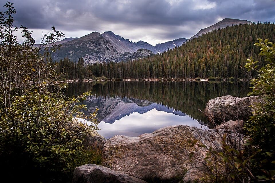 EasyBear Lake Loop0.6 mi · 30 min · At the trailheadA short lakeside loop with Hallett Peak in view.
 ModerateLake Haiyaha Trail4.2 mi · 3.5 hr · At the trailheadA boulder-lined alpine lake beyond Nymph and Dream lakes.
 ChallengingBear Lake to Fern Lake Trailhead9.2 mi · 7 hr · At the trailheadTwo lake detours, then a long descent to Fern Falls.
 ModerateBear Lake to Two Rivers Lake and Lake Helene Trail6.3 mi · 3.5 hr · At the trailheadTwo high lakes, faint spurs, and a close view of Notchtop.ChallengingOdessa Lake Trail from Bear Lake8.2 mi · 5.5 hr · At the trailheadA long climb, then Odessa Gorge opens to the lake.
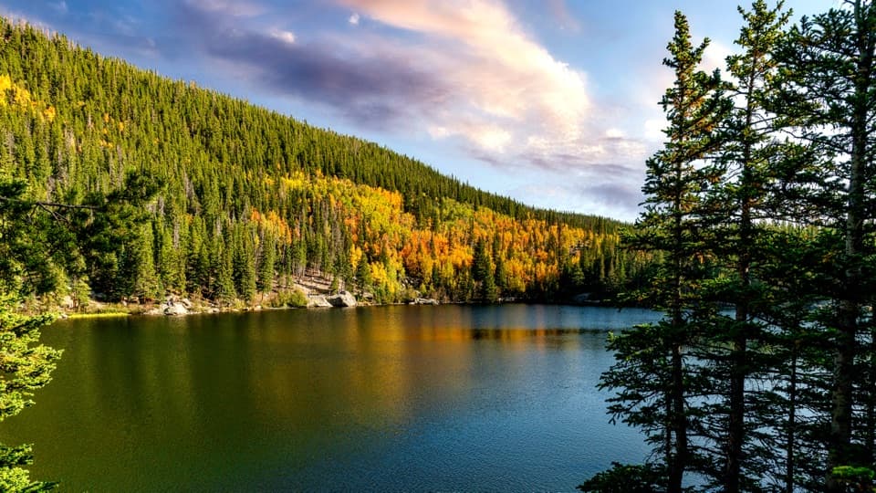 Sight · 0.2 mi awayBear LakeA classic alpine lake, with Hallett Peak just beyond the shore.
 Sight · 0.3 mi awayNymph LakeA short uphill walk to summer lily pads and mountain views.
 Sight · 0.7 mi awayAlberta FallsA short, uphill hike ends at a thunderous waterfall.
 Sight · 0.7 mi awayDream LakeA mile from Bear Lake, Hallett Peak fills the skyline.Sight · 1 mi awayLake HaiyahaA mountain lake tinted green by a 2022 rockslide.
 Sight · 1.2 mi awayEmerald LakeThree lakes in, the trail ends beneath steep mountain walls.
 Sight · 1.5 mi awayThe LochAfter a real climb, alpine peaks mirror across the lake.
 Sight · 1.5 mi awayBierstadt LakeMountain reflections reward the steep walk in.
Parkwolf’s Rocky Mountain ranking

The audio tour guide for the drive, plus offline maps, trails, and wildlife heatmaps for when the signal drops.

