South Fork Campground in Sequoia National Park

Campground · Sequoia National Park

South Fork Campground

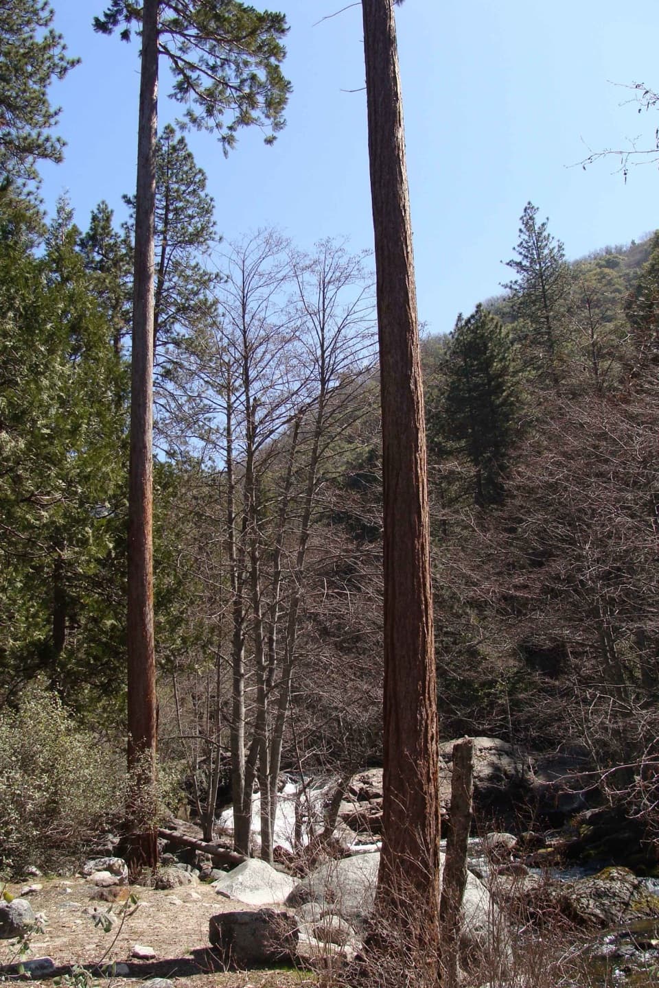
A quiet, remote base beside the Ladybug Trail.

Photo: Public Domain
Type
Campground
Nearest trail
0.1 mi
Audio stories
2 nearby
  • Restrooms
  • Trailhead
  • Picnic tables
  • Parking

Hear the audio tour

South Fork Campground and Ladybug Trail

Overview

About South Fork Campground

Why stop

  • Early Ladybug Trail viewpoints open onto the canyon.

Heads up

  • Rough dirt access, no drinking water or showers.

Map

Where it is

Loading the Sequoia map
Full map
CampgroundSouth Fork Campground36.34972, -118.76505
Keep this map with you offline in the Parkwolf app

Plan your stop

Before you go

8 active Sequoia alerts

  • ClosureSouth Fork campground and trail access restrictionsMentions this placeSouth Fork Campground is closed, vehicles cannot reach the old trailhead parking area, and trails in the South Fork drainage are not currently passable to stock.Official details
  • CautionStage 1 fire restrictionsStage 1 fire restrictions are in effect due to high fire danger and catastrophic-wildfire risk; the restrictions reduce the possibility of accidental human-caused fires that could threaten visitors…Official details

See all 8 alerts
A park ranger sits on a dash-mounted phone, talking, as Parkwolf’s Tour Guide plays “Army Cutworm Moths: A Grizzly Bear Buffet” on Grand Loop Road below Dunraven Pass in Yellowstone
Parkwolf Tour GuideThe highest, rockiest slopes around here are a summer buffet for grizzly bears.

Sequoia Tour Guide

Your drive to South Fork Campground, narrated.

Parkwolf is a GPS audio tour guide for Sequoia National Park. As you drive, it chimes in with what’s ahead: hidden gems, upcoming stops, history, geology, and wildlife, right through your car’s speakers.

See the Sequoia audio tour

Recorded for this place

South Fork Campground and Ladybug Trail
0:00 / 0:25
“Up ahead is South Fork Campground, a primitive riverside camp well away from the main park highways. There's no drinking water or food here, so bring your supplies.”

Plays as you drive up to South Fork Campground in the Parkwolf Sequoia Tour Guide.

More stories near here in the app

  • The Oak That Grows a Nursery
  • The Vulture's Wobbly Flight
  • The Case That Crawls
  • Leaves Held on Edge
  • 71 audio storiesacross Sequoia’s roads, triggered by GPS as you drive
  • Wildlife heatmapsfor Black Bear, Mountain Lion, Bobcat, and 13 more
  • Works offlinemaps, 99 trails, 68 places, and audio download before you lose signal
  • CarPlay readysimple controls built for the drive
★★★★★
“…The kids and my husband and I all agree that the narration really added to our experience driving through the parks. We learned so much about the history and the flora & fauna.”
JessestblondeApp Store review
Download Parkwolf on the App StoreGet Parkwolf on Google Play

4.7 from 8,600+ ratings

Guide

More about South Fork Campground

A remote foothill campgroundSouth Fork Campground is a small, primitive site at about 3,600 feet on the South Fork of the…

South Fork Campground is a small, primitive site at about 3,600 feet on the South Fork of the Kaweah River, well away from Sequoia’s main highways and attractions. Save it for campers who want a quiet, out-of-the-way base with a trail leaving from camp; it’s a deliberate detour, not a quick stop.

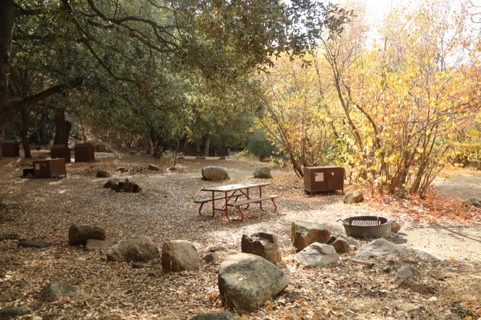
A basic campWhen operating, its documented setup includes picnic tables, fire rings, bear-resistant food…

When operating, its documented setup includes picnic tables, fire rings, bear-resistant food lockers and vault toilets, but no potable water or showers. Bring drinking water. The ground is uneven and unpaved, with no designated accessible campsites. Pets are allowed in camp on leash, but not on park trails.

Ladybug Trail and the canyonThe Ladybug Trail starts at the campground’s east end. Its first 2.

The Ladybug Trail starts at the campground’s east end. Its first 2.5 miles climb along the north side of the South Fork canyon, with open views toward Homers Nose and Salt Creek Ridge. Farther on, Cedar Flat Grove holds sequoias; look for ladybugs gathered on its trees and rocks. Along the route, the riverbed changes from metamorphic rock in the lower canyon to granite near the waterfalls above Cedar Creek.

Plan for the approachFrom Highway 198, turn onto South Fork Road about five miles before the main park entrance and…

From Highway 198, turn onto South Fork Road about five miles before the main park entrance and travel east for 12.3 miles. The last stretch is a rough dirt road, and low-clearance cars aren’t recommended. This is a remote camp with no staff, food or drinking water on site, so plan supplies and check road conditions before setting out.

Wildlife

Wildlife in Sequoia

All Sequoia wildlife maps

Sighting maps show where each species has been reported across Sequoia. Wildlife moves, so no sighting is guaranteed.

Parkwolf’s Sequoia ranking

Top sights in Sequoia

All 68 places
  1. 1General Sherman TreeSight
  2. 2Moro RockSight
  3. 3Crystal CaveSight
  4. 4Crescent MeadowSight
  5. 5Tokopah FallsSight
  6. 6Tunnel LogSight

Take Parkwolf to Sequoia.

The audio tour guide for the drive, plus offline maps, trails, and wildlife heatmaps for when the signal drops.

4.7 from 8,600+ ratings

Download Parkwolf on the App StoreGet Parkwolf on Google Play