
Place · 7.7 mi away
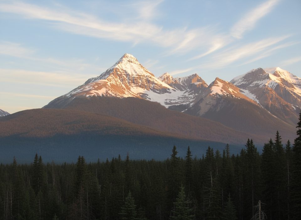
Mount Goodsir anchors the southern end of the park with two dramatic summits—the higher South Tower and the North Tower—rising in a hulking massif you can spot from far away. It’s among the most prominent peaks in the southern Canadian Rockies and, despite not being the most technical, it’s notorious for its poor rock. Translation: gorgeous to look at, serious to climb.
The twin “towers” give Goodsir a silhouette unlike anything else around, and its ultra prominence (over 1,900 m) makes the peak feel like its own range. It’s rarely climbed and fiercely remote, which is exactly why seasoned alpinists seek it out.
From Goodsir Pass and the surrounding valleys you’ll move through dense forest into sub‑alpine larch meadows and open alpine slopes, with sweeping views across Yoho and into neighboring ranges. On-route ridges are exposed with knife‑edge sections and panoramic drop-offs.
Approaches are long and committing via the Ice River or Moose Creek valleys—expect a full day just to reach a basecamp. Near the towers, there are no maintained trails and route-finding matters. Most of the technical bits are low 5th class, but the rock is notoriously loose and unprotectable in places. Helmets and conservative decision-making aren’t optional here.
Marmots are commonly noted in the alpine meadows near Goodsir Pass. This is remote country with typical high-country wildlife—carry bear spray and give animals space.
There are no services at or near the mountain: no parking, restrooms, or water taps. The closest formal access for hikers eyeing views is the Goodsir Pass trail (from the Ottertail parking), with basic backcountry camp infrastructure along the trail—not at the mountain itself.
Late summer into early fall offers the most reliable travel windows; early season snow can linger near the pass. It’s never crowded; even peak weekends are quiet compared to the rest of the park. Pick a stable weather window for any alpine attempt and start early to manage daylight and rockfall timing.
Place · 7.7 mi away
Place · 7.7 mi away
Place · 7.8 mi away
Place · 8.4 mi away
Easy · 8.2 mi away
Easy · 11 mi away
Moderate · 11 mi away
Easy · 13.7 mi away

Parkwolf Tour Guide
