Cliff Trail in Acadia National Park

Acadia National Park, ME

Cliff Trail

A rugged shore walk between granite ledges and Atlantic coves.

Length
0.8mi
Time
45min
Elev. change
62ft
Difficulty
Moderate
  • Dogs allowed
  • High point 79 ft
  • #36 of 142 in Acadia
Parkwolf audio tour116 stories across Acadia’s roads

Overview

About Cliff Trail

Why go

  • Open water views and rocky coves in a short coastal segment.

Heads up

  • Rough ups and downs; retracing doubles the distance.

Map & elevation

The route

Loading the Acadia map
Full map
Elevation16–79 ft
TrailheadWestern Head Road / Goat Trail junction44.01475, -68.64952
Keep this map with you offline in the Parkwolf app

Plan your hike

Before you go

Parking

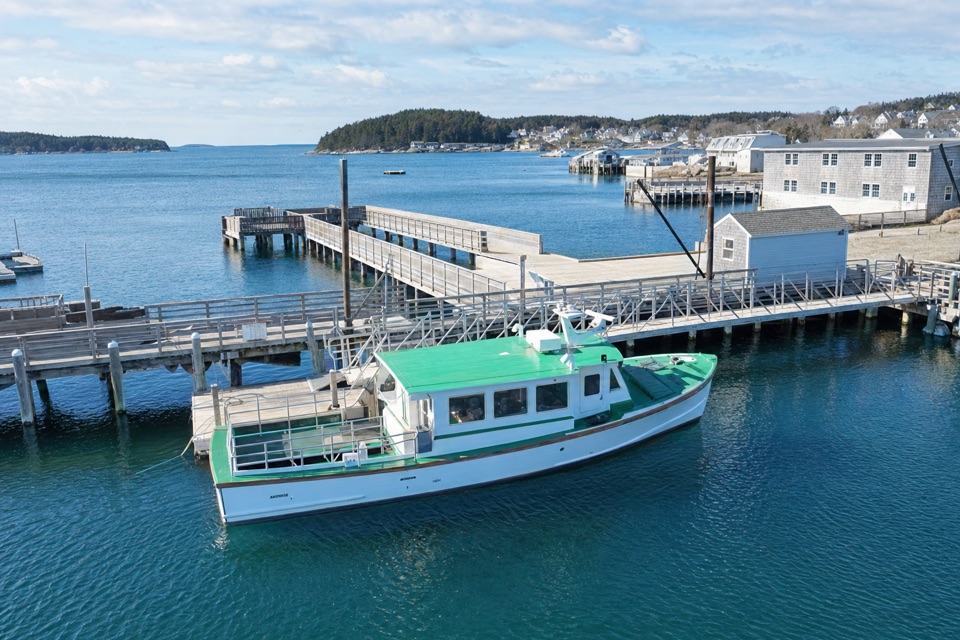
Isle au Haut is reached by passenger-only ferry from Stonington. The ferry serves Town Landing year-round and adds a Duck Harbor stop from mid-June through late September; Duck Harbor is closer to the southern trails. This route starts at the Western Head Road/Goat Trail junction, reached on foot from the ferry landing.


Safety

Uneven granite, wooden steps and repeated short climbs require careful footing; wet coastal rock can be slick. No water source is identified along this segment, so bring what you need.

4 active Acadia alerts

  • CautionAvoid water contact at Sand Beach LagoonDo not swim at Sand Beach Lagoon. - Bacterial levels have exceeded public-health standards, so the NPS has posted a Public Health Advisory.Official details
  • ClosureSchoodic Mountain Road closed for repairsSchoodic Mountain Road is closed from Schoodic Loop Road to the summit of Schoodic Head. - The closure began August 31 for resurfacing, regrading, and ditching.Official details
See all 4 alerts
A park ranger sits on a dash-mounted phone, talking, as Parkwolf’s Tour Guide plays “Army Cutworm Moths: A Grizzly Bear Buffet” on Grand Loop Road below Dunraven Pass in Yellowstone
Parkwolf Tour GuideThe highest, rockiest slopes around here are a summer buffet for grizzly bears.

Acadia Tour Guide

Your drive to Cliff Trail, narrated.

Parkwolf is a GPS audio tour guide for Acadia National Park. As you drive, it chimes in with what’s ahead: hidden gems, upcoming stops, history, geology, and wildlife, right through your car’s speakers.

  • 116 audio storiesacross Acadia’s roads, triggered by GPS as you drive
  • Wildlife heatmapsfor Bald Eagle, Peregrine Falcon, White-tailed Deer, and 13 more
  • Works offlinemaps, 142 trails, 72 places, and audio download before you lose signal
  • CarPlay readysimple controls built for the drive
★★★★★
“…As we drove through Acadia it gave us a tour, which was really cool. Lots of great info about the parks and how to avoid the crowds. It’s a great travel companion!”
MyMysteryChicaApp Store review
Download Parkwolf on the App StoreGet Parkwolf on Google Play

4.7 from 8,600+ ratings

Trail guide

Hiking Cliff Trail

A short coastal through-walkCliff Trail is a short, rugged 0.

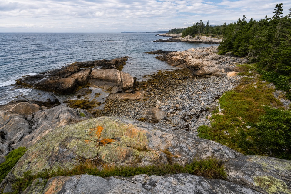
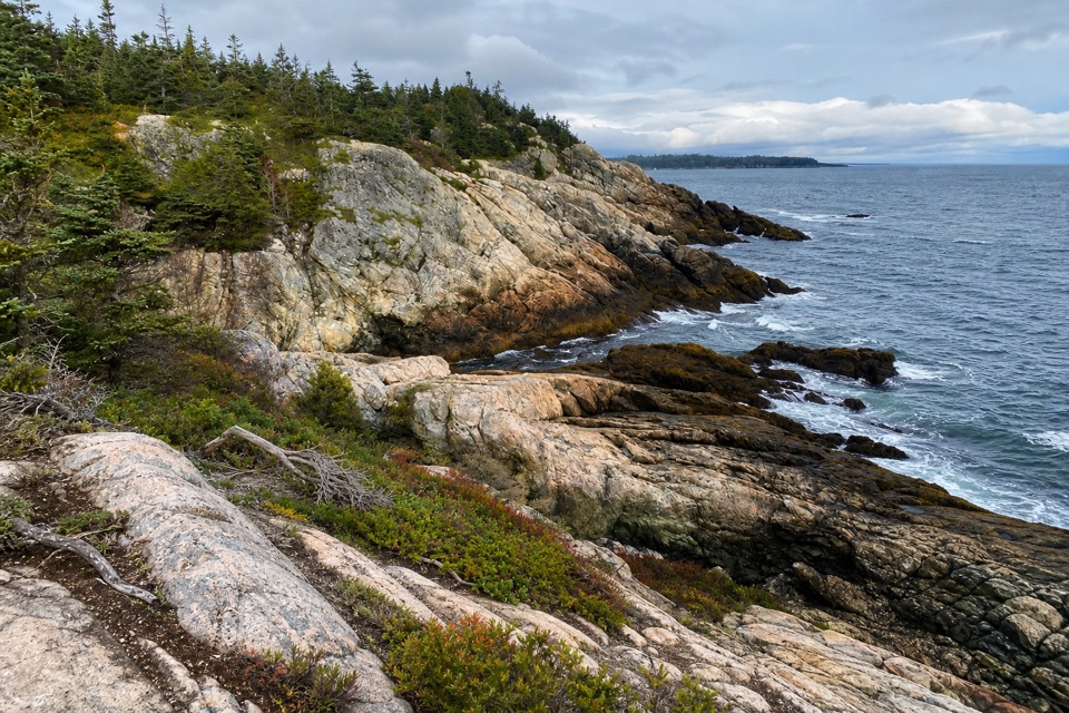
Cliff Trail is a short, rugged 0.8-mile one-way path across the shore of Western Head on Isle au Haut. It runs from the Western Head Road and Goat Trail junction to its southern junction with Western Head Trail. Expect several ups and downs over granite ledges above coves and rocky beaches; allow about 45 minutes one way. Published park distances differ by a tenth: the visitor trail table gives 0.7 mile and the trail-name catalog gives 0.8. The mapped line is about 0.81 mile, so 0.8 is the best fit for walking through. Retracing it makes the segment about 1.6 miles round trip.

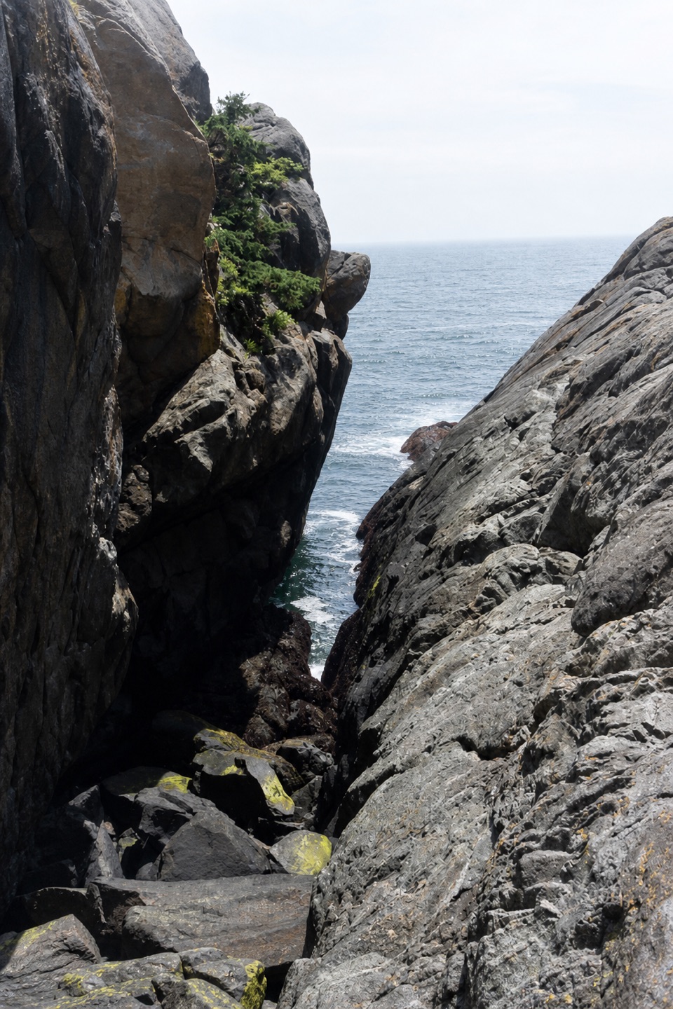
Where the route opens upWooden steps and rough path alternate with bare granite.

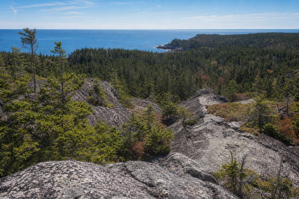
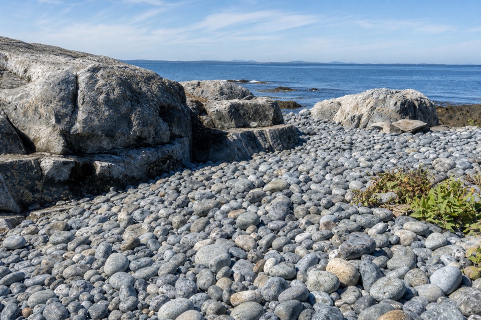
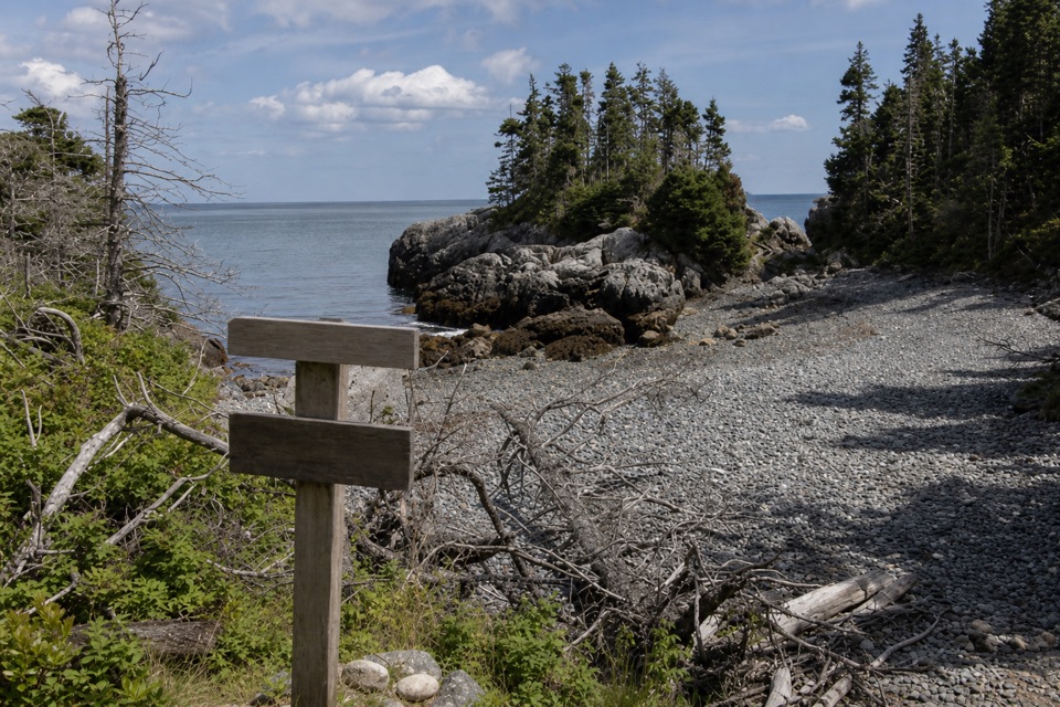
Wooden steps and rough path alternate with bare granite. High points open toward the Atlantic; lower stretches dip toward narrow coves and stone beaches. Near the south end, a small beach faces Western Ear across a short channel. Frame the granite foreground with the low island across the water. The channel crossing is separate from the mapped trail and depends on the tide; do not count on reaching Western Ear as part of this hike.

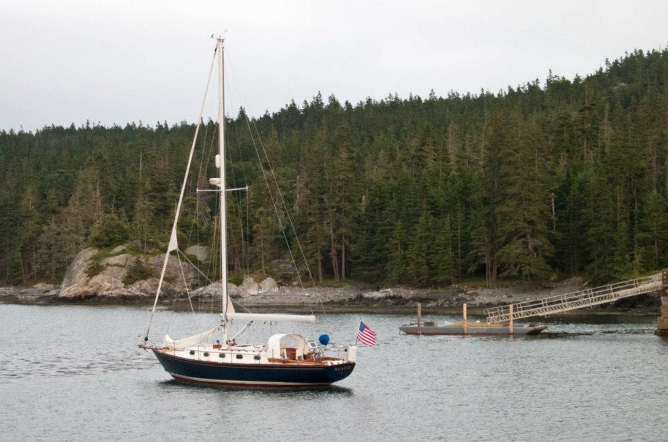
Plan for the islandIsle au Haut is reached by passenger-only ferry from Stonington.

Isle au Haut is reached by passenger-only ferry from Stonington. The ferry serves Town Landing year-round and adds a Duck Harbor stop from mid-June through late September; Duck Harbor is the better base for hiking, and Cliff Trail starts at a trail junction. The island has few services and no water source is identified along this segment, so bring what you need. A small store and post office are near Town Landing, not along the trail.

Footing and rulesThis is a moderate hike on rough terrain, not a smooth shoreline stroll.

This is a moderate hike on rough terrain, not a smooth shoreline stroll. The island averages about 10°F cooler than the mainland; good footwear, a warm layer, and rain gear make sense here. Dogs are allowed on park trails when leashed no longer than six feet. From the south junction, you can continue on the separate Western Head Trail for a longer coastal walk.

Wildlife

Wildlife in Acadia

All Acadia wildlife maps

Sighting maps show where each species has been reported across Acadia. Wildlife moves, so no sighting is guaranteed.

Parkwolf’s Acadia ranking

Top-rated trails in Acadia

All 142 trails
  1. 1Beehive Loop TrailChallenging · 1.4 mi
  2. 2Precipice TrailChallenging · 2.1 mi
  3. 3Jordan Pond PathModerate · 3.3 mi
  4. 4Bubbles TrailModerate · 1.5 mi
  5. 5Ocean PathEasy · 2.2 mi
  6. 6Cadillac Mountain South Ridge TrailChallenging · 7.8 mi

Take Parkwolf to Acadia.

The audio tour guide for the drive, plus offline maps, trails, and wildlife heatmaps for when the signal drops.

4.7 from 8,600+ ratings

Download Parkwolf on the App StoreGet Parkwolf on Google Play