Lake Travers Access Point (#23) in Algonquin Provincial Park

Sight · Algonquin Provincial Park

Lake Travers Access Point (#23)

A remote launch for Lake Travers and multi-day Petawawa River trips.

Type
Sight
Audio stories
2 nearby
  • Parking

Hear the audio tour

Lake Travers and the Turtle Club Ruins

Overview

About Lake Travers Access Point (#23)

Why stop

  • A direct starting point for backcountry Petawawa River paddling.

Heads up

  • The 54.4 km drive beyond Sand Lake Gate makes this a commitment.

Map

Where it is

Loading the Algonquin map
Full map
SightLake Travers Access Point (#23)45.96019, -78.06255
Keep this map with you offline in the Parkwolf app

Plan your stop

Before you go

Getting there and preparing

The main road runs 54.4 km past Sand Lake Gate, through the Algonquin Radio Observatory area, to the access point. Parking is available. For overnight backcountry trips, arrange a permit ahead: reservations open up to five months before the trip, by phone or online. Check the park’s water-level advisories before leaving.

4 active Algonquin alerts

  • ClosureProvoking Falls Bridge ClosedThe Provoking Falls bridge on the Highland Backpacking Trail is closed because of safety concerns; the bridge has been removed. - Use the posted reroute, which adds 2.5 km.Official details
  • CautionLow Water on Backcountry Canoe RoutesOntario Parks currently lists low-water alerts for six backcountry canoe-route sections: - Varley Lake from Carl Wilson Lake - Latour Creek north of Rosebary Lake - Carcajou Creek north towards…Official details
See all 4 alerts
A park ranger sits on a dash-mounted phone, talking, as Parkwolf’s Tour Guide plays “Army Cutworm Moths: A Grizzly Bear Buffet” on Grand Loop Road below Dunraven Pass in Yellowstone
Parkwolf Tour GuideThe highest, rockiest slopes around here are a summer buffet for grizzly bears.

Algonquin Tour Guide

Your drive to Lake Travers Access Point (#23), narrated.

Parkwolf is a GPS audio tour guide for Algonquin Provincial Park. As you drive, it chimes in with what’s ahead: hidden gems, upcoming stops, history, geology, and wildlife, right through your car’s speakers.

See the Algonquin audio tour

Recorded for this place

Lake Travers and the Turtle Club Ruins
0:00 / 0:31
“You’re nearing Lake Travers Access Point, a remote canoe launch for trips along the Petawawa River. Even if you’re staying on land, there’s a small piece of logging history worth a look.”

Plays as you drive up to Lake Travers Access Point (#23) in the Parkwolf Algonquin Tour Guide.

More stories near here in the app

  • Radio Astronomy Among the Pines
  • What a Rotting Log Reveals
  • How a Quill Lets Go
  • Why Maple Sap Runs Before the Leaves
  • 107 audio storiesacross Algonquin’s roads, triggered by GPS as you drive
  • Wildlife heatmapsfor Moose, Eastern Wolf, Black Bear, and 13 more
  • Works offlinemaps, 39 trails, 66 places, and audio download before you lose signal
  • CarPlay readysimple controls built for the drive
★★★★★
“Fantastic app with many points of information… It’s great to just turn on while you’re driving and it gives you an audio tour of the national Park. We love it!!!!”
JMJamesApp Store review
Download Parkwolf on the App StoreGet Parkwolf on Google Play

4.7 from 8,600+ ratings

Guide

More about Lake Travers Access Point (#23)

A remote canoe launchLake Travers Access Point 23 is a drive-in canoe launch at the southwest tip of Lake Travers,…

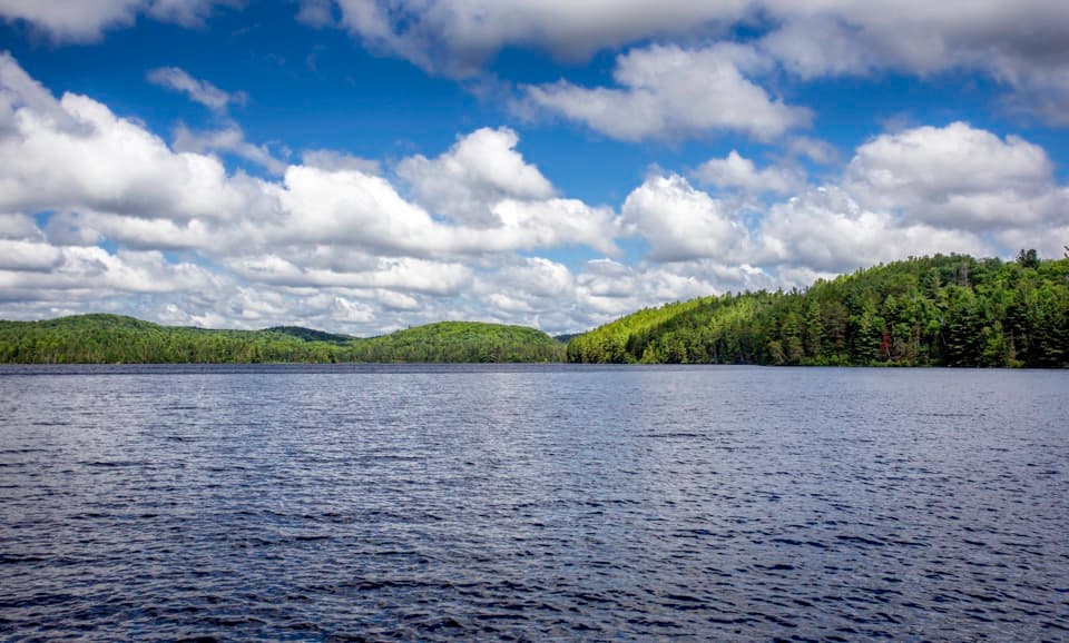
Lake Travers Access Point #23 is a drive-in canoe launch at the southwest tip of Lake Travers, near the mouth of the Petawawa River. It is chiefly a trip start for paddlers heading into Algonquin’s backcountry, especially on multi-day whitewater routes; this is not a quick stop off Highway 60.

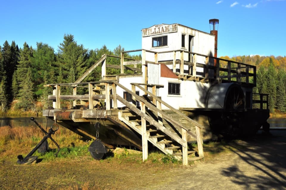
The Turtle Club remainsA footpath about 300 m from behind the parking-lot information board leads to five stone…

A footpath about 300 m from behind the parking-lot information board leads to five stone chimneys, the remains of J.R. Booth’s turtle-shaped log lodge. Built in 1933, the Turtle Club was dismantled in 1978; its shape echoed Booth’s timber mark.

A river shaped by loggingThe last log drive down the Petawawa took place in 1959.

The last log drive down the Petawawa took place in 1959. Red-pine deadheads remain in the water, and an abandoned log crib lies beyond the first takeout, reminders of the river’s logging past.

Wildlife

Wildlife in Algonquin

All Algonquin wildlife maps

Sighting maps show where each species has been reported across Algonquin. Wildlife moves, so no sighting is guaranteed.

Parkwolf’s Algonquin ranking

Top sights in Algonquin

All 66 places
  1. 1Barron Canyon LookoutSight
  2. 2Algonquin Logging MuseumSight
  3. 3Lake Opeongo Access Point and Opeongo StoreSight
  4. 4Canoe Lake Access Point and Portage StoreSight
  5. 5Booth's Rock LookoutSight
  6. 6LookoutSight

Take Parkwolf to Algonquin.

The audio tour guide for the drive, plus offline maps, trails, and wildlife heatmaps for when the signal drops.

4.7 from 8,600+ ratings

Download Parkwolf on the App StoreGet Parkwolf on Google Play