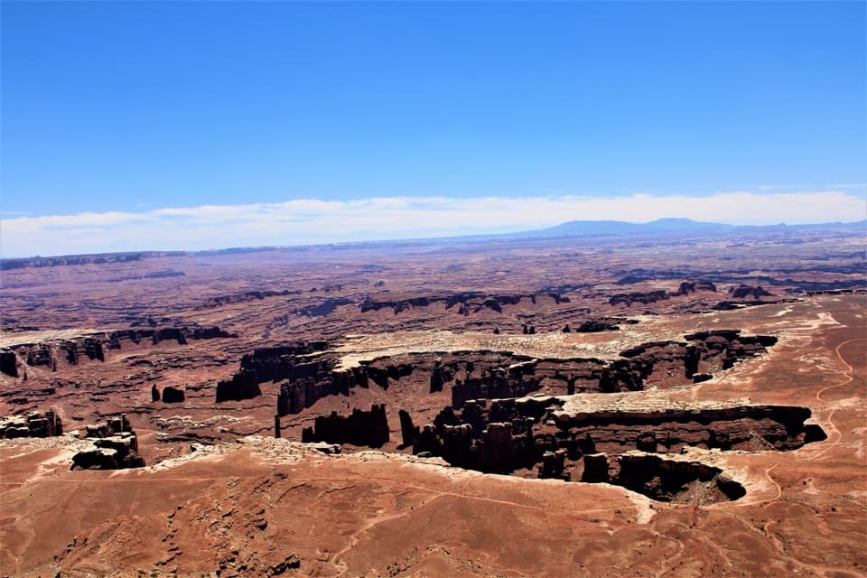
Panorama Point in Canyonlands National Park

Sight · Canyonlands National Park

Panorama Point

A two-hour 4WD crawl from Hans Flat ends above Horse Canyon.

Type
Sight
Nearest trail
2.7 mi
  • Scenic viewpoint
  • Parking
  • Campground
Parkwolf audio tour43 stories across Canyonlands’s roads

Overview

About Panorama Point

Why stop

  • Wide rim views across Horse Canyon and Elaterite Basin.

Heads up

  • The rough 4WD approach is remote and there is no water or service.

Map

Where it is

Loading the Canyonlands map
Full map
SightPanorama Point38.27069, -110.03914
Keep this map with you offline in the Parkwolf app

Plan your stop

Before you go

2 active Canyonlands alerts

  • ClosureRain-damaged Needles backcountry roads impassableRecent rains have made several Needles backcountry roads impassable; do not drive these routes.Official details
  • CautionMaze access roads require high-clearance 4WDOnly use high-clearance 4WD to reach Hans Flat or Horseshoe Canyon in The Maze; low-clearance vehicles are not recommended on these damaged, rutted, muddy routes.Official details
Canyonlands alerts
A park ranger sits on a dash-mounted phone, talking, as Parkwolf’s Tour Guide plays “Army Cutworm Moths: A Grizzly Bear Buffet” on Grand Loop Road below Dunraven Pass in Yellowstone
Parkwolf Tour GuideThe highest, rockiest slopes around here are a summer buffet for grizzly bears.

Canyonlands Tour Guide

Your drive to Panorama Point, narrated.

Parkwolf is a GPS audio tour guide for Canyonlands National Park. As you drive, it chimes in with what’s ahead: hidden gems, upcoming stops, history, geology, and wildlife, right through your car’s speakers.

See the Canyonlands audio tour
  • 43 audio storiesacross Canyonlands’s roads, triggered by GPS as you drive
  • Wildlife heatmapsfor Bighorn Sheep, Mule Deer, Coyote, and 13 more
  • Works offlinemaps, 63 trails, 65 places, and audio download before you lose signal
  • CarPlay readysimple controls built for the drive
★★★★★
“Fantastic app with many points of information… It’s great to just turn on while you’re driving and it gives you an audio tour of the national Park. We love it!!!!”
JMJamesApp Store review
Download Parkwolf on the App StoreGet Parkwolf on Google Play

4.7 from 8,600+ ratings

Guide

More about Panorama Point

A stop for a prepared Maze tripPanorama Point is a rim viewpoint on North Point in the Orange Cliffs, looking out over Horse…

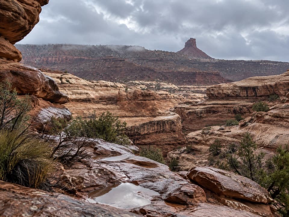
Panorama Point is a rim viewpoint on North Point in the Orange Cliffs, looking out over Horse Canyon and Elaterite Basin. It is a remote Maze backcountry destination, not a casual detour from the paved Island in the Sky drives. From Hans Flat Ranger Station, the route is about 12 miles and takes roughly two hours; the road requires high-clearance, low-range four-wheel drive. Hans Flat is itself a long dirt-road drive from UT 24, and the Maze is usually a multi-day outing. Go only with backcountry driving and self-rescue preparation. GPS directions can mislead people here, and weather can close Maze backcountry roads, so check conditions before setting out.

Read the landscapeThe rim looks across Horse Canyon and Elaterite Basin, with Standing Rocks to the southeast and…

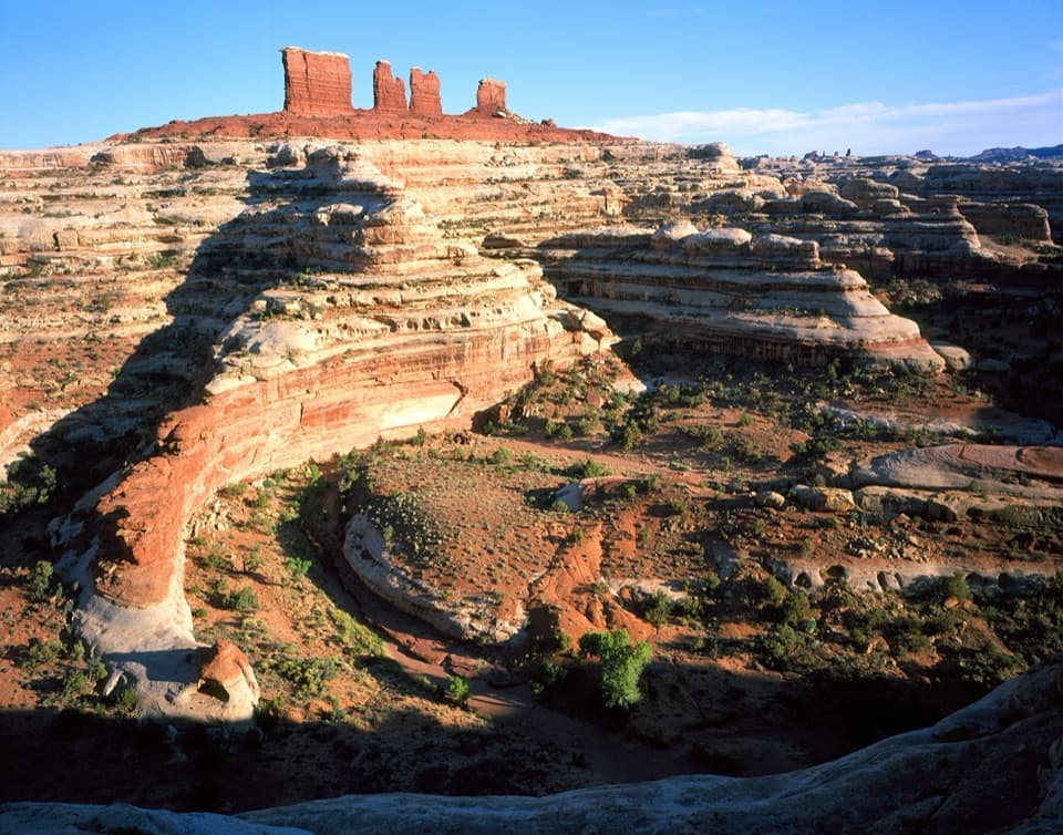
The rim looks across Horse Canyon and Elaterite Basin, with Standing Rocks to the southeast and Elaterite Butte to the south. North Point narrows into several finger-like ridges near its northern end; the Panorama Point road takes the eastern branch, while the west branch leads toward Cleopatra's Chair. The surrounding Orange Cliffs share the Maze's backcountry management and permit system.

Walk to the eastern tipFrom the small parking area, follow the cairns about 200 yards to the first good viewpoint.

From the small parking area, follow the cairns about 200 yards to the first good viewpoint. Another half mile reaches the eastern tip, where the view turns north along the Green River gorge toward Anderson Bottom. For a broader photo, continue to the tip and include the canyon rim in the frame; keep well back from the edge.

If you camp hereA single designated vehicle campsite sits beside the point and accommodates up to nine people…

A single designated vehicle campsite sits beside the point and accommodates up to nine people and three vehicles. It has no pit toilet or picnic table, and there is no potable water, food, fuel or other service in the Maze. Campers need a cleanable reusable toilet system. Overnight trips require a permit, groups must use designated sites, and pets are not allowed, even in vehicles.

Wildlife

Wildlife in Canyonlands

All Canyonlands wildlife maps

Sighting maps show where each species has been reported across Canyonlands. Wildlife moves, so no sighting is guaranteed.

Parkwolf’s Canyonlands ranking

Top sights in Canyonlands

All 65 places
  1. 1Mesa ArchSight
  2. 2Grand View PointSight
  3. 3Green River OverlookSight
  4. 4Great GallerySight
  5. 5Upheaval DomeSight
  6. 6Druid ArchSight

Take Parkwolf to Canyonlands.

The audio tour guide for the drive, plus offline maps, trails, and wildlife heatmaps for when the signal drops.

4.7 from 8,600+ ratings

Download Parkwolf on the App StoreGet Parkwolf on Google Play