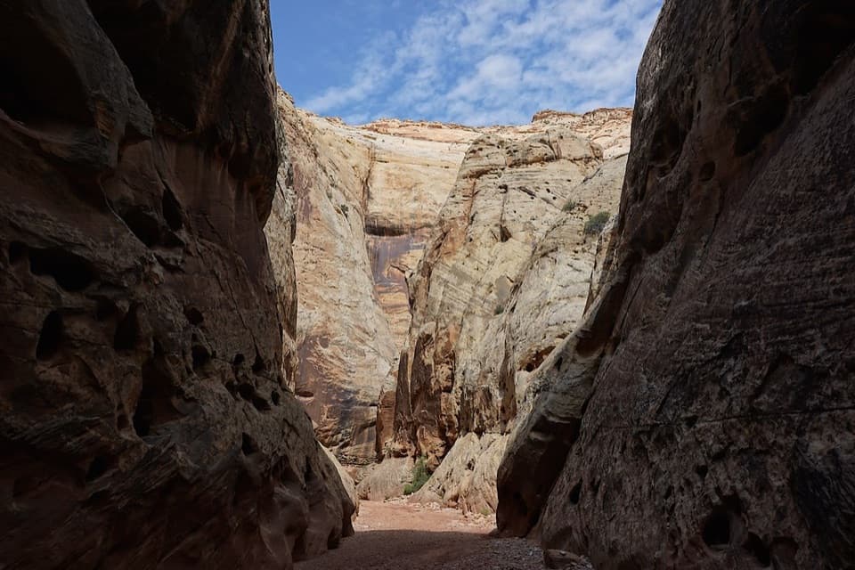
Capitol Reef East Entrance Wayside in Capitol Reef National Park

Scenic pullout · Capitol Reef National Park

Capitol Reef East Entrance Wayside

A quick map stop before the 15-mile Highway 24 crossing.

Photo: Wikimedia Commons
Type
Scenic pullout
Nearest trail
3.5 mi
Audio stories
5 nearby
  • Pullout
  • Parking
  • Exhibit
  • Restrooms

Hear the audio tour

How a Rattle Grows

Overview

About Capitol Reef East Entrance Wayside

Heads up

  • Mostly a brief roadside stop once you have the route.

Map

Where it is

Loading the Capitol Reef map
Full map
Scenic pulloutCapitol Reef East Entrance Wayside38.28371, -111.12905
Keep this map with you offline in the Parkwolf app

Plan your stop

Before you go

2 active Capitol Reef alerts

  • CautionFlash-flood hazard in canyons and washesHeavy rains can cause sudden flooding in Capitol Reef’s canyons and washes; do not hike or drive through floodwater.Official details
  • CautionE. coli advisory for Fremont River and Sulphur CreekDo not swim in the Fremont River or Sulphur Creek or get water in your mouth: NPS reports elevated E. coli in both waterways, and Utah DEQ has issued a warning advisory. - DEQ reports Sulphur Creek E.Official details

Capitol Reef alerts
A park ranger sits on a dash-mounted phone, talking, as Parkwolf’s Tour Guide plays “Army Cutworm Moths: A Grizzly Bear Buffet” on Grand Loop Road below Dunraven Pass in Yellowstone
Parkwolf Tour GuideThe highest, rockiest slopes around here are a summer buffet for grizzly bears.

Capitol Reef Tour Guide

Your drive to Capitol Reef East Entrance Wayside, narrated.

Parkwolf is a GPS audio tour guide for Capitol Reef National Park. As you drive, it chimes in with what’s ahead: hidden gems, upcoming stops, history, geology, and wildlife, right through your car’s speakers.

See the Capitol Reef audio tour

Recorded for this area

How a Rattle Grows
0:00 / 0:28
“A rattlesnake adds a new section to its rattle each time it sheds its skin. The rattle is made of hollow, loosely connected scales.”

Plays on the road 0.6 mi from Capitol Reef East Entrance Wayside in the Parkwolf Capitol Reef Tour Guide.

More stories near here in the app

  • The Ground Is Alive
  • Two Caretakers, No Pay
  • Listen for the Canyon Wren
  • Shrimp That Wait Out Drought
  • 116 audio storiesacross Capitol Reef’s roads, triggered by GPS as you drive
  • Wildlife heatmapsfor Bighorn Sheep, Mule Deer, Marmot, and 13 more
  • Works offlinemaps, 48 trails, 52 places, and audio download before you lose signal
  • CarPlay readysimple controls built for the drive
★★★★★
“Fantastic app with many points of information… It’s great to just turn on while you’re driving and it gives you an audio tour of the national Park. We love it!!!!”
JMJamesApp Store review
Download Parkwolf on the App StoreGet Parkwolf on Google Play

4.7 from 8,600+ ratings

Guide

More about Capitol Reef East Entrance Wayside

Start here for the cross-park driveCapitol Reef East Entrance Wayside is a roadside orientation pullout where Utah Highway 24…

Capitol Reef East Entrance Wayside is a roadside orientation pullout where Utah Highway 24 enters the park from the east. Welcome boards mark the easternmost stop on the park’s 15-mile Highway 24 crossing. Give it a few minutes if you want to place the route before driving west; if you’re already set, it can stay a quick sign stop.

The east approach has its own storyThe gray sloping badlands east of the park are mostly Mancos Shale, a marine rock unit reaching…

The gray sloping badlands east of the park are mostly Mancos Shale, a marine rock unit reaching about 2,000 feet thick and the park’s thickest exposed layer. Along the corridor toward Hanksville, the road passes traces of former settler communities at Aldridge, Clifton, Elephant and Giles; flooding and gradual depopulation ended those towns.

Take the entrance photo, then keep goingThe sandstone park sign is the natural quick photo stop, with its stone base and arrowhead…

The sandstone park sign is the natural quick photo stop, with its stone base and arrowhead emblem giving the entrance marker a clear shape. Recent visitors have mentioned a camera support in front of the sign, handy for a solo shot if it’s still there. A pit toilet serves the pullout; water availability and accessibility details are unclear.

Wildlife

Wildlife in Capitol Reef

All Capitol Reef wildlife maps

Sighting maps show where each species has been reported across Capitol Reef. Wildlife moves, so no sighting is guaranteed.

Parkwolf’s Capitol Reef ranking

Top sights in Capitol Reef

All 52 places
  1. 1Hickman BridgeSight
  2. 2Gifford HomesteadSight
  3. 3Fremont PetroglyphsSight
  4. 4Cassidy ArchSight
  5. 5Temples of the Sun and MoonSight
  6. 6Fruita OrchardsSight

Take Parkwolf to Capitol Reef.

The audio tour guide for the drive, plus offline maps, trails, and wildlife heatmaps for when the signal drops.

4.7 from 8,600+ ratings

Download Parkwolf on the App StoreGet Parkwolf on Google Play