
Place · 0.6 mi away
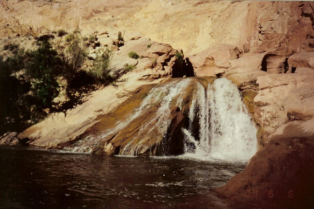
A small, scenic waterfall right off UT‑24, Fremont River Waterfall is the park’s accidental oasis—formed when the river was rerouted for highway construction in the 1960s. It’s a quick, rewarding pull-off: a short sandy path leads to a broad plunge pool beneath a pair of drops framed by bright sandstone cliffs.
Expect a compact cascade with two tiers, feeding a large, clear plunge pool in a tight canyon pocket. The contrast is the draw—lush riparian edges and desert rock. On calm mornings, you might catch faint rainbows in the mist.
Look for a paved pullout on the north side of UT‑24 roughly 6–7 miles east of the visitor center (near mile 86). Signage can be limited, so watch your odometer. From the pullout, a short sandy path heads straight to the base of the falls. There are no restrooms or picnic tables here.
Do not enter the water. Strong currents and aerated water at the base have led to near drownings, and swimming/wading are prohibited. The park has temporarily closed this area in past summers for safety—respect all posted closures and barriers and keep kids well back from the edge.
Mornings offer the softest light and the best chance for subtle rainbows, plus cooler temps. Weekdays are quieter; hot afternoons and holidays can draw roadside crowds. There’s little shade—bring water and sun protection. Access may be seasonally restricted; check current conditions before you go.
Shoot from the pullout rim for broader canyon context, then drop down for low angles that emphasize the main cascade and reflective pool. A polarizer helps cut glare on wet rock; mornings are kinder to highlights.
This is a rare park feature created by humans: when the Fremont River was rerouted for Highway 24 in 1962, the flow began carving today’s falls and plunge pool. The scene is classic Capitol Reef—red and white sandstone walls, desert vegetation—and along the river corridor you may notice conspicuous dark boulders and cobbles scattered on lighter substrates.
While this spot isn’t known for marquee wildlife, the riparian corridor commonly hosts birds and lizards, and you may spot small fish in calmer edges of the river.
Place · 0.6 mi away
Place · 1.8 mi away
Place · 2.9 mi away
Place · 3.2 mi away
Easy · 1.7 mi away
Moderate · 3.2 mi away
Challenging · 3.5 mi away
Moderate · 3.5 mi away

Parkwolf Tour Guide
