Pros & cons
PROS
- Reliable spot for viewing grizzlies and other megafauna from the road
- Sweeping open-tundra vistas with Denali visible on clear days
- Longstanding wildlife protection zone keeps the area feeling wild
CONS
- Hiking is prohibited; you must stay on or by the road
- No facilities or parking; typically reached by shuttle/tour bus
- Weather can be windy or cloudy, softening views and photos
Overview
Sable Pass is a high, treeless stretch of Denali Park Road that delivers big tundra views and a real chance to watch wildlife moving across open slopes. It sits between the Igloo Creek area and the colorful country closer to Polychrome, and it’s one of those places where the park’s scale clicks into focus.
Why it’s special
This is Denali’s most strictly protected stretch of road. A five‑mile wildlife closure around the pass has been in place since 1956, and it’s the only permanent no‑hiking zone of its kind along the road. That protection is not just a rule—it’s why the area still feels raw and alive. Even the wooden pass sign is notorious for tooth marks, a cheeky reminder of who really runs the place.
Wildlife you might see
Grizzly bears are the headliners here, often working the green-up on south-facing slopes in spring and early summer, then keying in on berries later in the season. Caribou and Dall sheep are regulars, too, and wolves make occasional appearances. The open terrain makes it easier to spot movement at a distance—binoculars pay off.
Scenery and sense of place
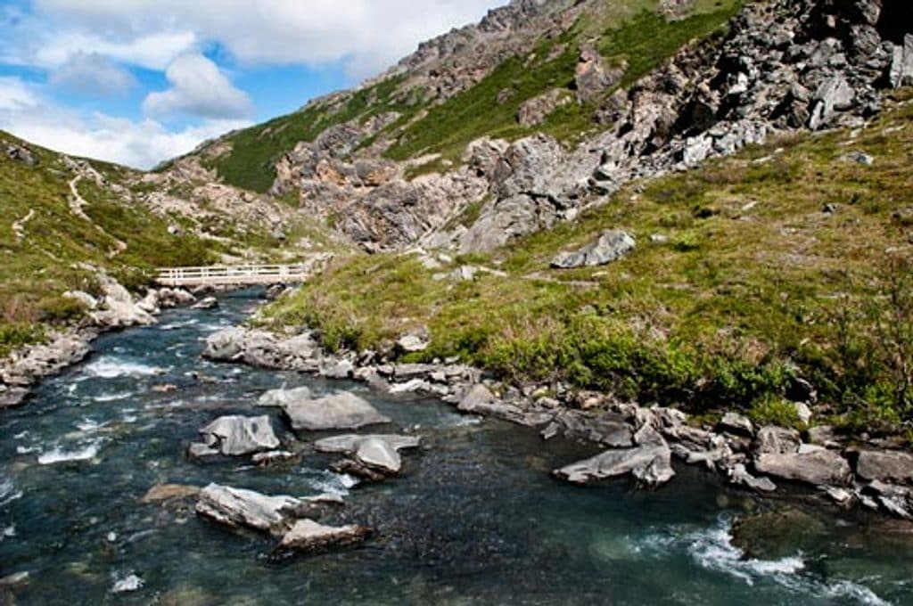
With little vegetation to block the view, you get wide panoramas of rolling tundra and surrounding hills. On those coveted clear days, Denali can appear on the far horizon, a stark white massif floating above the ridges. It’s a classic Denali scene: vast, uncluttered, and elemental.
Access and on-the-ground reality
Most visitors experience Sable Pass from the park’s shuttle or tour buses, which often pause for photos and wildlife watching. You can step off the bus to shoot from the road margin, but the rules are non‑negotiable: do not hike here, and do not leave the roadway. There’s no developed parking, no restrooms, and no services—just road and wilderness.
A bit of history
The park road reached this high country in the early 20th century, and by the mid‑1950s managers had already recognized its importance as bear habitat—hence the long‑standing closure. That decision continues to pay dividends for both wildlife and visitors hoping for authentic encounters from a respectful distance.
When to look and how to look
- Spring/early summer: scan greener, south‑facing slopes for feeding bears.
- Late summer/fall: berry crops can draw bears back into view.
- Mornings and evenings often feel livelier; keep optics handy so you’re ready when something appears.

Practical notes
There are no facilities at Sable Pass. Plan bathroom breaks at established rest stops before or after this section of road, carry your own water and layers, and keep cameras and binoculars within arm’s reach—the action here can unfold fast.
Where it is
63.5547, -149.6633Tips for Sable Pass
- 01Use the park shuttle/tour system; there’s no developed parking at the pass.
- 02You may step off the bus, but stay on the road—hiking is prohibited here.
- 03Bring binoculars; the open slopes reward long-distance scanning.
- 04Plan restroom stops before or after this stretch; there are no facilities.
- 05In spring and late summer, focus on food sources: fresh green-up and berries.
Amenities
Near Sable Pass
All places →All trails →
4.5 mi awayIgloo Creek CampgroundTiny creekside, tent-only camp reached by the camper busCampground · Restroom
7.5 mi awayTeklanika River Rest AreaScenic bus stop with big Teklanika River views and many pit toiletsPullout · Restroom
8.4 mi awayTeklanika River CampgroundRemote riverside base you can actually drive to past Mile 15Campground · Restroom
8.8 mi awayPolychrome PassKaleidoscopic rock colors from a dramatic roadside perchPullout · Scenic Viewpoint
16.7 mi awayMountain Vista TrailEasy roadside loop with interpretive signs and big mountain viewsEasy · 0.6 mi · 30 min
16.8 mi awaySavage Alpine TrailShort, steep alpine ridge with big views and a handy shuttleChallenging · 4.2 mi · 2.8 hr
17.1 mi awaySavage River Loop TrailEasy river canyon loop with bridge, big tundra views, frequent wildlifeEasy · 2 mi · 1.2 hr
21.7 mi awayEielson Alpine TrailShort, very steep climb to Thorofare Ridge with big Alaska Range viewsChallenging · 1.7 mi · 1.5 hr