Pros & cons
PROS
- Remote, fjord-like lake with moody mirror reflections
- Iconic stretch of the Hollyford Track, including the Demon Trail
CONS
- Sandflies can be fierce around the lakeshore
- Trails are often muddy, rough, and slow; almost no services
Overview
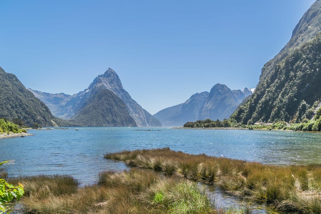
Long, narrow, and wildly atmospheric, Lake McKerrow/Whakatipu Waitai runs like a flooded glacial valley along the Hollyford corridor. Forested slopes drop straight to dark water, and on calm mornings the reflections are next-level. It feels far away from everything—in the best way—yet it’s a core feature of the non‑alpine, year‑round Hollyford Track.
Getting There & Access
There’s no road to the lake. Most people reach it on foot via the Hollyford Track, which follows the valley and then the lakeshore, or as part of a guided trip that jet‑boats down the lake and continues to the coast. Expect true backcountry remoteness: no shops, no cell service, and only basic hut infrastructure nearby.
The Experience on the Shore
The lake is infamous for the Demon Trail, a rugged section that clings to the steep eastern shore. Think roots, mud, slippery benched sections, and a few three‑wire bridges. It’s slow going but memorable. Huts associated with this section (e.g., McKerrow Island Hut, Demon Trail Hut, Hokuri Hut) help break up the journey.
Culture & History
The dual name reflects deep Ngāi Tahu ties here. This valley was a major route for kai (food) and for pounamu, with historic settlement and leadership connected to the area. That living heritage continues today, including guided experiences operated by Ngāi Tahu Tourism along the valley and coast.
Wildlife
In the valley: native forest birds like tui, bellbird, fantail, tomtit, and kererū. In the lower Hollyford there are occasional encounters with whio and kaka, and you might hear ruru at night. Deer are present (you’ll hear stags during the Roar). Down at the coast near Martins Bay, seals are a regular sight and seasonal penguins are possible.
Conditions & Hazards
Fiordland is wet—expect persistent rain, slick roots, and swollen streams. The Demon Trail is notorious for slow, technical tramping. Sandflies are relentless in still, warm conditions. During the Roar (deer mating season), you may encounter hunters; keep visible and alert.
Best Time to Visit
- Year-round is possible because the Hollyford isn’t alpine, but winter brings short days and cold.
- For photography, aim for early morning when the lake is glassy for reflections.
- After heavy rain, expect slower travel and potential flooding; plan extra time.
- Summer has longer daylight but also peak sandflies; cooler, breezier days help.

Who Will Love It
Trampers who want Fiordland’s raw edge without going high alpine, photographers chasing moody light and reflections, and history buffs interested in Ngāi Tahu heritage. If you want an easier, curated taste, the guided option that jet‑boats the lake and heads to the coast is a smart move.
Where it is
-44.4428, 168.0540Tips for Lake McKerrow / Whakatipu Waitai
- 01Tackle the Demon Trail only if you’re comfortable with steep, muddy, slow terrain.
- 02If rough trails aren’t your thing, consider the guided option that jet‑boats the lake.
- 03Bring serious rain gear, gaiters, and strong sandfly repellent—this is Fiordland at full strength.
- 04During the Roar, wear high‑vis and avoid low‑light travel where hunters may be present.
- 05Carry LINZ topo maps or GPS files; there’s no service and navigation can be tricky after rain.
Near Lake McKerrow / Whakatipu Waitai
All places →All trails →
5.4 mi awayHollyford Track to Hidden FallsClassic Fiordland rainforest day walk to a thundering waterfallModerate · 11.4 mi · 6 hr
5.4 mi awayLake Alabaster TrackEasy Hollyford ramble to a mirror-calm lake and a comfy hutModerate · 7.4 mi · 2.9 hr
5.4 mi awayPyke–Big Bay RouteWild Fiordland river-to-coast traverse for well-equipped prosChallenging · 22.4 mi · 12 hr
6.3 mi awayKaipo HutRemote six-bunk hut for serious off-track solitude seekersLodging
6.8 mi awayMartins BayRemote surf-lashed bay with seals at the end of the HollyfordScenic Viewpoint
7.2 mi awayLake Alabaster / Wāwāhi WakaRemote Fiordland lake with hut and moody, mirror-like views
7.9 mi awayBig Bay–Martins Bay Coastal RouteRemote beaches, big rivers, and penguins on a wild coastal edgeChallenging · 17.1 mi · 9 hr
10.5 mi awayMount TūtokoThe park’s high point, a wild granite-and-glacier summit for climbers