Pros & cons
PROS
- True wilderness solitude away from the park’s main routes
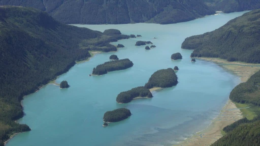
- Intricate waterways with shoals and rocky islets that reward skilled navigation
- Historic Dundas Bay Cannery ruins on the west shore
CONS
- Challenging navigation with shoals and rocks
- No developed facilities or services of any kind
Overview
Dundas Bay is Glacier Bay’s quiet side—an out-of-the-way inlet known for rugged beauty, labyrinthine channels, and a deep sense of wilderness. It’s the kind of place that rewards preparation and calm decision-making on the water.
What Makes It Different
Unlike the heavily trafficked main bay, Dundas is defined by shoals, rocky islets, and outcrops first described by early Western explorers. Boaters come for the seclusion and the satisfaction of threading through complex waters where you’re far more likely to hear seabirds than engines.
History Snapshot
On the west shore you’ll find the remains of the Dundas Bay Cannery—ruins that speak to the region’s commercial fishing past. It’s a historical waypoint, not a serviced site, and adds a layer of human story to an otherwise wild coastline.
What to Expect
- Waterways punctuated by rocks and islets—careful piloting is essential.
- No docks, restrooms, campgrounds, or services—plan to be fully self-sufficient.
- Backcountry-style use: small boats and kayaks are well-suited for exploring sheltered corners when conditions allow.
Wildlife
This is prime habitat for the marine life and seabirds typical of Glacier Bay’s coastal inlets. Keep your distance, keep it quiet, and bring binoculars—you’re in their home here.
Best Time to Visit
Dundas Bay isn’t about beating crowds—it’s about catching good conditions. Aim for stable weather and plan your time around daylight and visibility for safer navigation and better photography. Early and late light adds drama to the rocky shoreline.

Know Before You Go
- There are no amenities—no restrooms, no food, no water, no established campgrounds. Pack everything and practice Leave No Trace.
- Solid navigation skills and tools (nautical charts, GPS) aren’t optional here.
- For regulations and boating guidance specific to park waters, consult the park’s official guidance and maps before launching.
Where it is
58.3431, -136.3404Tips for Dundas Bay
- 01Bring nautical charts and a reliable GPS—shoals and rocks are common.
- 02Plan for total self-sufficiency; there are no services in the bay.
- 03Small boats and kayaks can access sheltered corners when conditions are calm.
- 04Review the park’s boating guidance and maps before you commit to the trip.
Near Dundas Bay
All places →All trails →
17 mi awayBartlett CoveHub for trails, day tours, culture, and free campingVisitor Center · Campground
17.8 mi awayBartlett Cove CampgroundFree walk-in rainforest campground with a communal beach fire pitCampground · Restroom
18 mi awayLester IslandQuiet, kayak-friendly island just off Bartlett Cove
18.2 mi awayBartlett Cove Visitor Information Station (VIS)Permit and orientation hub by the Bartlett Cove dockRestroom · Parking
18.2 mi awayTlingit TrailA gentle bayside stroll into Huna Tlingit culture and Bartlett CoveEasy · 1 mi · 1 hr
Bartlett River TrailQuiet rainforest walk to a wildlife-rich river estuaryEasy · 5 mi · 4.5 hr
Forest Loop TrailRainforest loop with pond views, beach detour, and spring birdsongEasy · 1 mi · 1 hr
Bartlett Lake TrailLong, soggy rainforest trek to a quiet lake—bring rubber boots.Moderate · 8 mi · 7 hr