Pros & cons
PROS
- One of the few advancing tidewater glaciers
- Frequent, thunderous calving with photo‑worthy ice cliffs
- Prime viewing for seabirds and harbor seals on icebergs
CONS
- Boat-only access; no trails or on-site land viewing
- Fog, rain, and wind are common and can limit visibility
Overview
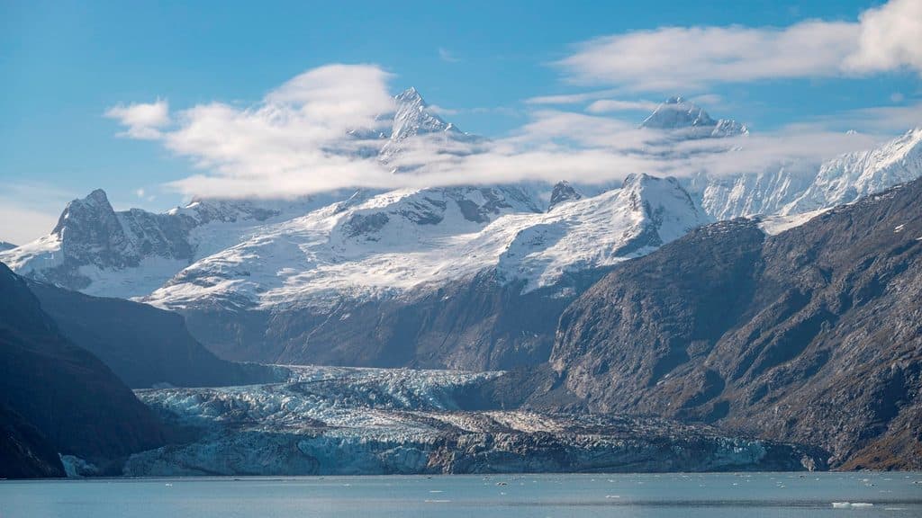
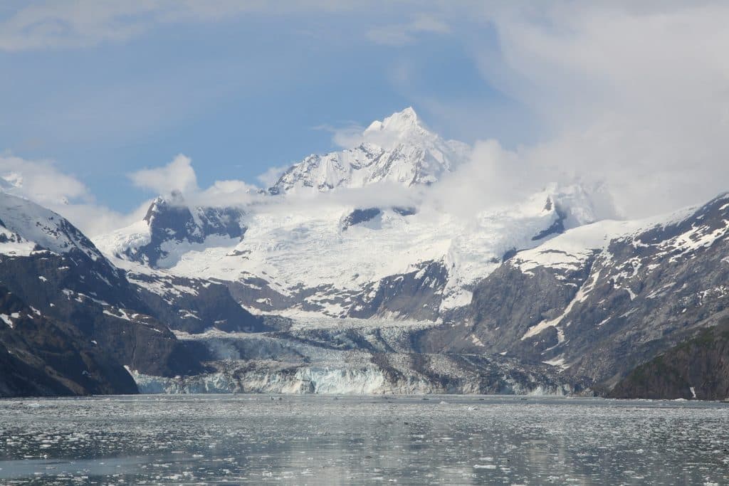
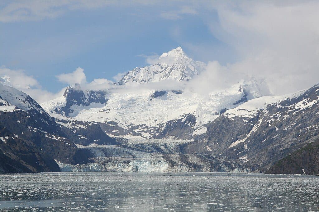
Johns Hopkins Glacier sits at the head of Johns Hopkins Inlet, deep in the upper bay. It’s the rare glacier that’s still advancing, which makes the experience feel alive—booming calving, shifting ice, and a constantly changing face. There’s no road or trail here; you view it from a boat or cruise ship, which keeps the setting wild and pristine.
What You’ll See
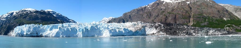
Expect a mile-wide wall of blue-and-white ice rising roughly 225–300 feet above the water, with fresh icebergs drifting in the inlet. On overcast days the ice can glow an electric blue; in bright sun it can look cleaner and whiter. Look for dark stripes slicing through the ice—the glacier carries about fifty medial moraines formed where tributary glaciers merge. This is a dramatic, photogenic scene framed by the Fairweather Range.
Wildlife Spotlight
Harbor seals often haul out on the icebergs, and seabirds are a big draw: kittiwakes, puffins, guillemots, scoters, and both Marbled and Kittlitz’s Murrelets are possible along the inlet corridor. Keep an eye on shorelines for the occasional brown bear.
Getting There & What to Expect
There’s no hiking to the face—boats are the only way in. Most visitors view the glacier from cruise ships or smaller tour boats that work up the inlet. Conditions are dynamic: the inlet has opened within the last century, and the ice front is active, with regular calving sending echoes down the fjord.
Best Time to Visit
Early summer often brings the clearest views, but weather is famously fickle here year‑round. If multiple cruise ships are scheduled, expect more company in the inlet; the vast scale helps absorb crowds, but solitude isn’t guaranteed. For photos, cloud cover can deepen the blues; clear skies give a brighter white look.

Geology & History
This is a 12‑mile‑long tidewater glacier fed by numerous tributaries, which explains the striking bands of debris on its surface. It flows west into the sea at Johns Hopkins Inlet and is notable for advancing while many regional glaciers retreat. It was named in 1893 for Johns Hopkins University, and it also carries a Tlingit name, reflecting deep Indigenous ties to this landscape.
Where it is
58.8067, -137.2503Tips for Johns Hopkins Glacier
- 01Bring binoculars or a telephoto lens for seabirds, seals, and calving detail.
- 02Dress in warm, waterproof layers—wind and spray are common even in summer.
- 03Protect cameras from mist and rain; calving can throw spray a surprising distance.
- 04If you get seasick, take remedies before entering the inlet’s choppy waters.
- 05Early summer often offers clearer views; cloudy days can enhance the ice’s blue tones.
Near Johns Hopkins Glacier
All places →All trails →
4.8 mi awayJohns Hopkins Glacier ViewpointBoat-only views of an advancing tidewater glacier and teeming wildlife
4.9 mi awayMount OrvilleRemote, glaciated peak with ocean-to-summit relief for expert alpinists
5.2 mi awayMount WilburRemote Fairweather Range peak for serious, self-sufficient expeditions
5.3 mi awayMount SalisburyRemote Fairweather Range giant for serious, self-sufficient alpinists
54.8 mi awayTlingit TrailA gentle bayside stroll into Huna Tlingit culture and Bartlett CoveEasy · 1 mi · 1 hr
Bartlett River TrailQuiet rainforest walk to a wildlife-rich river estuaryEasy · 5 mi · 4.5 hr
Forest Loop TrailRainforest loop with pond views, beach detour, and spring birdsongEasy · 1 mi · 1 hr
Bartlett Lake TrailLong, soggy rainforest trek to a quiet lake—bring rubber boots.Moderate · 8 mi · 7 hr