
Place
Moderate
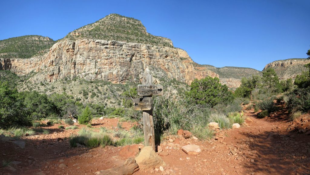
Looking for a quieter slice of Grand Canyon? Waldron trades big cliffside vistas for a peaceful descent through South Rim pine–fir forest. It’s a mellow, less-traveled alternative to the park’s dramatic rim-to-river routes—great if you value shade, solitude, and a bit of history over nonstop panoramas.
You’ll reach Waldron from the Hermit Trail: hike about 1.2 miles down from Hermit’s Rest to the signed junction, then turn onto Waldron. From that junction, Waldron runs roughly 2 miles one way to meet the Dripping Springs Trail. By itself, Waldron is an out-and-back. If you’re just sampling the Waldron segment, plan for about 4 miles round trip on Waldron (plus the 2.4-mile round-trip approach on Hermit). Most hikers take 1–2 hours for the Waldron segment one way, depending on pace.
Expect a tranquil, shaded walk through conifers with chances to spot deer, squirrels, and birds. Historic signposts and traces of early trail work add interest, and the corridor ties into the story of Louis Boucher—the “hermit” behind the Hermit Trail. Geology buffs will recognize the typical South Rim sequence (Kaibab Limestone, Coconino Sandstone, Hermit Shale), though dense forest limits the classic layer-cake views.
Call it intermediate: less strenuous and less exposed than the main Hermit Trail, with a steady descent and a generally well-defined tread. It’s quieter and less maintained than the corridor trails, so bring self‑sufficiency.
Spring and fall deliver the sweet spot of cooler temps and fewer heat hazards. Late fall can pop with color in the forest. Summer is hot; winter can mean snow or ice up high—always check conditions.
Water is not reliable—carry everything you need. Waldron is a handy connector to Dripping Springs or for stitching together longer loops with Hermit and nearby backcountry trails. If you’re chasing big Grand Canyon vistas, consider South Kaibab or Bright Angel instead; Waldron’s charm is its quiet forested feel, not rim-to-river drama.
Weather can swing fast (heat, storms, even flash flooding). There are reports that driving all the way to the historic Waldron/Dripping Springs trailheads via dirt roads may not be allowed and those roads can become impassable when wet—verify access with the park’s Backcountry Office if you’re considering that option. Day hiking requires no permit; overnight trips need a backcountry permit.
Park at Hermit Trailhead (Hermit’s Rest) and hike 1.2 miles down Hermit Trail to the Waldron junction. Note: driving to the historic Waldron/Dripping Springs trailheads via dirt roads may be restricted; confirm with the Backcountry Office if considering that access.
No reliable water; variable weather and potential storms; less-traveled trail requires self-sufficiency. Dirt-road access to the historic Waldron trailhead may be closed or impassable when wet—verify status with the Backcountry Office.
Place
Place
Place
Place
Challenging
Challenging
Challenging
Challenging

Parkwolf Tour Guide
