Cape Royal in Grand Canyon National Park

#7 of 58 sights in Grand Canyon

Sight · Grand Canyon National Park

Cape Royal

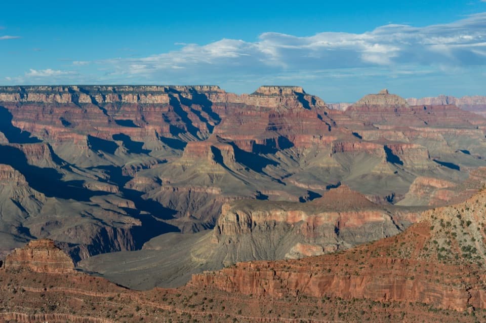
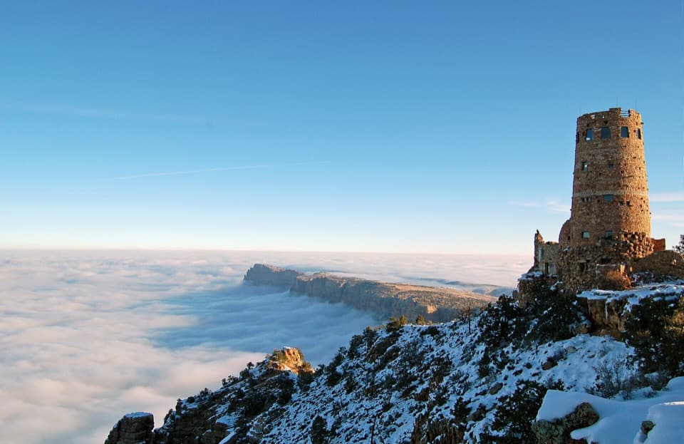
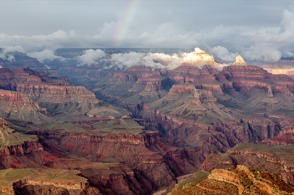
A 23-mile North Rim drive opens onto a 270-degree canyon view.

Photo: National Park Service
Type
Sight
Nearest trail
0.4 mi
Audio stories
3 nearby
  • Parking
  • Restrooms
  • Picnic tables
  • Scenic viewpoint

Hear the audio tour

Cape Royal and Angels Window

Overview

About Cape Royal

Why stop

  • A 270-degree panorama includes the Colorado River, Painted Desert, and major canyon formations.

Heads up

  • The 23-mile winding approach makes this a substantial North Rim outing.

Map

Where it is

Loading the Grand Canyon map
Full map
SightCape Royal36.11722, -111.94879
Keep this map with you offline in the Parkwolf app

Plan your stop

Before you go

4 active Grand Canyon alerts

  • ClosureInner Canyon and North Rim trail closuresMentions this placeDo not enter the closed trails, bridges, campgrounds, and inner-canyon areas.Official details
  • ClosureNorth Rim scenic roads closed for repairsMentions this placeCape Royal Road and Point Imperial Road are closed from sunset October 15 through sunrise November 3, 2026. - The roads are closed to accommodate critical road repair and rehabilitation work.Official details

See all 4 alerts
A park ranger sits on a dash-mounted phone, talking, as Parkwolf’s Tour Guide plays “Army Cutworm Moths: A Grizzly Bear Buffet” on Grand Loop Road below Dunraven Pass in Yellowstone
Parkwolf Tour GuideThe highest, rockiest slopes around here are a summer buffet for grizzly bears.

Grand Canyon Tour Guide

Your drive to Cape Royal, narrated.

Parkwolf is a GPS audio tour guide for Grand Canyon National Park. As you drive, it chimes in with what’s ahead: hidden gems, upcoming stops, history, geology, and wildlife, right through your car’s speakers.

See the Grand Canyon audio tour

Recorded for this place

Cape Royal and Angels Window
0:00 / 0:32
“You're nearing Cape Royal, where a nearly level paved walk leads to one of the North Rim's widest panoramas.”

Plays as you drive up to Cape Royal in the Parkwolf Grand Canyon Tour Guide.

More stories near here in the app

  • Cliff Springs’ Ravine Walk
  • Walhalla Overlook and Pueblo
  • Cape Final’s Forest Walk
  • Why the Map Has Temples
  • 79 audio storiesacross Grand Canyon’s roads, triggered by GPS as you drive
  • Wildlife heatmapsfor California Condor, Bighorn Sheep, American Bison, and 13 more
  • Works offlinemaps, 73 trails, 96 places, and audio download before you lose signal
  • CarPlay readysimple controls built for the drive
★★★★★
“Fantastic app with many points of information… It’s great to just turn on while you’re driving and it gives you an audio tour of the national Park. We love it!!!!”
JMJamesApp Store review
Download Parkwolf on the App StoreGet Parkwolf on Google Play

4.7 from 8,600+ ratings

Guide

More about Cape Royal

Keep walking to the pointCape Royal is the southern tip of the Walhalla Plateau, reached by a paved walk at the end of a…

Cape Royal is the southern tip of the Walhalla Plateau, reached by a paved walk at the end of a 23-mile drive across the North Rim. It is a destination overlook, not a roadside pullout: the path passes the spur for Angels Window and continues to Cape Royal itself. Keep going to the end for the full canyon panorama and a view of the Colorado River from high above it.

The walk and its midway spurThe flat, paved route is 0.8 miles round trip from the parking area.

The flat, paved route is 0.8 miles round trip from the parking area. A shorter paved branch reaches a railed overlook over Angels Window about halfway along; Cape Royal is farther ahead. Set aside one to two hours if you want time for both viewpoints and the interpretive signs. The main path is nearly level and accessible for many visitors, including wheelchair users.

Look across the whole canyonFrom the point, the canyon opens in a broad sweep: the Colorado River far below, the Painted…

From the point, the canyon opens in a broad sweep: the Colorado River far below, the Painted Desert to the east, and prominent formations including Freya Castle and Vishnu Temple. Cape Royal sits on a plateau that projects into the canyon like a peninsula, which is why the view reaches so far from east to south and west.

Frame the river for scaleCape Royal is one of the North Rim's signature sunset viewpoints, when red and orange cliffs…

Cape Royal is one of the North Rim's signature sunset viewpoints, when red and orange cliffs alternate with deep purple shadow. For a phone photo, keep a slice of the Colorado River low in the frame and the far cliffs above it; a frame filled only with rock loses the distance that makes this view special.

A road built for the viewThe scenic road was surveyed in the late 1920s and took nearly four years to build.

The scenic road was surveyed in the late 1920s and took nearly four years to build. Its construction camp later became a Civilian Conservation Corps camp. By the 1930s, automobile sightseeing tours were already bringing visitors out to Cape Royal, a tradition that still shapes the stop: the drive and its overlooks are part of the outing.

Make the long approach workCape Royal is about 23 miles from the North Rim developed area, on a narrow, winding road with…

Cape Royal is about 23 miles from the North Rim developed area, on a narrow, winding road with blind corners. Vehicles and vehicle-trailer combinations longer than 22 feet are prohibited on the scenic roads. The lot has multiple lanes, a vault restroom, and picnic tables on its west side. North Rim access is seasonal and can end early with snow, so check both road and trail status before making the drive.

Wildlife

Wildlife in Grand Canyon

All Grand Canyon wildlife maps

Sighting maps show where each species has been reported across Grand Canyon. Wildlife moves, so no sighting is guaranteed.

Parkwolf’s Grand Canyon ranking

Top sights in Grand Canyon

All 96 places
  1. 1Mather PointSight
  2. 2Desert View WatchtowerSight
  3. 3Yavapai Geology MuseumSight
  4. 4Hopi PointSight
  5. 5Toroweap OverlookSight
  6. 6Point ImperialSight

Take Parkwolf to Grand Canyon.

The audio tour guide for the drive, plus offline maps, trails, and wildlife heatmaps for when the signal drops.

4.7 from 8,600+ ratings

Download Parkwolf on the App StoreGet Parkwolf on Google Play