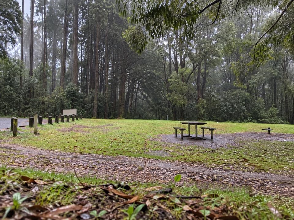
Beauchamp Falls in Great Otway National Park

#9 of 46 sights in Great Otway

Sight · Great Otway National Park

Beauchamp Falls

A fern-framed 20-metre fall worth the uphill walk back.

Photo: Wikimedia Commons
Type
Sight
Nearest trail
4.3 km
Audio stories
6 nearby
  • Trailhead
  • Restrooms
  • Picnic tables
  • Parking

Hear the audio tour

Beauchamp Falls: Leave Time for the Climb

Overview

About Beauchamp Falls

Why stop

  • A close waterfall payoff after a fern-filled forest walk

Heads up

  • Steep, sometimes slippery uphill return
Beauchamp Falls is a roughly 20-metre waterfall near Beech Forest in the Otway Ranges, reached by a 3 km return walk from the Beauchamp Falls Campground picnic area. This is a proper waterfall stop, not a roadside pull-off. If you like a close view after a forest walk, go; just leave time for the climb back. Allow one to two hours for the walk and a look around.
Parkwolf’s verdictWorth the walk?

Map

Where it is

Loading the Great Otway map
Full map
SightBeauchamp Falls-38.64936, 143.61177
Keep this map with you offline in the Parkwolf app

Plan your stop

Before you go

3 active Great Otway alerts

  • ClosureWye Road closed after storm and flood damageWye Road is closed until further notice because recent storm and flood damage requires road maintenance and repair works; plan around the closure.Official details
  • ClosureLorne-area walking trails closed after flood damageSome walking trails near Lorne are closed for public safety after the January 2026 flash floods washed away or severely damaged bridges and walkways.Official details

See all 3 alerts
A park ranger sits on a dash-mounted phone, talking, as Parkwolf’s Tour Guide plays “Army Cutworm Moths: A Grizzly Bear Buffet” on Grand Loop Road below Dunraven Pass in Yellowstone
Parkwolf Tour GuideThe highest, rockiest slopes around here are a summer buffet for grizzly bears.

Great Otway Tour Guide

Your drive to Beauchamp Falls, narrated.

Parkwolf is a GPS audio tour guide for Great Otway National Park. As you drive, it chimes in with what’s ahead: hidden gems, upcoming stops, history, geology, and wildlife, right through your car’s speakers.

See the Great Otway audio tour

Recorded for this place

Beauchamp Falls: Leave Time for the Climb
0:00 / 0:23
“You're nearing the Beauchamp Falls campground, where the walk to the falls begins. Allow one to two hours for the three-kilometre return trip through mountain ash and thick ferns to a twenty-metre waterfall and its pool.”

Plays as you drive up to Beauchamp Falls in the Parkwolf Great Otway Tour Guide.

More stories near here in the app

  • Soil Through an Earthworm
  • A Home a Century in the Making
  • The Flower with a Lid
  • The Digger Behind the Little Pits
  • 252 audio storiesacross Great Otway’s roads, triggered by GPS as you drive
  • Wildlife heatmapsfor Koala, Grey Kangaroo, Echidna, and 13 more
  • Works offlinemaps, 83 trails, 79 places, and audio download before you lose signal
  • CarPlay readysimple controls built for the drive
★★★★★
“Fantastic app with many points of information… It’s great to just turn on while you’re driving and it gives you an audio tour of the national Park. We love it!!!!”
JMJamesApp Store review
Download Parkwolf on the App StoreGet Parkwolf on Google Play

4.7 from 8,600+ ratings

Guide

More about Beauchamp Falls

The way in and outThe path drops through mountain ash and thick ferns toward the falls, so the return is the…

The path drops through mountain ash and thick ferns toward the falls, so the return is the harder half. Visitors repeatedly describe a steep climb with lots of steps, and wet ground can be slippery. The falls can carry more water after rain, which makes the payoff bigger but the footing less forgiving.

Take time at the baseA viewing platform brings you close to the cascade and pool.

A viewing platform brings you close to the cascade and pool. Some visitors continue down more steps and rocks for a lower look; footing there can be slick, so don't push past what feels secure. For a photo, include the creek and boulders in the foreground to show the height of the drop.

Ferns all the way downMountain ash and thick ferns line the walk, so the forest is part of the payoff, not just the…

Mountain ash and thick ferns line the walk, so the forest is part of the payoff, not just the way to the falls. Around the pool, boulders and fallen logs carry the creek right up to the base of the cascade.

Start at the picnic areaThe trail starts at the campground's picnic area, where day visitors can use toilets, a shelter…

The trail starts at the campground's picnic area, where day visitors can use toilets, a shelter and picnic tables. There is no potable water, so bring what you'll need for the walk. The approach road is unsealed; it's suitable for 2WD, though visitors sometimes report rough or muddy conditions after rain.

Wildlife

Wildlife in Great Otway

All Great Otway wildlife maps

Sighting maps show where each species has been reported across Great Otway. Wildlife moves, so no sighting is guaranteed.

Parkwolf’s Great Otway ranking

Top sights in Great Otway

All 79 places
  1. 1Cape Otway LightstationSight
  2. 2Erskine FallsSight
  3. 3Hopetoun FallsSight
  4. 4Triplet FallsSight
  5. 5Aire Valley RedwoodsSight
  6. 6Lake ElizabethSight

Take Parkwolf to Great Otway.

The audio tour guide for the drive, plus offline maps, trails, and wildlife heatmaps for when the signal drops.

4.7 from 8,600+ ratings

Download Parkwolf on the App StoreGet Parkwolf on Google Play