Hopetoun Falls Walk in Great Otway National Park

#4 of 83 trails in Great Otway

Great Otway National Park, VIC

Hopetoun Falls Walk

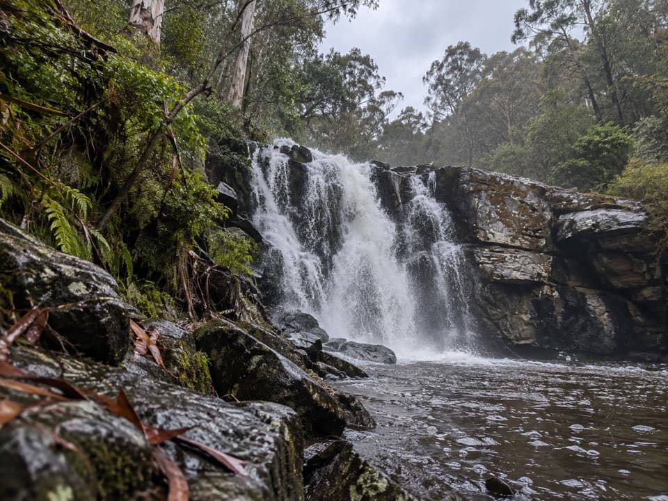
Two hundred steps through tree ferns to a 30-metre waterfall.

Photo: Public Domain
Length
0.8km
Time
35min
Elev. change
46m
Difficulty
Moderate
  • Loop
  • No dogs
  • High point 296 m

Hear the audio tour

Hopetoun Falls: Down Through the Ferns

Overview

About Hopetoun Falls Walk

Why go

  • Full-height waterfall view in a fern-filled river setting
  • Two viewpoints on a short walk

Heads up

  • Roughly 200 steep steps to climb back
  • Very limited parking beside the walk

Map & elevation

The route

Loading the Great Otway map
Full map
Elevation250–296 m
TrailheadHopetoun Falls Car Park-38.66835, 143.56806
Keep this map with you offline in the Parkwolf app

Plan your hike

Before you go

Parking

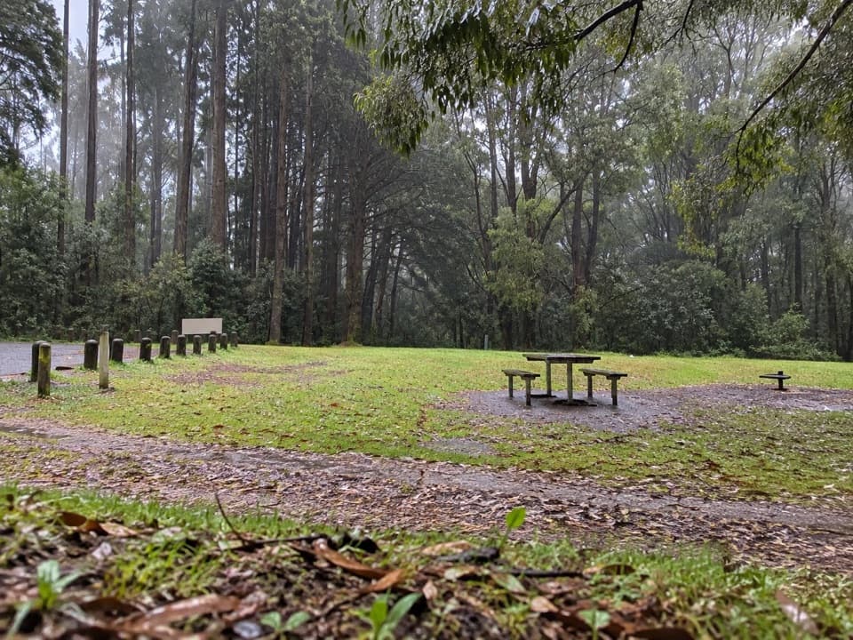
The roadside lot beside the walk is small. A larger overflow area is reported about 400 m uphill, adding a walk beside the access road; space estimates vary. No toilets, food or water service were confirmed at the trailhead or along the route.

Safety

About 200 steep steps, uneven track and a damp boardwalk; wet footing and rocks near unstable cliff edges can be slippery. Dogs are prohibited. Stay on the maintained path and viewing areas.

3 active Great Otway alerts

  • ClosureSeasonal campsite closures at Aire RiverMentions Aire River, referenced in this guideSeasonal closures remain in effect at Aire River through 30 October 2026; do not use the closed sites. - Aire River East: all sites are closed from 29 May to 30 October 2026 and reopen 31 October.Official details
  • ClosureWye Road closed after storm and flood damageWye Road is closed until further notice because recent storm and flood damage requires road maintenance and repair works; plan around the closure.Official details
See all 3 alerts
A park ranger sits on a dash-mounted phone, talking, as Parkwolf’s Tour Guide plays “Army Cutworm Moths: A Grizzly Bear Buffet” on Grand Loop Road below Dunraven Pass in Yellowstone
Parkwolf Tour GuideThe highest, rockiest slopes around here are a summer buffet for grizzly bears.

Great Otway Tour Guide

Your drive to Hopetoun Falls Walk, narrated.

Parkwolf is a GPS audio tour guide for Great Otway National Park. As you drive, it chimes in with what’s ahead: hidden gems, upcoming stops, history, geology, and wildlife, right through your car’s speakers.

See the Great Otway audio tour

Recorded for this trailhead

Hopetoun Falls: Down Through the Ferns
0:00 / 0:25
“Up ahead is the Hopetoun Falls car park, the starting point for a short but steep waterfall walk. Take the path through the tree ferns to the lower boardwalk for the full view of the falls dropping into the Aire River.”

Plays as you drive up to this trailhead in the Parkwolf Great Otway Tour Guide.

More stories near here in the app

  • Aire Valley Redwoods: A Planted Forest
  • A Crayfish Under the Forest Floor
  • A Breeze Made by Sunshine
  • The Flower with a Lid
  • 252 audio storiesacross Great Otway’s roads, triggered by GPS as you drive
  • Wildlife heatmapsfor Koala, Grey Kangaroo, Echidna, and 13 more
  • Works offlinemaps, 83 trails, 79 places, and audio download before you lose signal
  • CarPlay readysimple controls built for the drive
★★★★★
“Fantastic app with many points of information… It’s great to just turn on while you’re driving and it gives you an audio tour of the national Park. We love it!!!!”
JMJamesApp Store review
Download Parkwolf on the App StoreGet Parkwolf on Google Play

4.7 from 8,600+ ratings

Trail guide

Hiking Hopetoun Falls Walk

The short route to the lower fallsHopetoun Falls Walk is a 0.77 km (0.48 mi) return walk, usually about 30–35 minutes.

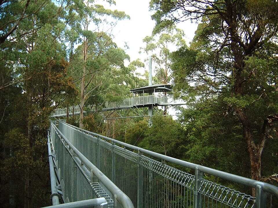
Hopetoun Falls Walk is a 0.77 km (0.48 mi) return walk, usually about 30–35 minutes. It passes an upper lookout, descends through tree ferns to the lower boardwalk beside the Aire River, then returns to the same parking access through the stair section. The full-height view of the 30-metre falls is from below; the short upper stop only glimpses the top.

Upper platform to the riverThe upper platform is only a short walk from the car park.

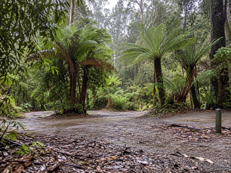
The upper platform is only a short walk from the car park. From there, the main route drops down roughly 200 steep steps through a fern-filled gully. At the bottom, a damp boardwalk curves around the lower viewing area. The falls come into view as you follow it, with the Aire River below. The return climb is the walk’s hardest stretch.

Effort and footingThis is a short but moderate, stair-heavy walk, not a level stroll.

This is a short but moderate, stair-heavy walk, not a level stroll. Steps, uneven track and a wet boardwalk can be slippery, especially around water; wear shoes with good grip and take your time on the climb. Stay on the maintained track and viewing areas: the rocks beyond the lookout are not part of the supported route. Dogs are prohibited in the park.

Parking and facilitiesThe roadside car park by the walk is small.

The roadside car park by the walk is small. A larger overflow area is reported about 400 m uphill, adding a walk beside the access road; estimates of spaces vary. No toilets, food or water service were confirmed at the trailhead or along the walk, so arrive prepared.

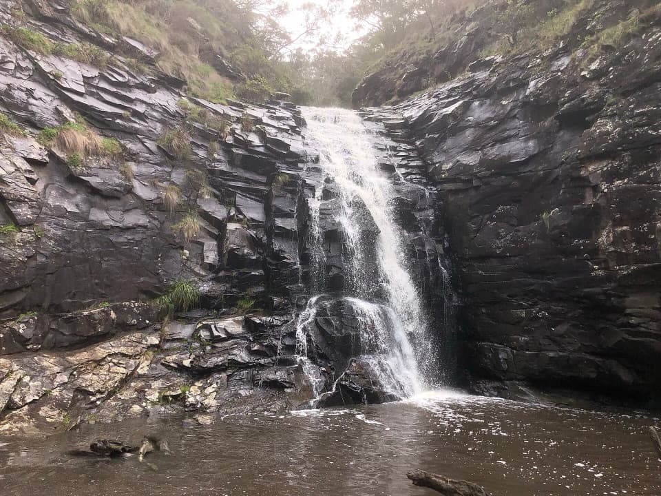
Seeing the fallsHopetoun Falls drops about 30 m into the Aire River.

Hopetoun Falls drops about 30 m into the Aire River. The lower boardwalk gives the clearest view, framed by tree ferns and forest; the upper platform is a quick, partial glimpse for visitors who do not take the stairs. The official trail is the maintained lower platform route, not the informal scramble over rocks sometimes described beyond it.

Wildlife

Wildlife in Great Otway

All Great Otway wildlife maps

Sighting maps show where each species has been reported across Great Otway. Wildlife moves, so no sighting is guaranteed.

Keep exploring

Near Hopetoun Falls Walk

See it all on the map

Trails that start nearby

Places near the trailhead

Parkwolf’s Great Otway ranking

Top-rated trails in Great Otway

All 83 trails
  1. 1Great Ocean WalkChallenging · 100 km
  2. 2Maits Rest Rainforest WalkEasy · 0.8 km
  3. 3Triplet Falls WalkModerate · 1.8 km
  4. 5Madsen’s Track Nature WalkModerate · 1.4 km
  5. 6Lake Elizabeth Loop WalkEasy · 4.7 km
  6. 7Sheoak Falls and Swallow Cave WalkModerate · 2.2 km

Take Parkwolf to Great Otway.

The audio tour guide for the drive, plus offline maps, trails, and wildlife heatmaps for when the signal drops.

4.7 from 8,600+ ratings

Download Parkwolf on the App StoreGet Parkwolf on Google Play