

Place · 4.4 mi away
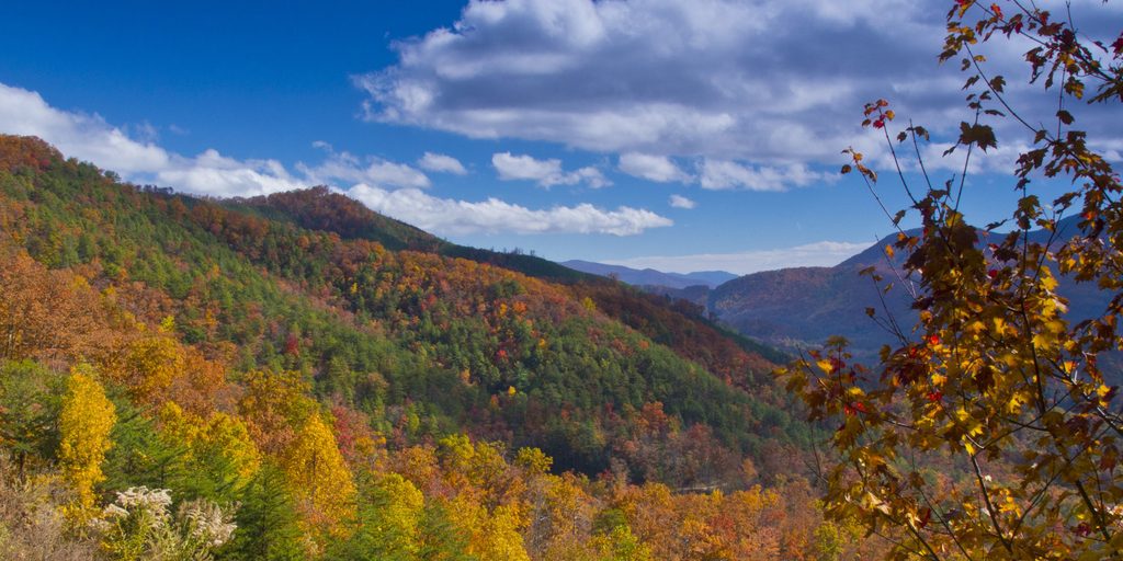
Foothills Parkway is the park’s big-view, roll-the-windows-down drive along the northern edge of the Smokies in Tennessee. It delivers those classic layer-upon-layer mountain vistas with a string of pullouts that beg you to stop often. If you like seeing the range without battling the heaviest in-park traffic, this is a great play.
The Parkway is split: Foothills Parkway West runs between US 129 and the Wears Valley/Walland area; Foothills Parkway East runs between I‑40 near Hartford and US 321 at Cosby. Sugarlands Visitor Center sits between the two sections, while Cades Cove Visitor Center is closer to the western stretch, depending on where you hop on.
Expect a true ridgeline drive with broad panoramas in both directions. On the West segment, overlooks face the high Smokies and the country around Cades Cove and Thunderhead Mountain. On the East segment, pull-offs open toward the eastern Smokies, including the Mount Cammerer area. Look Rock, the high point on the West side, adds a short paved walk to an observation tower for 360-degree views.
Most overlooks are just that—scenic cutouts without facilities. Plan bathroom and picnic breaks around dedicated spots: Look Rock Picnic Area along the West segment; Cosby Picnic Area and Greenbrier Picnic Area near the East segment. For guaranteed running-water restrooms, route via Sugarlands or Cades Cove visitor centers. Services directly on the road are sparse, so top off essentials before you go.
You’re driving through prime habitat—expect the possibility of wildlife near the roadway at dawn and dusk. Keep speeds down, use pullouts for photos, and never feed animals. Shoulders can be narrow and curvy; stick to official overlooks when you stop.
Weekdays and early mornings are the sweet spot for lighter traffic and clearer air. Low-angle light at sunrise and late afternoon makes the scenery and photos pop, with fall color and crisp winter days offering standout visibility. Weather can bring fog or ice to the ridges any time of year, so check day-of conditions and be flexible.
Start early, take your time, and give yourself permission to stop at every view that grabs you. If you want a leg-stretcher, add the short Look Rock Tower walk on the West side. If you’re on the East side, pair the drive with a picnic at Cosby or Greenbrier and a nearby waterfall or old-growth forest hike.
Place · 4.4 mi away
Place · 6 mi away
Place · 6 mi away
Place · 6.5 mi away
Moderate · 6.7 mi away
Challenging · 6.8 mi away

Moderate · 7 mi away
Easy · 7.3 mi away

Parkwolf Tour Guide
