Pros & cons
PROS
- Fortress-like wall of spires above Amethyst Lake
- Spectacular sunrise light and golden larches in fall
CONS
- Reached by a long, multi-day backcountry hike
- Mosquitoes and muddy sections in midsummer; glacial stream crossings
- Seasonal caribou closures may limit access
Overview
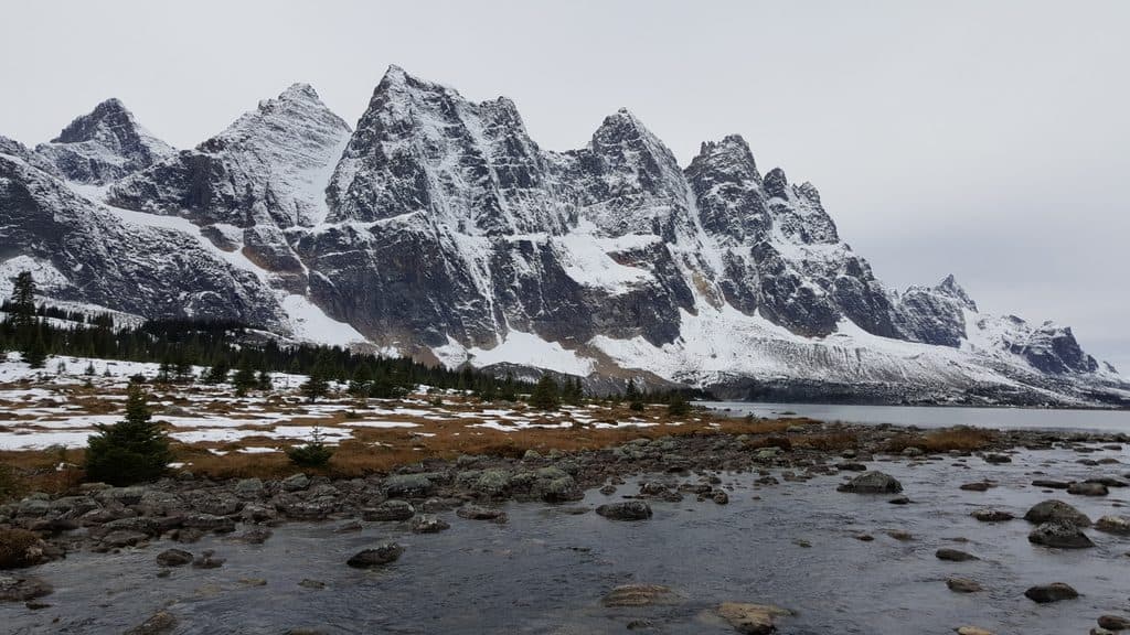
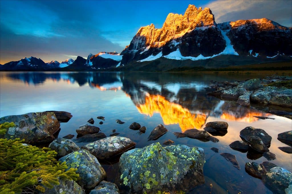
The Ramparts are a jagged line of pinnacled peaks straddling the Continental Divide, forming the dramatic western wall of the Tonquin Valley. Highest among them is Mount Geikie, and many summits carry fortress-themed names—Bastion, Parapet, Redoubt—because the skyline looks exactly like a stone citadel. They’re the signature backdrop to Amethyst Lake and one of the park’s most photogenic mountain vistas.
What You'll See
From the meadows and shorelines around Amethyst Lake, the Ramparts vault nearly straight up, a sheer, serrated skyline reflected in quiet water. Expect a mosaic of subalpine lakes, wildflower meadows, and larch forests that flare gold in autumn. It’s remote, big-country scenery with huge skies and that far‑from‑civilization feeling.
How People Experience It
Most visitors meet the Ramparts on a multi-day backpack along the Tonquin Valley Trail via the Astoria or Portal Creek trailheads. Typical trips run 44–60 km depending on your loop and campsites, with the classic views centered around Amethyst Lake. There are multiple established backcountry campgrounds in the valley and an Alpine Club of Canada hut near the lake.
Wildlife
This is important habitat for caribou (now rarely seen) and home to grizzly and black bears. Listen for marmots and pikas in the talus and watch for eagles, ptarmigan, and migrating waterfowl near the lakes. Be bear‑aware and keep a clean camp.
Conditions and Challenges
The approach is long and can be muddy after wet weather, and there are glacial stream crossings that change character with conditions. Mosquitoes can be fierce in July and August—plan accordingly. Weather turns quickly in the high country even in summer, so pack real layers and rain protection.
Photography
Sunrise and late‑day light are prime when the Ramparts catch warm side‑light and winds drop for mirror reflections on Amethyst Lake. Clear nights can deliver big‑sky stars over the ridge.
Best Time to Visit
- Season: Late summer through early fall for more stable weather; September is special when the larches go gold and bugs fade.
- Week timing: Midweek tends to be quieter at campsites.
- Light: Be on the lakeshore at dawn or late afternoon for the best angles and reflections.
- Closures: Caribou conservation closures can affect access—check current advisories and plan permits and campsites early in peak season.

Practical Notes
This is pure backcountry: no services in the valley. Backcountry campgrounds have basic pit/vault toilets; bring all food and a water treatment method. Carry navigation (NTS 83D/9 “Amethyst Lakes” is the relevant topo), bear spray, and proper food storage gear.
Where it is
52.7000, -118.3000Tips for The Ramparts
- 01Reserve backcountry campsites and permits early for peak season itineraries.
- 02Astoria and Portal Creek are the two main trailheads—plan your loop accordingly.
- 03Expect glacial stream crossings and potentially muddy sections after rain.
- 04Prime light is sunrise and late afternoon along Amethyst Lake’s shore.
- 05Carry the NTS 83D/9 Amethyst Lakes topo, bear spray, and a water filter.
Near The Ramparts
All places →All trails →
0.8 mi awayAmethyst LakesRemote alpine lakes mirrored by the Ramparts in Tonquin ValleyRestroom · Campground
1.8 mi awayTonquin ValleyBackcountry valley of jagged Ramparts, mirror lakes, and caribouTrailhead · Campground
3.2 mi awayWates-Gibson HutRemote hut on a lake, gateway to Tonquin alpineLodging
9.6 mi awayIndian RidgeHigh‑alpine ridgewalk with huge views, a short SkyTram awayScenic Viewpoint
10.1 mi awayTonquin Valley TrailBig-mountain swagger: Amethyst Lakes under the jagged RampartsChallenging · 27.3 mi · 60 hr
10.1 mi awayVerdant Pass TrailQuiet alpine meadows and big views if you don't miss the turnChallenging · 11.5 mi · 7 hr
10.1 mi awayAstoria River TrailGentle gateway into Tonquin Valley along a wildlife-rich riverModerate · 8.8 mi · 5 hr
10.1 mi awayCavell Lake LoopShort, glassy-lake circuit beneath Mount Edith CavellEasy · 1 mi · 30 min