

Place · 2 mi away
Challenging
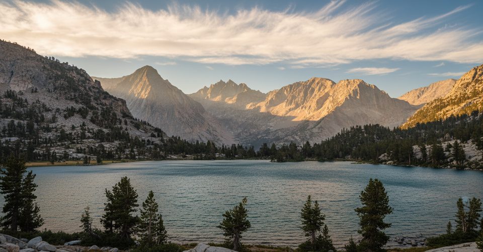
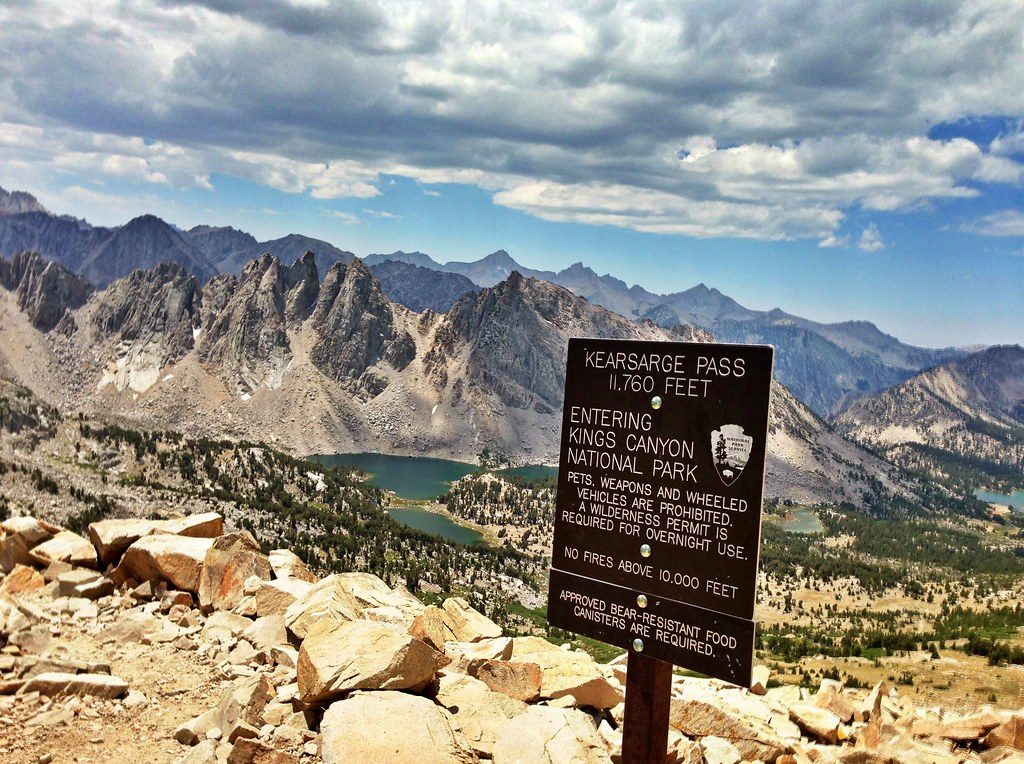
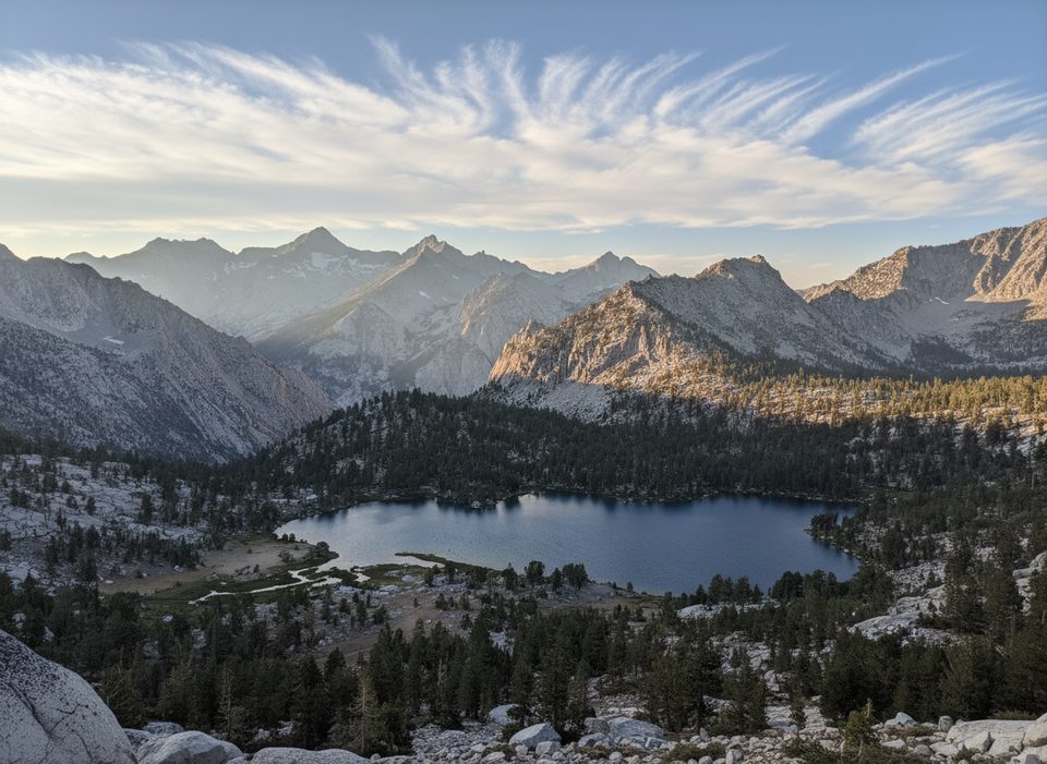
This is a strenuous high‑altitude out-and-back over Kearsarge Pass to Bullfrog Lake in Kings Canyon’s high country. Expect roughly 13.1 miles total with about 3,746 feet of climbing, topping out at Kearsarge Pass (11,760 feet) before dropping toward the lake. Many day hikers turn around at the high overlook; continuing to the shoreline adds distance and makes the return climb back to the pass feel much bigger.
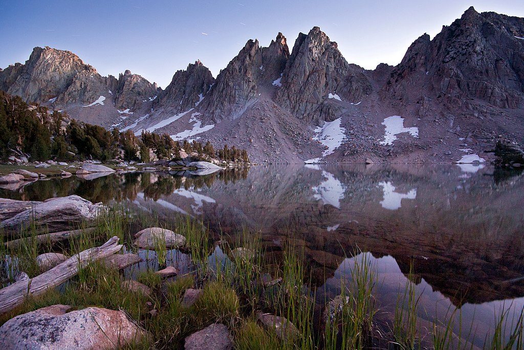
Start from Onion Valley above Independence and head up the well-built Kearsarge Pass Trail. The path threads a chain of lakes—Little Pothole, Gilbert, Flower, Heart, and Big Pothole—on sustained switchbacks to the pass. From Kearsarge Pass, descend into Kearsarge Basin toward a signed spur for Bullfrog Lake. Views here are classic Sierra Nevada granite and glacial terrain. Expect to cross paths with JMT/PCT thru-hikers along the pass corridor.
This is a full-day effort at real altitude. The climb is steady on the way up, but the sting comes late: if you drop down to Bullfrog Lake, you must re-climb back to the pass before descending to the trailhead. The reward is nonstop scenery and a quintessential Sierra pass crossing.
Best in late spring through early fall, with the most reliable snow-free window in summer to early fall depending on the year. Start early for cooler temps and calmer skies; afternoon build-ups and fast weather shifts are common at high elevation. Shoulder seasons can bring lingering snow and ice on the pass—check conditions before you go.
Day hiking this route does not require a wilderness permit. Overnight trips do require a wilderness permit and proper food storage. No camping is allowed within 1/4 mile of Bullfrog Lake; popular legal options are in nearby basins like Kearsarge/Charlotte Lakes (limits apply). Follow minimum-impact rules for human waste and campsite selection.
Leashed pets are allowed on trails in the surrounding national forest, but pets are prohibited on trails once you enter the national park—plan accordingly if you’re aiming for Bullfrog Lake inside park boundaries.
There’s a different “Bullfrog Lakes” hike from Mineral King via Farewell Gap in the Golden Trout Wilderness/Sequoia area. Great trip, but different place, different stats. Make sure you’re planning for the Onion Valley → Kearsarge Pass route if your target is Bullfrog Lake in Kings Canyon.
Large, free parking lot at Onion Valley/Kearsarge Pass Trailhead by the campground; arrive early on weekends.
High altitude, rapid weather shifts, and a steep re-climb to the pass; snow/ice can linger in shoulder seasons. No camping within 1/4 mile of Bullfrog Lake. Pets prohibited on park trails.
Place · 2 mi away
Place · 2.6 mi away
Place · 3.6 mi away
Place · 3.7 mi away
Challenging · 0 mi away
Challenging · 0 mi away
Challenging · 0 mi away
Challenging · 13.5 mi away

Parkwolf Tour Guide
