

Place · 4.1 mi away
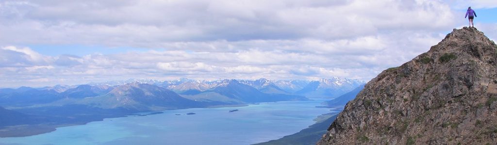
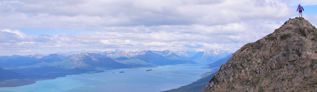
If you want the signature big view without a bush plane drop on a glacier, Tanalian Mountain is your Port Alsworth classic. It’s a serious day out with a real summit feel, sweeping looks over Lake Clark and the jagged Chigmit skyline, and the option to bail at a high cairn that already delivers huge scenery.
Start on the Tanalian trail system from Port Alsworth, taking either the Beaver Pond or Tanalian Falls path to the Tanalian Mountain junction (about 1.7 miles). From there, the grade cranks up. Expect forested switchbacks, muddy and rooty stretches with some boardwalks low, then open tundra and rock higher. Many hikers turn around at a rocky cairn roughly 4 miles in and about 2,200 feet up—views are already outstanding here.
Going for the true summit? The final mile is unmaintained and earns the “hard” rating: around 1,200 feet of additional gain on a narrow, often windy ridgeline with rock scrambling. Plan on 8.6–12 miles round-trip, 2,200–4,000 feet of gain, and 6–9 hours depending on your turnaround point and whether you add the waterfall detour.
You’re in bear country. Carry bear spray, make noise, and give wildlife space. Above treeline, it’s possible to spot mountain sheep on ridges and raptors riding thermals. Weather swings are real—rain or even summer snow can roll in fast. Bring layers, rain gear, sturdy boots (traction helps on steep, loose rock), plenty of food/water, and offline navigation. No cell service; a satellite communicator is smart.
There are no roads in—most visitors fly by small plane or floatplane into Port Alsworth from hubs like Anchorage, Homer, or Kenai, with typical round-trip fares starting around the $500 range. Once in town, you’ll walk to the trail system; don’t expect a conventional parking lot or typical trailhead amenities. Plan as if there are no restrooms or potable water at the trail start. Camping and private lodges exist in and near Port Alsworth, including a private campground about a mile from the trailhead. The park itself doesn’t charge an entrance fee.
This corner of Lake Clark has a long human story. Tanalian Point, just south of Port Alsworth, was an early settlement and travel hub on the lake’s southeastern shore. The Dena’ina name for the Tanalian River translates to “flows into water stream,” a nod to the landscape’s web of waterways.
June through September offers the best window for snow-free travel and open local services. Start early for calmer winds and better weather odds; aim for clear days if you’re considering the exposed summit ridge. Crowds aren’t the issue here—weather and daylight are. Morning light can be gorgeous on the lake; late afternoon often brings more wind up high.
If you’re up for a legit climb and want the definitive Port Alsworth panorama, absolutely. The cairn makes it accessible to strong hikers who don’t love exposure; the summit rewards confident scramblers. Add the falls if you’ve got gas in the tank on the way down.
Place · 4.1 mi away

Place · 4.4 mi away

Place · 4.8 mi away
Place · 4.8 mi away
Challenging · 4.4 mi away
Moderate · 4.4 mi away

Easy · 4.4 mi away

Easy · 4.4 mi away

Parkwolf Tour Guide
