Tanalian Mountain Trail in Lake Clark National Park

#3 of 5 trails in Lake Clark

Lake Clark National Park, AK

Tanalian Mountain Trail

A steep all-day climb for wide views over Lake Clark.

Photo: National Park Service
Length
8.6mi
Time
8.5hr
Elev. change
3,435ft
Difficulty
Challenging
  • Dogs allowed
  • High point 3,711 ft

Hear the audio tour

Tanalian Trails and Falls

Overview

About Tanalian Mountain Trail

Why go

  • Wide summit views over Lake Clark and Kontrashibuna Lake
  • A route from spruce and birch forest to open tundra
  • A chance to spot sheep near the summit

Heads up

  • A steep, strenuous outing that takes at least eight hours
  • The upper route continues beyond the marked maintenance boundary

Map & elevation

The route

Loading the Lake Clark map
Full map
Elevation276–3,711 ft
TrailheadTanalian Mountain Trail junction with Tanalian Falls Trail60.19714, -154.31272
Keep this map with you offline in the Parkwolf app

Plan your hike

Before you go

Parking

Port Alsworth is not connected to the road system. The Tanalian Trails access is near the southernmost airstrip; follow the Tanalian Falls Trail to the Mountain Trail junction, where the 8.6-mile route begins. Check with the visitor center for the current map and trail conditions.

Safety

The climb is steep and can be muddy, slippery and rocky; some scrambling may be needed. The upper route is unmaintained beyond the marked boundary. This is bear and moose habitat: keep dogs leashed, and use proper food storage.

A park ranger sits on a dash-mounted phone, talking, as Parkwolf’s Tour Guide plays “Army Cutworm Moths: A Grizzly Bear Buffet” on Grand Loop Road below Dunraven Pass in Yellowstone
Parkwolf Tour GuideThe highest, rockiest slopes around here are a summer buffet for grizzly bears.

Lake Clark Tour Guide

Your drive to Tanalian Mountain Trail, narrated.

Parkwolf is a GPS audio tour guide for Lake Clark National Park. As you drive, it chimes in with what’s ahead: hidden gems, upcoming stops, history, geology, and wildlife, right through your car’s speakers.

See the Lake Clark audio tour

Recorded for this trailhead

Tanalian Trails and Falls
0:00 / 0:21
“You're approaching the Tanalian Trails access, where I'd choose the walk to Tanalian Falls. It's roughly four miles round trip and takes about two and a half hours through birch and spruce.”

Plays as you drive up to this trailhead in the Parkwolf Lake Clark Tour Guide.

More stories near here in the app

  • Cissie's Kitchen
  • Port Alsworth Visitor Center and Fish Cache
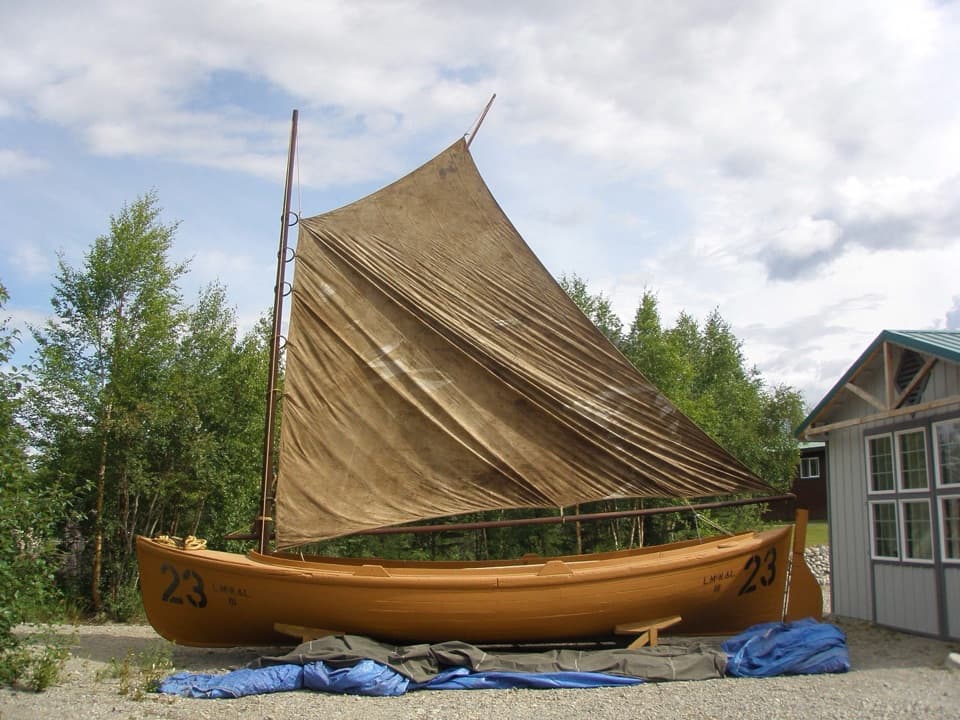
  • Libby's Orange Sailboat
  • 18 audio storiesacross Lake Clark’s roads, triggered by GPS as you drive
  • Wildlife heatmapsfor Brown Bear, Bald Eagle, Common Merganser
  • Works offlinemaps, 5 trails, 34 places, and audio download before you lose signal
  • CarPlay readysimple controls built for the drive
★★★★★
“Fantastic app with many points of information… It’s great to just turn on while you’re driving and it gives you an audio tour of the national Park. We love it!!!!”
JMJamesApp Store review
Download Parkwolf on the App StoreGet Parkwolf on Google Play

4.7 from 8,600+ ratings

Trail guide

Hiking Tanalian Mountain Trail

Is this your day?Tanalian Mountain Trail is an 8.

Tanalian Mountain Trail is an 8.6-mile out-and-back from the Tanalian Falls Trail to a rocky summit above Lake Clark. Allow at least eight hours. This is a steep, strenuous mountain day, not a quick extension of the waterfall walk. The park’s distance matches the Mountain Trail from its junction with the Falls Trail; walking in from another point on the Tanalian trail system adds approach distance.

From forest to tundraThe route starts along the Tanalian Falls Trail through birch and spruce, with alder and willow…

The route starts along the Tanalian Falls Trail through birch and spruce, with alder and willow farther up. Then the forest gives way to open tundra and rocky slopes. The climb rises quickly: the upper ascent goes from about 650 feet to 3,900 feet in roughly 2.5 miles. Expect muddy or slippery ground, rocks, and some scrambling. If a long, steep climb is not your kind of hike, the summit is a poor fit.

Know where maintenance endsThe park map marks a point beyond which the trail is not maintained, even though the mapped…

The park map marks a point beyond which the trail is not maintained, even though the mapped route continues toward the summit. The upper section needs more care with route-finding than the forest approach. Pick up the current trail map and check conditions at the Port Alsworth visitor center before heading out.

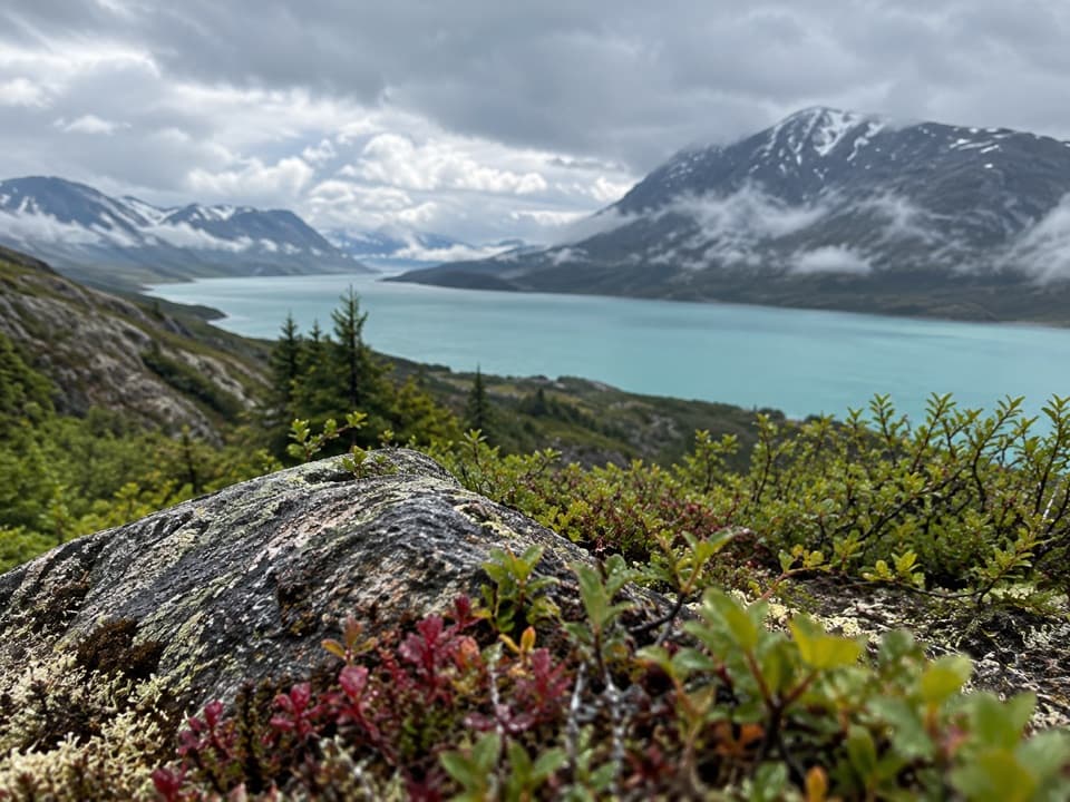
The summit payoffFrom the top, the view opens over Lake Clark and Kontrashibuna Lake toward distant mountain…

From the top, the view opens over Lake Clark and Kontrashibuna Lake toward distant mountain ridges. A survey benchmark sits just before the very top, and sheep may be seen near the summit. Give yourself time at the top; turning around as soon as you reach the benchmark means stopping short of the highest point.

Plan for a full dayThe summit is colder and windier than the lower trail, and rain can come at any time.

The summit is colder and windier than the lower trail, and rain can come at any time. Bring plenty of water and snacks, plus layers and rain gear. This is bear country, and proper food storage is required; the visitor center has bear-resistant containers for temporary use. Dogs are allowed on leash, though the park strongly encourages leaving them at home because bears and moose use the area.

Want a shorter walk?The moderate Tanalian Falls walk is about 4 miles round trip. The Beaver Pond Loop is 3.

The moderate Tanalian Falls walk is about 4 miles round trip. The Beaver Pond Loop is 3.2 miles round trip. Either makes more sense if you want a half-day outing; the Mountain Trail is for hikers ready to spend most of the day climbing.

Wildlife

Wildlife in Lake Clark

All Lake Clark wildlife maps

Sighting maps show where each species has been reported across Lake Clark. Wildlife moves, so no sighting is guaranteed.

Parkwolf’s Lake Clark ranking

Top-rated trails in Lake Clark

All 5 trails
  1. 1Tanalian Falls TrailModerate · 4 mi
  2. 2Kontrashibuna Lake TrailModerate · 5.8 mi
  3. 4Teetering Rock TrailModerate · 1.6 mi
  4. 5Portage Creek TrailModerate · 6.5 mi

Take Parkwolf to Lake Clark.

The audio tour guide for the drive, plus offline maps, trails, and wildlife heatmaps for when the signal drops.

4.7 from 8,600+ ratings

Download Parkwolf on the App StoreGet Parkwolf on Google Play