Dales Way in Lake District National Park

Lake District National Park, EN

Dales Way

80-mile point-to-point walk from Ilkley to Bowness-on-Windermere

Photo: Wikimedia Commons
Length
128.7km
Time
2days
Elev. change
376m
Difficulty
Challenging
  • Dogs allowed
  • High point 438 m
  • #86 of 265 in Lake District
Parkwolf audio tour298 stories across Lake District’s roads

Overview

About Dales Way

Why go

  • Long-distance route through changing landscapes
  • Frequent rail access at both ends

Heads up

  • Requires multi-day accommodation and logistics
  • Cam Fell is exposed and weather-sensitive

Map & elevation

The route

Loading the Lake District map
Full map
Elevation62–438 m
TrailheadDales Way start, Ilkley53.92870, -1.83052
Keep this map with you offline in the Parkwolf app

Plan your hike

Before you go

Parking

Point-to-point: begin at the signed Dales Way start in Ilkley, a few hundred metres from the railway station. There is no single car park for the full route; finish in Bowness and use the bus or walk to Windermere station for the return.
Safety

This is a long, multi-day route with livestock, field gates, wet ground and exposed open moorland. Cam Fell can be difficult to navigate in poor weather, so carry a map, guidebook or GPX and pack for wind and rain. Plan food, water and overnight stops between settlements.

8 active Lake District alerts

  • ClosureChapel Stile footpath closed for retaining-wall riskPart of Footpath 543030 between Chapel Stile and Baysbrown campsite is closed because a retaining wall beside the path could collapse and material it supports could fall across the footpath.Official details
  • ClosureStanley Ghyll Lower Falls footpath closed for rockfallThe section of Footpath 408037 leading towards Stanley Ghyll Lower Falls is closed because severe rockfall damage has made the path unstable and further rockfall remains a danger.Official details
See all 8 alerts
A park ranger sits on a dash-mounted phone, talking, as Parkwolf’s Tour Guide plays “Army Cutworm Moths: A Grizzly Bear Buffet” on Grand Loop Road below Dunraven Pass in Yellowstone
Parkwolf Tour GuideThe highest, rockiest slopes around here are a summer buffet for grizzly bears.

Lake District Tour Guide

Your drive to Dales Way, narrated.

Parkwolf is a GPS audio tour guide for Lake District National Park. As you drive, it chimes in with what’s ahead: hidden gems, upcoming stops, history, geology, and wildlife, right through your car’s speakers.

  • 298 audio storiesacross Lake District’s roads, triggered by GPS as you drive
  • Wildlife heatmapsfor Red Deer, Eurasian Otter, Osprey, and 13 more
  • Works offlinemaps, 265 trails, 89 places, and audio download before you lose signal
  • CarPlay readysimple controls built for the drive
★★★★★
“Fantastic app with many points of information… It’s great to just turn on while you’re driving and it gives you an audio tour of the national Park. We love it!!!!”

JMJamesApp Store review
Download Parkwolf on the App StoreGet Parkwolf on Google Play

4.7 from 8,600+ ratings

Trail guide

Hiking Dales Way

Route and distanceType: point-to-point, walked as one continuous line rather than a loop
  • Type: point-to-point, walked as one continuous line rather than a loop
  • Distance: 80 miles (128 km) one way, quoted as the full end-to-end route
  • Start: Ilkley, beside the River Wharfe
  • Finish: Bowness-on-Windermere
  • The line links the Yorkshire Dales with southern Lakeland, and the stored route deliberately covers the whole walk rather than a shortened section
Time and difficultyTypical schedule: 5 to 7 days, with about six days the common choice
  • Typical schedule: 5 to 7 days, with about six days the common choice
  • Difficulty: moderate to hard, 7/10
  • The grade reflects multi-day mileage on mixed ground and the more demanding Cam Fell crossing, where the walking is higher, rougher and more exposed than the riverside stages
What the walking is likeVariable riverside paths, quiet lanes, farm tracks, and many gates and stiles
  • Variable riverside paths, quiet lanes, farm tracks, and many gates and stiles
  • Stretches of open, exposed moorland where weather changes quickly
  • Limestone country and a string of historic villages through the dales
  • Later stages bring the River Dee, the Howgills, the Lune Gorge and the Lakeland foothills
Rough sequence1. Ilkley and the River Wharfe

1. Ilkley and the River Wharfe

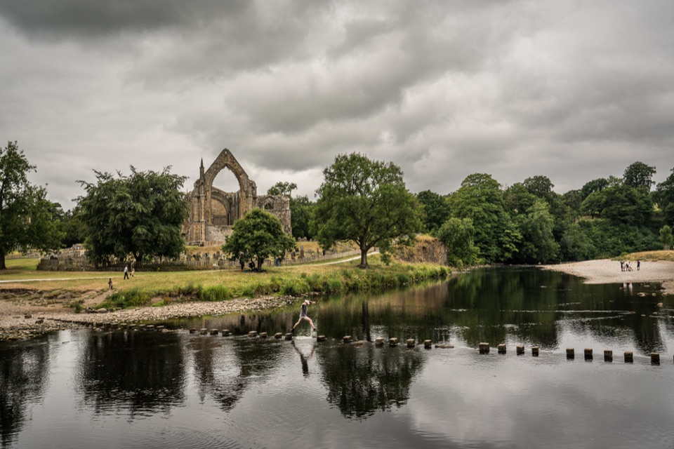
2. Bolton Abbey and the Strid

3. Burnsall, Grassington, Kettlewell, Buckden

4. Cam Fell and Upper Ribblesdale

5. Dentdale, Dent and Sedbergh

6. Lunesdale and the Lune Gorge

7. Burneside, the River Kent and Staveley

8. Lakeland foothills to the Bowness finish

Navigation and accessThe route is generally waymarked, but carry a map, guidebook or GPX, especially for higher and…
  • The route is generally waymarked, but carry a map, guidebook or GPX, especially for higher and moorland sections
  • The route follows public-access countryside; no route-specific permit was established in research.
  • Dogs are generally welcome; keep them on a lead or under close control around livestock and through farmland
Getting there and parkingIlkley station sits a few hundred metres from the start
  • Ilkley station sits a few hundred metres from the start
  • Windermere station is about 1.5 miles from Bowness, with a bus link into the village
  • There is no single car park that suits the full route, so travelling by train at both ends is the simpler plan for a one-way walk

Wildlife

Wildlife in Lake District

All Lake District wildlife maps

Sighting maps show where each species has been reported across Lake District. Wildlife moves, so no sighting is guaranteed.

Parkwolf’s Lake District ranking

Top-rated trails in Lake District

All 265 trails
  1. 1Scafell Pike via Hollow Stones from WasdaleChallenging · 9 km
  2. 2Helvellyn via Striding Edge and Swirral EdgeChallenging · 12.4 km
  3. 3CatbellsModerate · 6.6 km
  4. 4The Old Man of ConistonChallenging · 9 km
  5. 5Buttermere CircularEasy · 7.6 km
  6. 6The Fairfield HorseshoeChallenging · 17.2 km

Take Parkwolf to Lake District.

The audio tour guide for the drive, plus offline maps, trails, and wildlife heatmaps for when the signal drops.


4.7 from 8,600+ ratings

Download Parkwolf on the App StoreGet Parkwolf on Google Play










