Depot Creek Falls in Mount Aspiring National Park

Sight · Mount Aspiring National Park

Depot Creek Falls

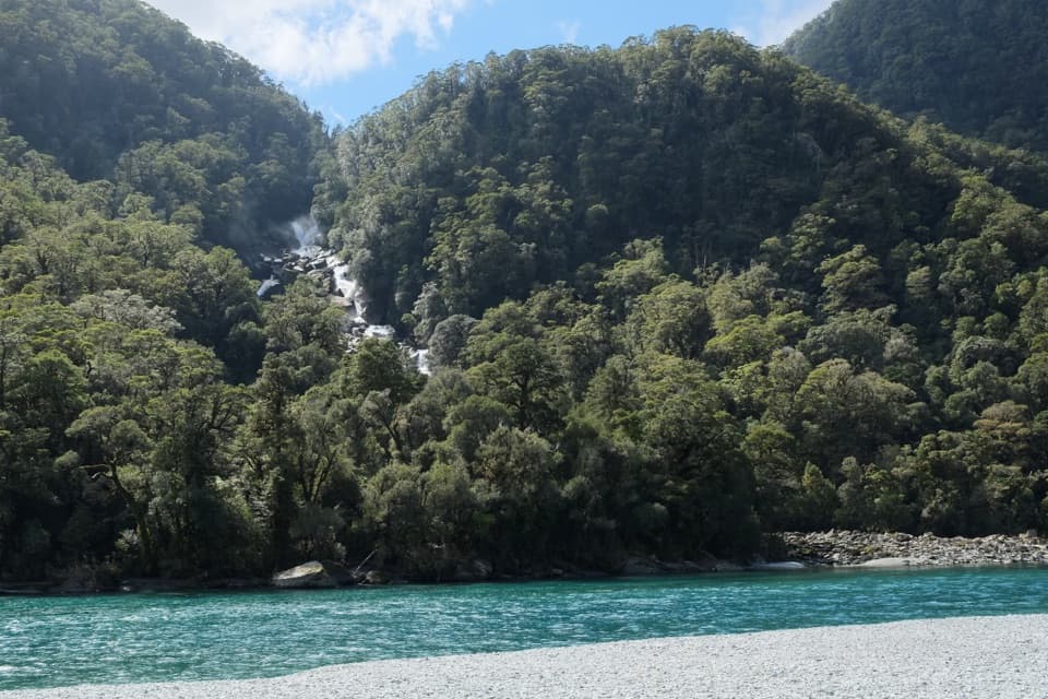
A short forest path leads to a waterfall beside the Haast Highway.

Type
Sight
Nearest trail
4.2 km
Audio stories
3 nearby
  • Pullout
  • Scenic viewpoint

Hear the audio tour

Depot Creek Falls: An Informal Forest Stop

Overview

About Depot Creek Falls

Why stop

  • A waterfall view after only a very short forest walk.

Heads up

  • The unsigned pull-off and informal path need care.

Map

Where it is

Loading the Mount Aspiring map
Full map
SightDepot Creek Falls-43.96125, 169.24224
Keep this map with you offline in the Parkwolf app

Plan your stop

Before you go

1 active Mount Aspiring alert

  • CautionRob Roy Track: stop at lower lookout during avalanche seasonFrom May through November, end your Rob Roy Track hike at the lower lookout; DOC strongly recommends against continuing to the upper lookout because the track crosses active avalanche paths.Official details
Mount Aspiring alerts
A park ranger sits on a dash-mounted phone, talking, as Parkwolf’s Tour Guide plays “Army Cutworm Moths: A Grizzly Bear Buffet” on Grand Loop Road below Dunraven Pass in Yellowstone
Parkwolf Tour GuideThe highest, rockiest slopes around here are a summer buffet for grizzly bears.

Mount Aspiring Tour Guide

Your drive to Depot Creek Falls, narrated.

Parkwolf is a GPS audio tour guide for Mount Aspiring National Park. As you drive, it chimes in with what’s ahead: hidden gems, upcoming stops, history, geology, and wildlife, right through your car’s speakers.

See the Mount Aspiring audio tour

Recorded for this place

Depot Creek Falls: An Informal Forest Stop
0:00 / 0:20
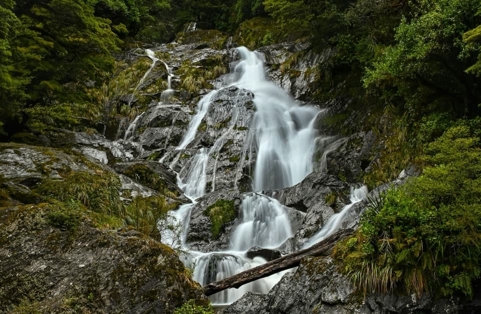
“You're approaching Depot Creek Falls, a small cascade over dark rock ledges in the forest. An unsigned, informal path leads from the gravel pull-off to a clearing, roughly fifty metres away.”

Plays as you drive up to Depot Creek Falls in the Parkwolf Mount Aspiring Tour Guide.

More stories near here in the app

  • Horopito's Red Warning
  • A Pounamu Blade’s Second Life
  • The Landslide That Made a Lake
  • Roaring Billy Falls: Forest and River
  • 80 audio storiesacross Mount Aspiring’s roads, triggered by GPS as you drive
  • Wildlife heatmapsfor Kea, Rockwren, Yellowhead, and 8 more
  • Works offlinemaps, 50 trails, 52 places, and audio download before you lose signal
  • CarPlay readysimple controls built for the drive
★★★★★
“Fantastic app with many points of information… It’s great to just turn on while you’re driving and it gives you an audio tour of the national Park. We love it!!!!”
JMJamesApp Store review
Download Parkwolf on the App StoreGet Parkwolf on Google Play

4.7 from 8,600+ ratings

Guide

More about Depot Creek Falls

A quick roadside waterfallDepot Creek Falls is a small cascade beside State Highway 6, near the bridge over Depot Creek.

Depot Creek Falls is a small cascade beside State Highway 6, near the bridge over Depot Creek. A short, informal path climbs through a patch of forest to a clearing facing the falls. It is a modest road stop on the Wanaka–Haast drive, with a waterfall view after only a brief walk.

The entrance is unsigned, and accounts describe a rough gravel area rather than a marked public car park. Stop only if you can pull well clear of traffic safely; skip it if the turnout does not look safe. There are no visitor facilities at the falls.

The short way inThe path is roughly 30 to 50 metres, rising gently through the trees.

The path is roughly 30 to 50 metres, rising gently through the trees. With no sign at the entrance, allow a couple of minutes to spot it from the gravel area. The clearing is the only clearly described viewpoint. There is no consistently described or marked route to the base, so do not count on a descent to the water.

After rain, the falls may look stronger, but the informal path can be slippery. Take care on the approach.

A cascade in the forestWater drops over a dark, sloping rock face in several steps, with moss and ferns around the…

Water drops over a dark, sloping rock face in several steps, with moss and ferns around the ledges. It is a smaller, quieter stop than the better-known falls along the pass, so it suits a quick pause more than a dedicated waterfall outing.

For a phone photo, include some of the rock shelves and forest around the water. That shows the falls’ stepped shape better than a tight crop of the white water alone.

Wildlife

Wildlife in Mount Aspiring

All Mount Aspiring wildlife maps

Sighting maps show where each species has been reported across Mount Aspiring. Wildlife moves, so no sighting is guaranteed.

Parkwolf’s Mount Aspiring ranking

Top sights in Mount Aspiring

All 52 places
  1. 1Mount Aspiring / TititeaSight
  2. 2Blue PoolsSight
  3. 3Rob Roy GlacierSight
  4. 4Thunder Creek FallsSight
  5. 5Fantail FallsSight
  6. 6Routeburn FallsSight

Take Parkwolf to Mount Aspiring.

The audio tour guide for the drive, plus offline maps, trails, and wildlife heatmaps for when the signal drops.

4.7 from 8,600+ ratings

Download Parkwolf on the App StoreGet Parkwolf on Google Play