King Charles III England Coast Path: North East and East Coast in North York Moors National Park

North York Moors National Park, EN

King Charles III England Coast Path: North East and East Coast

Cliffs, harbour towns and 328 miles of coast, Humber to the Border

Photo: Wikimedia Commons
Length
528.5km
Time
6days
Elev. change
164m
Difficulty
Challenging
  • Dogs allowed
  • High point 164 m
Parkwolf audio tour298 stories across North York Moors’s roads

Overview

About King Charles III England Coast Path: North East and East Coast

Why go

  • Huge variety from North Yorkshire cliffs to Northumberland beaches and heritage sites
  • Towns and villages break up the long point-to-point days

Heads up

  • Requires a multi-week itinerary and careful stage-by-stage logistics
  • Exposed, tidal and erosion-prone sections can change the practical line
This is a long, linear, logistics-heavy walk with repetitive road and promenade stretches between the highlights. If you mainly want the drama of the North Yorkshire coast, a staged section of the Cleveland Way covers the same cliffs in a few days with far simpler planning. The full route makes sense if what you actually want is a continuous long-distance coastal crossing of the whole North East.
Parkwolf’s verdictWorth being honest about

Map & elevation

The route

Loading the North York Moors map
Full map
Elevation0–164 m
TrailheadHumber Bridge53.70758, -0.45023
Keep this map with you offline in the Parkwolf app

Plan your hike

Before you go

Parking

Point-to-point route: begin at Humber Bridge, where the official North East section starts, and arrange overnight stops and return travel from the Scottish Border. Bridge-side access and parking serve the start; some Country Park approaches involve steps.

Best time to go

The trail is open year round. Long summer daylight makes the big coastal stages easier to fit in, while spring and autumn are quieter and often kinder for walking. Winter days are short and the exposure bites. Whatever the season, build slack into your schedule for weather and tide timing, especially around Holy Island.

Safety

Exposed cliffs and beaches, rapidly changing wind and storms, tides and waves, erosion-related rollbacks, steep flights of steps in places, and the tidal causeway to Holy Island. Follow local signs and check tide times before coastal or causeway stages.

8 active North York Moors alerts

  • ClosureHawnby Bridleway 110 closurePublic Bridleway 25.122/110/1 in Hawnby is closed to pedestrians, cyclists and equestrians because its bridge is unsafe. - The closure is between grid references SE 5309 9073 and SE 5335 9097.Official details
  • ClosureWest Ayton Footpath 1 closurePublic Footpath 1 in West Ayton (Forge Valley) is temporarily closed because its boardwalk is unsafe. - The closure is between SE 9860 8494 and SE 9839 8712.Official details
See all 8 alerts
A park ranger sits on a dash-mounted phone, talking, as Parkwolf’s Tour Guide plays “Army Cutworm Moths: A Grizzly Bear Buffet” on Grand Loop Road below Dunraven Pass in Yellowstone
Parkwolf Tour GuideThe highest, rockiest slopes around here are a summer buffet for grizzly bears.

North York Moors Tour Guide

Your drive to King Charles III England Coast Path: North East and East Coast, narrated.

Parkwolf is a GPS audio tour guide for North York Moors National Park. As you drive, it chimes in with what’s ahead: hidden gems, upcoming stops, history, geology, and wildlife, right through your car’s speakers.

  • 298 audio storiesacross North York Moors’s roads, triggered by GPS as you drive
  • Wildlife heatmapsfor Eurasian Otter, Red Deer, Grey Seal, and 13 more
  • Works offlinemaps, 126 trails, 65 places, and audio download before you lose signal
  • CarPlay readysimple controls built for the drive
★★★★★
“Fantastic app with many points of information… It’s great to just turn on while you’re driving and it gives you an audio tour of the national Park. We love it!!!!”
JMJamesApp Store review
Download Parkwolf on the App StoreGet Parkwolf on Google Play

4.7 from 8,600+ ratings

Trail guide

Hiking King Charles III England Coast Path: North East and East Coast

What this isThis is the full North East and East Coast section of the King Charles III England Coast Path,…

This is the full North East and East Coast section of the King Charles III England Coast Path, walked one way from the Humber Bridge to the Scottish Border. It runs about 328 miles (528 km) as a point-to-point National Trail section, so plan it as a multi-week walk rather than a day out. Most ordinary walkers take somewhere around 20 to 25 days depending on how long you make each stage and how often you stop.

The route in sequenceFrom the Humber Bridge the path works out along the East Riding coast, then north past…

From the Humber Bridge the path works out along the East Riding coast, then north past Bridlington and Filey onto the North Yorkshire coast, through Scarborough, Whitby and the cliff villages, across Teesside and Durham, on through Tyneside and finally the long Northumberland coast to the border near Berwick-upon-Tweed. Along the North York Moors coastline it shares the line of the Cleveland Way and is waymarked as both trails, which is handy for navigation and also means the coast path and the whole Cleveland Way are not the same walk. At the southern end of the North Yorkshire stretch the route leaves the cliffs and heads inland on signed permissive paths toward Bridlington.

Scenery and footingThe payoff is variety: rocky cliffs and flower-rich meadows, sandy beaches and rock pools,…

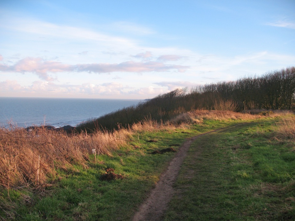
The payoff is variety: rocky cliffs and flower-rich meadows, sandy beaches and rock pools, working harbours and seaside towns, then wide open sands in Northumberland with the tidal causeway across to Holy Island. Surfaces change constantly. Expect natural coastal paths on some days, promenades and pavement through towns on others, and steps in places, including some long steep flights between Bridlington North Sands and Filey. Do not assume the whole route walks or feels the same underfoot, and do not assume it is all easy going.

Difficulty and exposureOverall this is a hard undertaking, mostly because of sheer length, day after day of exposure…

Overall this is a hard undertaking, mostly because of sheer length, day after day of exposure and the logistics rather than steep climbing. Individual sections can be gentle and even paved. The coast is open to storms and strong winds, cliff edges erode, and tides and waves matter on beach and causeway sections. Local diversions and seasonal or tidal changes happen, so follow the acorn and Coast Path waymarks and any local signs on the ground rather than an old plan.

Access, dogs and photosStart at the Humber Bridge and finish at the Scottish Border, so sort out overnight stays,…
  • Start at the Humber Bridge and finish at the Scottish Border, so sort out overnight stays, resupply and your return travel before you set off. Bridge-side parking exists at the start, though some approaches through the country park involve steps.
  • The route threads through towns and villages, but availability varies a lot by stage, so check locally as you plan each leg.
  • Dogs are fine on the public sections, kept under close control near livestock, wildlife, nesting birds, cliff edges and tidal ground, and following local signs and restrictions.
  • For photography, the cliff-top stretches near Whitby, Scarborough and Filey Brigg give you headlands, harbours and long coastal lines, best in low morning or evening light.

Wildlife

Wildlife in North York Moors

All North York Moors wildlife maps

Sighting maps show where each species has been reported across North York Moors. Wildlife moves, so no sighting is guaranteed.

Parkwolf’s North York Moors ranking

Top-rated trails in North York Moors

All 126 trails
  1. 1Cleveland Way National TrailChallenging · 175.4 km
  2. 2Coast to Coast Path National TrailChallenging · 305.8 km
  3. 3Roseberry Topping and Cook’s MonumentModerate · 11.6 km
  4. 4Levisham Moor & Hole of HorcumModerate · 8.4 km
  5. 5Ravenscar to Robin Hood's BayChallenging · 17.7 km
  6. 6Lyke Wake WalkChallenging · 64.7 km

Take Parkwolf to North York Moors.

The audio tour guide for the drive, plus offline maps, trails, and wildlife heatmaps for when the signal drops.

4.7 from 8,600+ ratings

Download Parkwolf on the App StoreGet Parkwolf on Google Play













