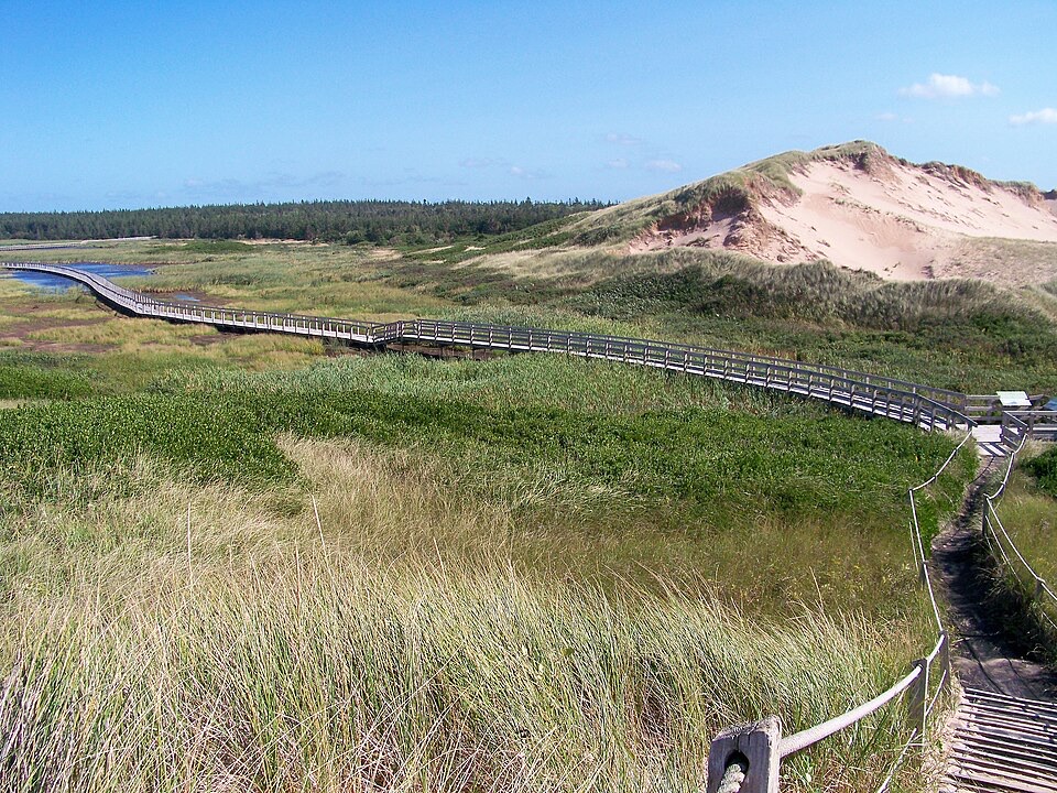
Gulf Shore Way West in Prince Edward Island National Park

#9 of 15 trails in Prince Edward Island

Prince Edward Island National Park, PE

Gulf Shore Way West

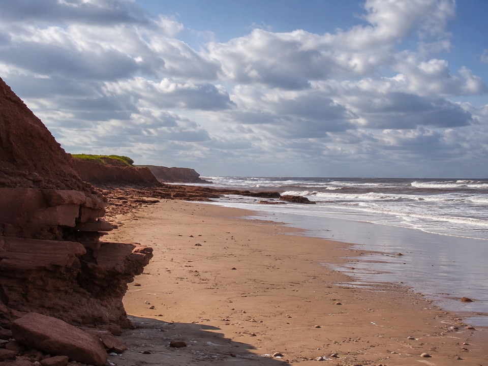
A smooth coastal path with red cliffs, coves, and a beach finish.

Photo: Wikimedia Commons
Length
8.5km
Time
2.8hr
Elev. change
28m
Difficulty
Easy
  • Dogs allowed
  • High point 28 m

Hear the audio tour

Oceanview Lookoff

Overview

About Gulf Shore Way West

Why go

  • Long red-cliff and Gulf views from a smooth paved path
  • Easy surface with beach and cove access along the way

Heads up

  • Point-to-point logistics require a pickup or a 17 km return
  • The parkway stays close, so parts feel road-adjacent

Map & elevation

The route

Loading the Prince Edward Island map
Full map
Elevation0–28 m
TrailheadOceanview, 100 Terre Rouge Lane46.49924, -63.38057
Keep this map with you offline in the Parkwolf app

Plan your hike

Before you go

Parking

Begin at the Oceanview access, 100 Terre Rouge Lane, Cavendish. This is a point-to-point route, so arrange a pickup at North Rustico Beach or return to the west end. The North Rustico end has lower and upper parking areas; washrooms are at the upper lot.

Safety

The paved path is shared with cyclists and stays near Gulf Shore Parkway for much of the route. Beach spurs use stairs and may have separate access rules. Dogs must stay on leash on the trail and are prohibited on park beaches from April 1 through October 15.

3 active Prince Edward Island alerts

  • ClosureOceanview cliff area closed beyond signs and fencingStay out of all unmown areas beyond the signs or fencing at Oceanview (46.49951N 63.38272W), including the rocks and cliff edges.Official details
  • ClosureHomestead trails closed because bridges are outDo not use Homestead Long Loop or Homestead Trail Short loop: both trails are closed because bridges are out. - Respect all posted warnings, closures, notices and signs while using other park trails.Official details
See all 3 alerts
A park ranger sits on a dash-mounted phone, talking, as Parkwolf’s Tour Guide plays “Army Cutworm Moths: A Grizzly Bear Buffet” on Grand Loop Road below Dunraven Pass in Yellowstone
Parkwolf Tour GuideThe highest, rockiest slopes around here are a summer buffet for grizzly bears.

Prince Edward Island Tour Guide

Your drive to Gulf Shore Way West, narrated.

Parkwolf is a GPS audio tour guide for Prince Edward Island National Park. As you drive, it chimes in with what’s ahead: hidden gems, upcoming stops, history, geology, and wildlife, right through your car’s speakers.

Recorded for this trailhead

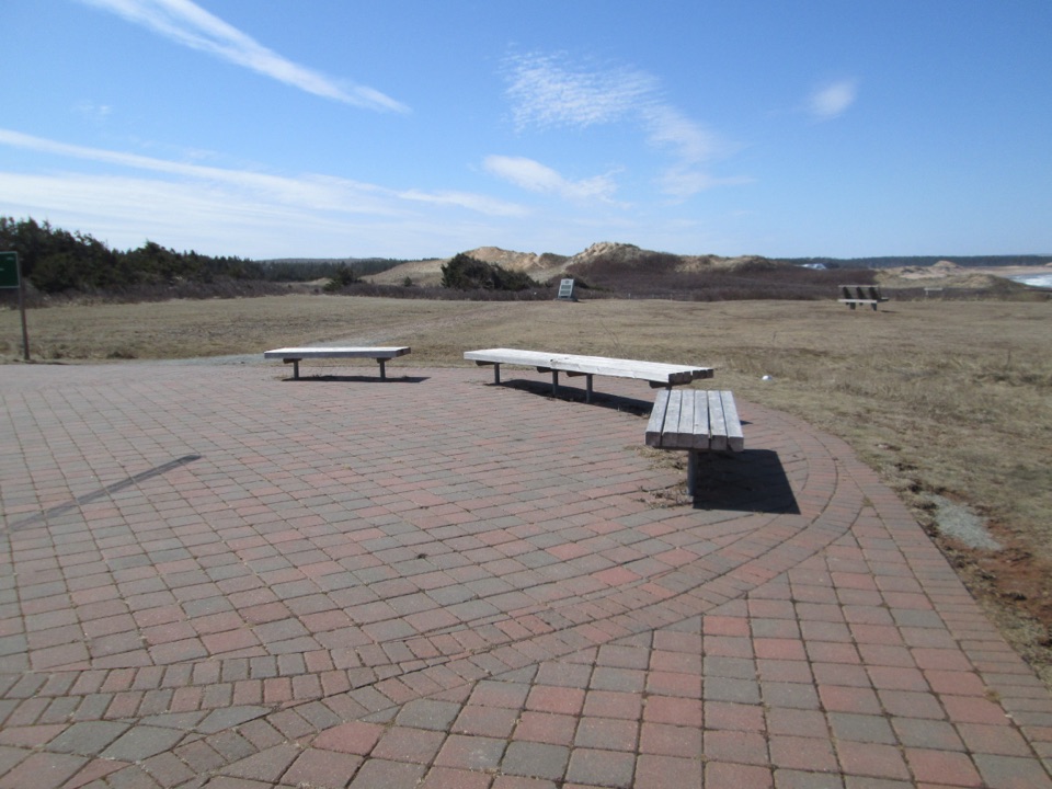
Oceanview Lookoff
0:00 / 0:34
“You're coming up on Oceanview Lookoff, a quick platform stop above the red Cavendish cliffs. It gives you the Gulf and the coastline in one sweep without a long walk.”

Plays as you drive up to this trailhead in the Parkwolf Prince Edward Island Tour Guide.

More stories near here in the app

  • Green Gables Heritage Place
  • Cavendish Grove
  • The Maples Behind the Beach
  • Before the Dinosaurs
  • 29 audio storiesacross Prince Edward Island’s roads, triggered by GPS as you drive
  • Wildlife heatmapsfor Bald Eagle, Osprey, Great Blue Heron, and 12 more
  • Works offlinemaps, 15 trails, 25 places, and audio download before you lose signal
  • CarPlay readysimple controls built for the drive
★★★★★
“Fantastic app with many points of information… It’s great to just turn on while you’re driving and it gives you an audio tour of the national Park. We love it!!!!”
JMJamesApp Store review
Download Parkwolf on the App StoreGet Parkwolf on Google Play

4.7 from 8,600+ ratings

Trail guide

Hiking Gulf Shore Way West

A smooth coastal crossingGulf Shore Way West is an 8.5-kilometre (5.

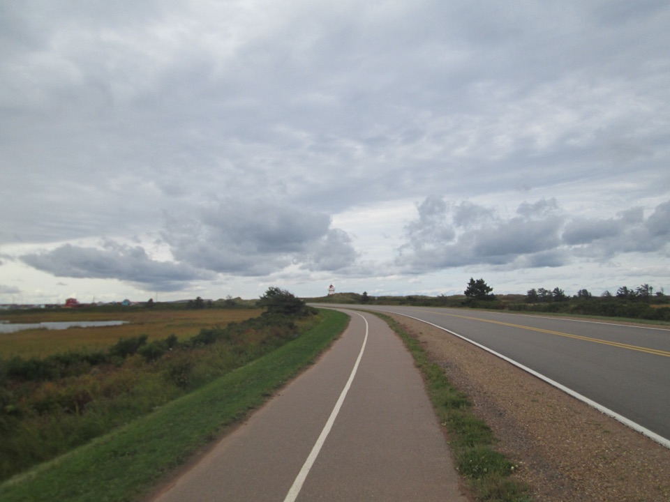
Gulf Shore Way West is an 8.5-kilometre (5.3-mile) one-way trail between Oceanview in Cavendish and the North Rustico entry gate. It follows a paved, multi-use path along the top of Prince Edward Island’s red sandstone coast, with Gulf views, beach access, and gentle rises rather than a hard climb. Allow about three hours one way if you stop at the lookouts and take a stairway down to the shore. This is the route to choose when you want a long coastal outing on a dependable surface, not a quiet backcountry walk.

The west segment is part of a larger Gulf Shore Way network, but this row is only the Cavendish-to-North Rustico connection. Longer listings fold in a town connector, a broader parkway route, or the return trip. Keep that distinction in mind when planning: the stored 8.5 km is one way, and the trail does not close into a loop.

The commitmentIt’s easy underfoot, but the distance is the catch.

It’s easy underfoot, but the distance is the catch. You’re walking point to point, so arrange a pickup at North Rustico or plan on retracing the route for roughly 17 km (10.6 miles). The path is shared with cyclists and other users, and the parkway stays close for much of the crossing. That means traffic and occasional road-adjacent stretches are part of the experience, even when the view is all cliffs and water.

The payoff is a smooth surface with very little route-finding. The trail suits a wide range of walkers and mobility needs, and its light rolling hills are manageable for most people. It’s a good choice for a long, steady outing, especially if uneven trail is a bigger concern than distance. If you’re looking for a secluded forest hike, choose something else.

What you’ll seeFrom Oceanview, the path settles into low rolling hills above the Gulf.

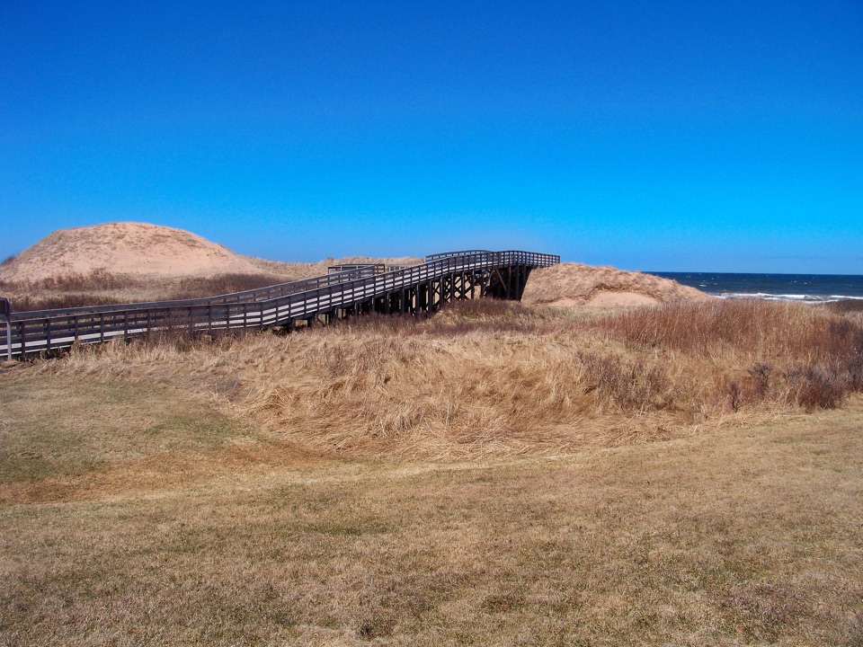
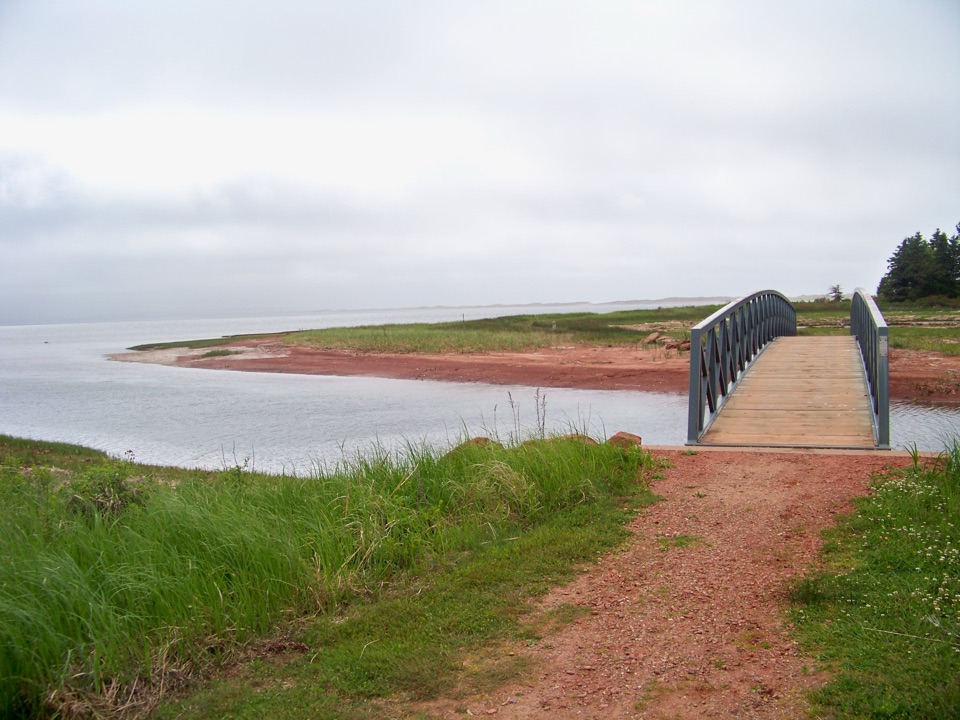
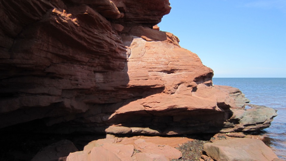
From Oceanview, the path settles into low rolling hills above the Gulf. Layered red cliffs fall toward coves and sandy beaches, and stairways at several points lead down toward the water. The route’s signature is the rhythm: elevated cliff, a gap or cove, another headland, then a new view along the shore. The tread stays paved, but the scenery doesn’t stay flat; the coastline keeps switching between high red rock, low beach, and dune-backed shore.

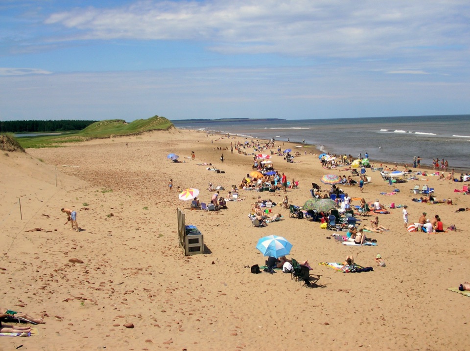
Around the middle, Orby Head is the standout pause. The coast opens in both directions, with rugged shoreline stretching away on either side. Stop here rather than treating it as another bend, and look back along the route to see how the path threads the edge of the parkway and cliffs. At the North Rustico end, the trail finishes beside a wide beach bordered by dunes and red cliffs. The beach gives the one-way walk a proper destination, not just an arbitrary turnaround.

Making it workUse Oceanview, 100 Terre Rouge Lane, as the west-end access.

Use Oceanview, 100 Terre Rouge Lane, as the west-end access. At North Rustico, the lower parking lot is just inside the park entrance and the upper parking area is at the far end of Beach Lane; washrooms are at the upper lot. Those are useful end-of-walk facilities, not midway services, so plan your food, water, and transport before you start.

Dogs may use the trail on leash, but they’re prohibited on park beaches from April 1 through October 15. That matters if you plan to take one of the stairways down from the path. For a photo, Orby Head is the best bet: include some of the red cliff or paved trail in the frame so the Gulf coastline has scale. The Cavendish-side cliffs are another strong stop when the light is clear.

Wildlife

Wildlife in Prince Edward Island

All Prince Edward Island wildlife maps

Sighting maps show where each species has been reported across Prince Edward Island. Wildlife moves, so no sighting is guaranteed.

Keep exploring

Near Gulf Shore Way West

See it all on the map

Trails that start nearby

Places near the trailhead

Parkwolf’s Prince Edward Island ranking

Top-rated trails in Prince Edward Island

All 15 trails
  1. 1Greenwich Dunes TrailModerate · 4.6 km
  2. 2Cavendish DunelandsEasy · 2.4 km
  3. 3Homestead Trail - Simpson LoopModerate · 6 km
  4. 4Tlaqatik TrailEasy · 4.6 km
  5. 5Haunted Wood TrailEasy · 0.9 km
  6. 6Homestead Trail - MacNeill LoopModerate · 10 km

Take Parkwolf to Prince Edward Island.

The audio tour guide for the drive, plus offline maps, trails, and wildlife heatmaps for when the signal drops.

4.7 from 8,600+ ratings

Download Parkwolf on the App StoreGet Parkwolf on Google Play