
Place
Challenging
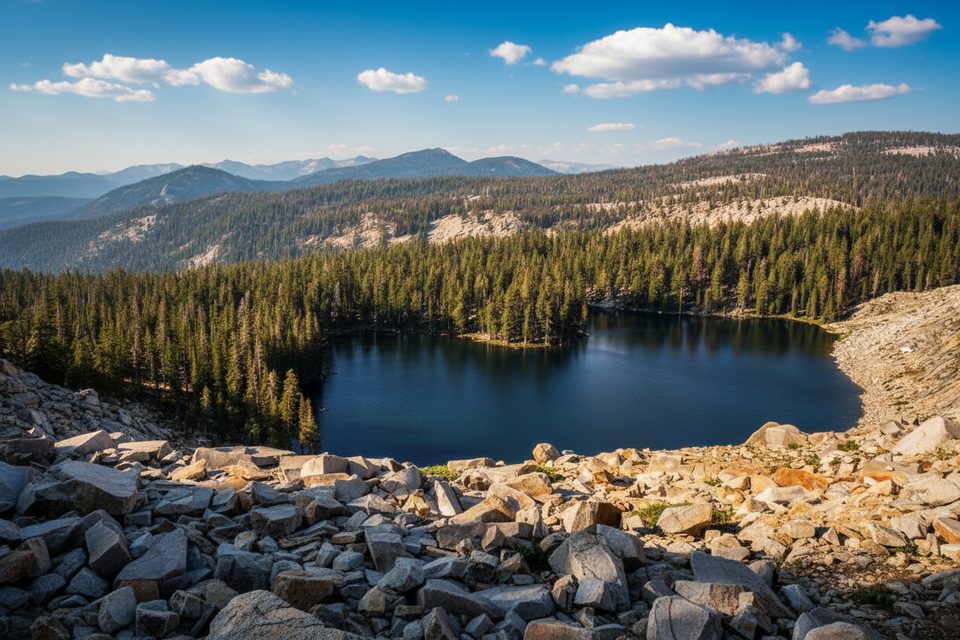
Jennie Lake sits just outside the park boundary in the Jennie Lakes Wilderness of Sequoia National Forest, but it’s a favorite for Sequoia trip planners. From the Fox Meadows Trailhead, the out-and-back is 10.7 miles total with about 2,050 feet of gain and typically takes around 5 hours if you keep moving. Expect a true high-country feel: forested approach, granite underfoot, a stout pass, and a big, clear alpine lake at roughly 9,000 feet.
Most hikers take the Fox Meadows out-and-back (10.7 miles, total). Big Meadows Trailhead is an alternative that adds roughly a mile and ~400 feet of climbing to the overall effort. There’s also a longer loop tying in Weaver Lake (roughly 16 miles total by common accounts), and a separate approach from Upper Stony Creek (~11.7 miles). If you’ve got gas left at Jennie Lake, a side trip east to JO Pass delivers broad ridge views toward Mount Silliman and into the national park.
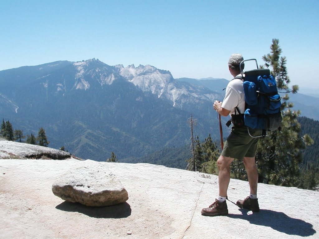
The trail winds around Shell Mountain through mixed conifer forest, then opens onto classic Sierra granite near Poop Out Pass. As you crest the high point and continue, watch for wildflowers in season and keep an eye out for marmots and deer; bear encounters have been reported, too. Jennie Lake is the prize—clear, swimmable water ringed by granite slabs—with established camps mostly on the north and west shores. On the longer loop, you’ll add Weaver Lake and a few crossings of forks of Boulder Creek.
This is a sustained, sometimes punchy climb to Poop Out Pass, followed by a drop and a final climb to the lake—a rollercoaster that can sap the legs. Underfoot is mostly dirt with gravel and rock slabs, and you may encounter downed trees or sun-exposed stretches. Signage is sparse in spots; there’s a known tricky junction about three miles in where the route skirts a small pass-like rest area rather than going straight through. Trekking poles, sun protection, and an offline map are smart calls.
Aim for June through September, adjusting for the year’s snowpack. Early summer brings cooler temps and fewer crowds; midsummer is prime for swimming and fishing but can mean more people and mosquitoes. Start early for cooler hiking, better light on the lake, and a smoother day if you’re pushing to JO Pass.
You’ll find numerous established camps at Jennie Lake (primarily on the north and west sides). Use existing sites and stay at least 100 feet from the shoreline. A wilderness permit isn’t required for trips based entirely in Jennie Lakes Wilderness, but complete the trailhead registration. If you plan to enter Sequoia or Kings Canyon National Parks from here, you’ll need a separate wilderness permit subject to quotas and fees. For any campfire or stove use, carry a valid California Campfire Permit and follow current fire restrictions.
Park at Fox Meadows Trailhead via a tolerable dirt road suitable for passenger cars; Big Meadows Trailhead is a paved-access alternative but adds about 1 mile and ~400 feet of climbing overall.
High-elevation effort with sustained climbs and a descent after Poop Out Pass; expect some rocky tread, downed trees, sun exposure, and sparse signage (notably a confusing spot ~3 miles in). Bears are reported—store food properly. Mosquitoes can be heavy in season. Fire restrictions vary and a California Campfire Permit is required for stoves/fires. Pets allowed in the wilderness but not on national park trails if you cross the boundary.
Place
Place
Place
Place
Challenging
Challenging
Challenging
Easy

Parkwolf Tour Guide
