High Sierra Trail in Sequoia National Park

#4 of 99 trails in Sequoia

Sequoia National Park, CA

High Sierra Trail

A 49-mile wilderness crossing from Giant Forest to the John Muir Trail.

Photo: Wikimedia Commons
Length
48.9mi
Time
1.7days
Elev. change
3,776ft
Difficulty
Challenging
  • No dogs
  • High point 10,558 ft

Hear the audio tour

Crescent Meadow and Tharp’s Log

Overview

About High Sierra Trail

Why go

  • A remarkable change from giant-sequoia forest to a high alpine pass and deep canyon
  • Hamilton Gorge’s tunnel, Precipice Lake, and the Kern Canyon make the route unusually varied

Heads up

  • Requires a multi-day wilderness itinerary, full overnight gear, and a planned exit
  • High altitude, steep rocky climbs, and seasonal creek-crossing hazards
The High Sierra Trail is a 48.9-mile, point-to-point wilderness route from Crescent Meadow in the Giant Forest to its junction with the John Muir Trail. It crosses the Great Western Divide at Kaweah Gap, drops into the Kern River canyon, and climbs back toward the Sierra crest. Plan five days with a full pack and permitted camps. The route ends at a remote junction; plan your exit before setting out. The separate continuation to Whitney Portal is longer and not counted here.
Parkwolf’s verdictIs this the hike for you?

Map & elevation

The route

Loading the Sequoia map
Full map
Elevation6,781–10,558 ft
TrailheadCrescent Meadow Trailhead36.55481, -118.74899
Keep this map with you offline in the Parkwolf app

Plan your hike

Before you go

Parking

Start at Crescent Meadow Trailhead at the end of Crescent Meadow Road. A shuttle stops at Crescent Meadow in summer; backpackers with a wilderness permit may access the trailhead even when normal road traffic is closed. No water is available at the trailhead.

Safety

This is a remote, high-altitude, multi-day backpack with steep exposed slopes and rocky climbs. Early-season creek crossings can be hazardous, and the long descent from Sky Parlor Meadow can be dry. Check current trail conditions and plan water carefully. A wilderness permit is required; pets are prohibited on park trails; service animals are treated differently.

8 active Sequoia alerts

  • CautionStage 1 fire restrictionsStage 1 fire restrictions are in effect due to high fire danger and catastrophic-wildfire risk; the restrictions reduce the possibility of accidental human-caused fires that could threaten visitors…Official details
  • ClosureGrant Grove trails and areas closed for prescribed burnSome trails and areas around Grant Grove and the General Grant Tree are closed for safety during a prescribed burn and until they are cleared of hazards.Official details
See all 8 alerts
A park ranger sits on a dash-mounted phone, talking, as Parkwolf’s Tour Guide plays “Army Cutworm Moths: A Grizzly Bear Buffet” on Grand Loop Road below Dunraven Pass in Yellowstone
Parkwolf Tour GuideThe highest, rockiest slopes around here are a summer buffet for grizzly bears.

Sequoia Tour Guide

Your drive to High Sierra Trail, narrated.

Parkwolf is a GPS audio tour guide for Sequoia National Park. As you drive, it chimes in with what’s ahead: hidden gems, upcoming stops, history, geology, and wildlife, right through your car’s speakers.

See the Sequoia audio tour

Recorded for this trailhead

Crescent Meadow and Tharp’s Log
0:00 / 0:33
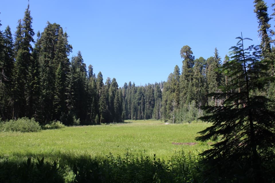
“Crescent Meadow is coming up, an open wetland ringed by giant sequoias, with picnic tables near the trailhead. Stop here if you'd like a gentler outing with room to see the red trunks against the meadow grass.”

Plays as you drive up to this trailhead in the Parkwolf Sequoia Tour Guide.

More stories near here in the app

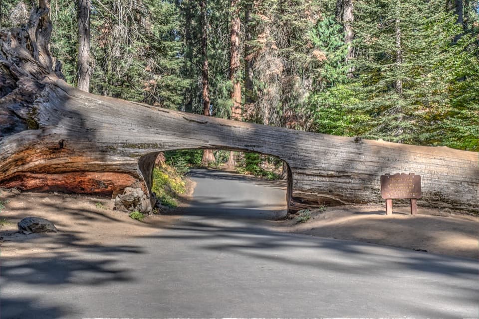
  • Tunnel Log
  • Parker Group and Buttress Tree
  • Moro Rock
  • Hanging Rock
  • 71 audio storiesacross Sequoia’s roads, triggered by GPS as you drive
  • Wildlife heatmapsfor Black Bear, Mountain Lion, Bobcat, and 13 more
  • Works offlinemaps, 99 trails, 68 places, and audio download before you lose signal
  • CarPlay readysimple controls built for the drive
★★★★★
“…The kids and my husband and I all agree that the narration really added to our experience driving through the parks. We learned so much about the history and the flora & fauna.”
JessestblondeApp Store review
Download Parkwolf on the App StoreGet Parkwolf on Google Play

4.7 from 8,600+ ratings

Trail guide

Hiking High Sierra Trail

Crescent Meadow to Bearpaw MeadowFor the first half-mile, the trail stays in cool forest among red and white fir, sugar pines,…

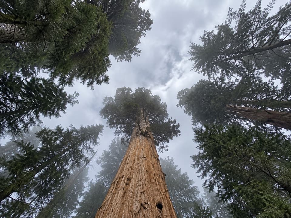
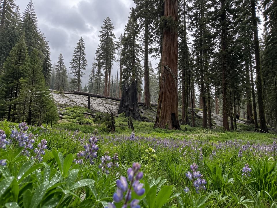
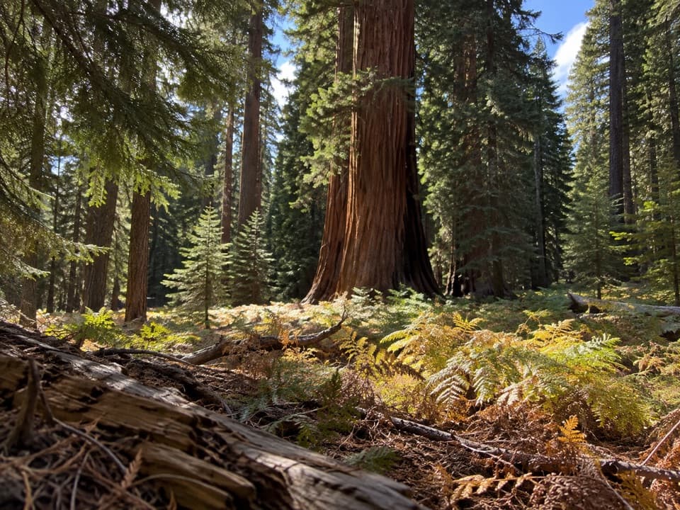
For the first half-mile, the trail stays in cool forest among red and white fir, sugar pines, and occasional giant sequoias. It then crosses the warm, south-facing slope at Eagle View, where the view opens back toward Moro Rock, down into the Middle Fork Kaweah canyon, and ahead to the Great Western Divide. Beyond Seven Mile Hill, the tread cuts across steep bluffs below Alta Meadow and Alta Peak; a crew spent most of 1930 blasting a mile-long section through the rock. Buck Canyon is known for floods, avalanches, and rockslides. Spring-fed streams may still be flowing late in the season, while early-summer crossings can be hazardous. After Buck Creek, a climb of about 500 feet in a little over a mile brings you to Bearpaw Meadow, 11.4 miles from the start.

Big Hamilton Lake and Kaweah GapFrom Bearpaw, long switchbacks climb beneath Angel Wings.

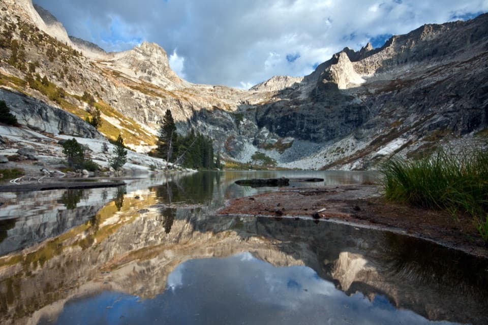
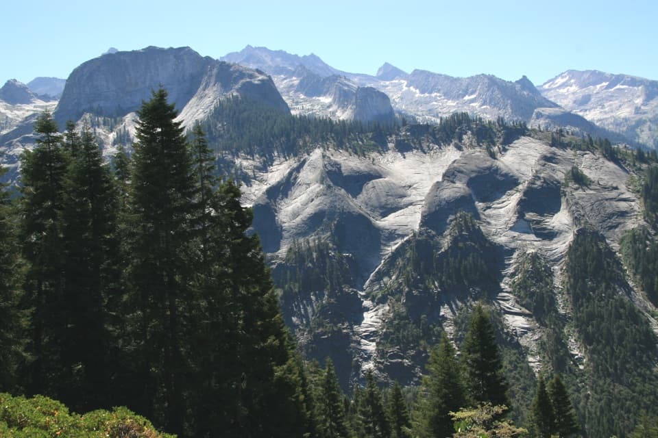
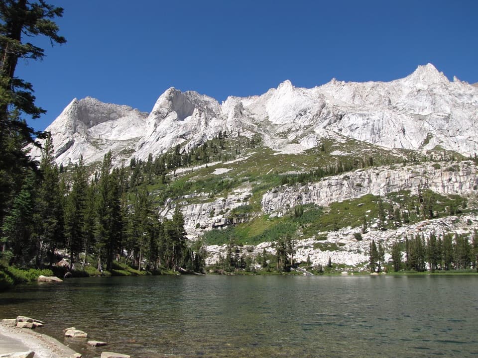
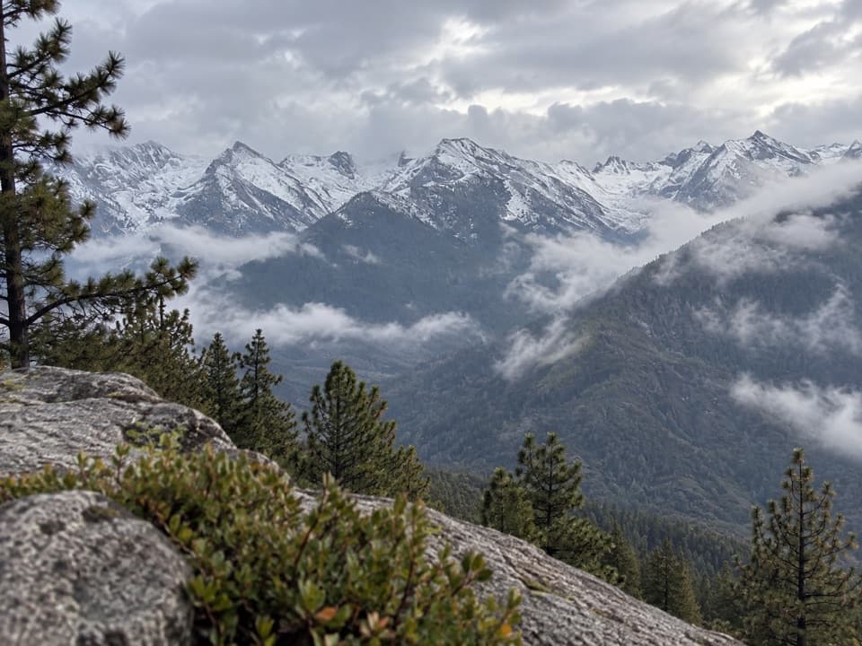
From Bearpaw, long switchbacks climb beneath Angel Wings. The route crosses Hamilton Creek above the lower falls, then climbs again to Big Hamilton Lake at mile 16.6. Above the lake, broad switchbacks lead to Hamilton Gorge. A suspension bridge built in 1932 was torn away by a 1937 avalanche; the trail now squeezes along a blasted ledge and through a tunnel cut by the Civilian Conservation Corps the following summer. Beyond the gorge, Precipice Lake sits under the north wall of Eagle Scout Peak, and shallow glacial ponds lead to Kaweah Gap at 10,700 feet. In this exposed alpine zone, only low shrubs and herbs can grow. For a photo at Valhalla, keep a strip of trail in the foreground so the granite walls still read as a place you are walking through.

Across the Big ArroyoFrom Kaweah Gap, the trail descends to Big Arroyo Junction at mile 22.

From Kaweah Gap, the trail descends to Big Arroyo Junction at mile 22.5, then climbs the arroyo's north wall onto Chagoopa Plateau. A branch leads to Moraine Lake; the more direct HST line crosses the plateau to Sky Parlor Meadow. The descent into the Kern Trench finishes in steep, rocky switchbacks and can be long and dry, so top up at Sky Parlor Meadow before dropping down.

Through the Kern River canyonThe route follows the valley floor through Jeffrey pine and incense cedar, with a glimpse of…

The route follows the valley floor through Jeffrey pine and incense cedar, with a glimpse of Chagoopa Falls through the trees. Kern Hot Springs lies 36.8 miles from Crescent Meadow; its rough concrete tub is beside the cold Kern River, and soap should stay out of both. Use the designated campsites. The canyon follows the Kern Canyon fault; its tall walls shade the floor until late morning, while open stretches can be hot by midday.

Back to the John Muir TrailFrom Junction Meadow at mile 42, the final climb leaves the Jeffrey pines and crosses steep,…

From Junction Meadow at mile 42, the final climb leaves the Jeffrey pines and crosses steep, rocky slopes with manzanita and currant. The view opens back along the Kern Canyon and west toward the Kaweah Peaks. At mile 48.9, the High Sierra Trail meets the John Muir Trail. From there, the JMT continues about 13 miles to Mount Whitney; reaching the summit and exiting at Whitney Portal adds a much longer itinerary and its own transport plan.

Access, permits, and waterStart at Crescent Meadow Trailhead at the end of Crescent Meadow Road.

Start at Crescent Meadow Trailhead at the end of Crescent Meadow Road. A shuttle stops at Crescent Meadow in summer; backpackers with a wilderness permit may access the trailhead even when normal road traffic is closed. There is no water at the trailhead. Overnight hikers need a wilderness permit, and entries are limited during quota season. Between Seven Mile Hill and Kaweah Gap, use a High Sierra Trail permit; an Alta Trail permit does not cover that stretch. Pets are prohibited on park trails; service animals are treated differently.

Wildlife

Wildlife in Sequoia

All Sequoia wildlife maps

Sighting maps show where each species has been reported across Sequoia. Wildlife moves, so no sighting is guaranteed.

Keep exploring

Near High Sierra Trail

See it all on the map

Trails that start nearby

Places near the trailhead

Parkwolf’s Sequoia ranking

Top-rated trails in Sequoia

All 99 trails
  1. 1Congress TrailEasy · 2.7 mi
  2. 2General Sherman Tree TrailModerate · 1 mi
  3. 3Moro Rock TrailModerate · 0.5 mi
  4. 5Mount Whitney TrailChallenging · 22 mi
  5. 6Lakes Trail to Pear LakeChallenging · 12.8 mi
  6. 7Big Trees TrailEasy · 0.7 mi

Take Parkwolf to Sequoia.

The audio tour guide for the drive, plus offline maps, trails, and wildlife heatmaps for when the signal drops.

4.7 from 8,600+ ratings

Download Parkwolf on the App StoreGet Parkwolf on Google Play