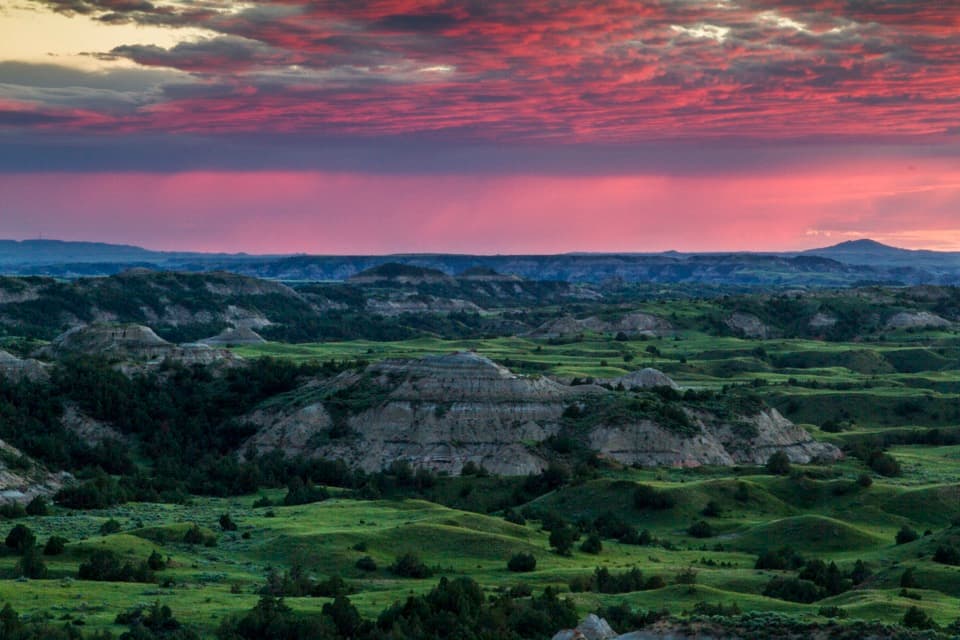
Skyline Vista in Theodore Roosevelt National Park

Sight · Theodore Roosevelt National Park

Skyline Vista

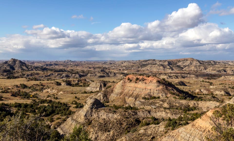
A quick paved walk to a broad Little Missouri badlands view.

Photo: National Park Service
Type
Sight
Nearest trail
0.1 mi
Audio stories
7 nearby
  • Parking
  • Scenic viewpoint
  • Trailhead
  • Exhibit

Hear the audio tour

Skyline Vista: The Valley Between Two Remnants

Overview

About Skyline Vista

Why stop

  • A useful geology wayside at a very short stop.

Heads up

  • I-94 is visible below and takes away from the remote feel.

Map

Where it is

Loading the Theodore Roosevelt map
Full map
SightSkyline Vista46.93408, -103.53296
Keep this map with you offline in the Parkwolf app

Plan your stop

Before you go

2 active Theodore Roosevelt alerts

  • ClosureRidgeline Nature Trail inaccessibleThe South Unit’s 0.6-mile Ridgeline Nature Trail is currently inaccessible because of a road collapse. Check current park conditions.Official details
  • InfoPetrified Forest trailhead: use approved routeUse the approved legal route from I-94, Exit 10 toward Camels Hump Lake, and follow the clearly marked posts to the Petrified Forest trailhead.Official details

Theodore Roosevelt alerts
A park ranger sits on a dash-mounted phone, talking, as Parkwolf’s Tour Guide plays “Army Cutworm Moths: A Grizzly Bear Buffet” on Grand Loop Road below Dunraven Pass in Yellowstone
Parkwolf Tour GuideThe highest, rockiest slopes around here are a summer buffet for grizzly bears.

Theodore Roosevelt Tour Guide

Your drive to Skyline Vista, narrated.

Parkwolf is a GPS audio tour guide for Theodore Roosevelt National Park. As you drive, it chimes in with what’s ahead: hidden gems, upcoming stops, history, geology, and wildlife, right through your car’s speakers.

See the Theodore Roosevelt audio tour

Recorded for this place

Skyline Vista: The Valley Between Two Remnants
0:00 / 0:33
“You're approaching the parking area for Skyline Vista, where a short paved walk leads to a seated view over the Little Missouri valley.”

Plays as you drive up to Skyline Vista in the Parkwolf Theodore Roosevelt Tour Guide.

More stories near here in the app

  • The Winter That Broke the Cattle Boom
  • Johnson's Plateau: Watching Prairie Dogs
  • Cottonwood Campground: A Riverside Base
  • Maltese Cross Cabin: A Well-Traveled Ranch House
  • 45 audio storiesacross Theodore Roosevelt’s roads, triggered by GPS as you drive
  • Wildlife heatmapsfor Bison, Wild Horse, Wapiti, and 13 more
  • Works offlinemaps, 38 trails, 35 places, and audio download before you lose signal
  • CarPlay readysimple controls built for the drive
★★★★★
“Fantastic app with many points of information… It’s great to just turn on while you’re driving and it gives you an audio tour of the national Park. We love it!!!!”
JMJamesApp Store review
Download Parkwolf on the App StoreGet Parkwolf on Google Play

4.7 from 8,600+ ratings

Guide

More about Skyline Vista

A first look at the badlandsSkyline Vista is a small seated overlook near the start of Theodore Roosevelt National Park’s…

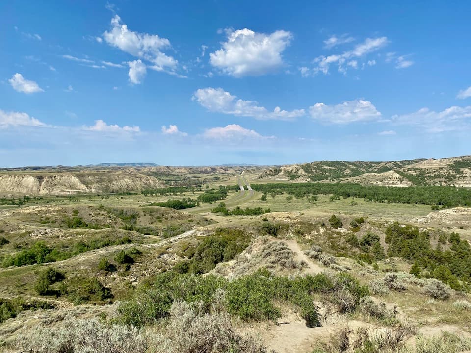
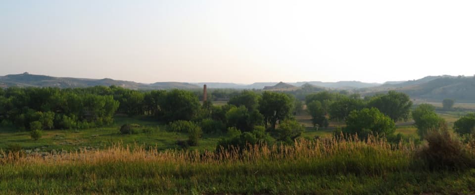
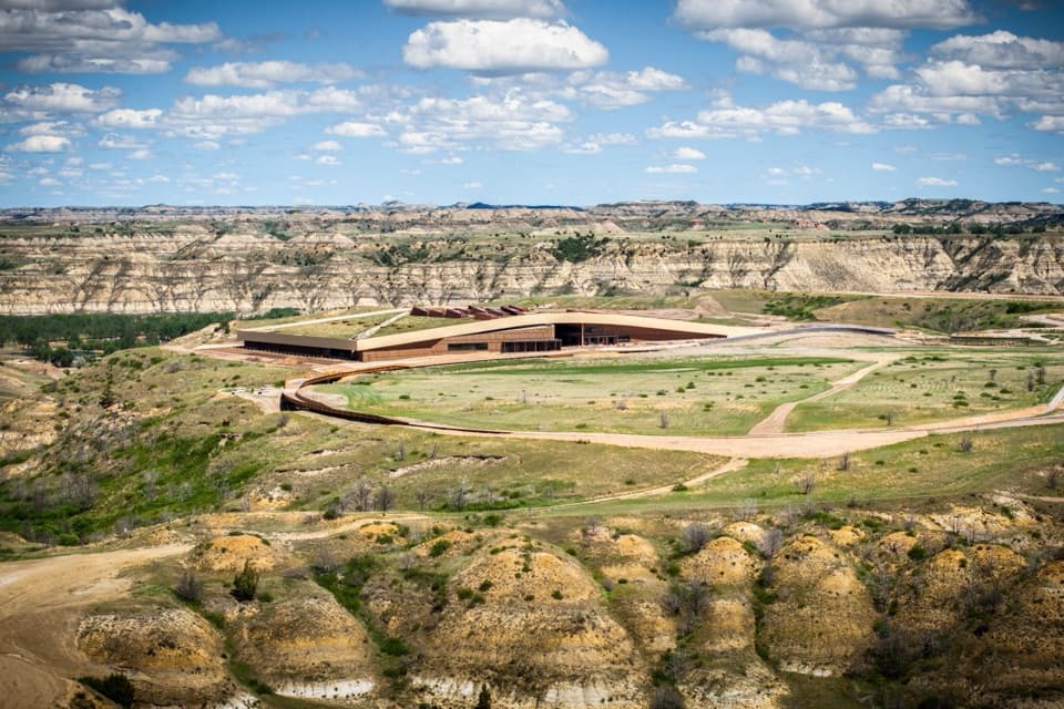
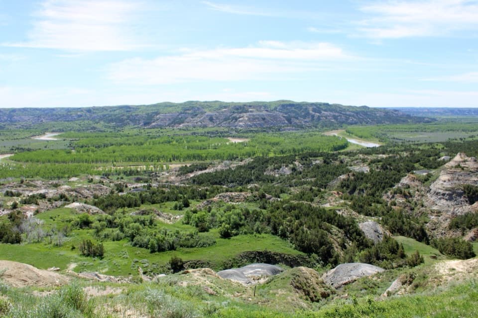
Skyline Vista is a small seated overlook near the start of Theodore Roosevelt National Park’s South Unit, reached by a paved 0.1-mile round trip. It looks south and west over the Little Missouri and the surrounding badlands, with Interstate 94 visible below. Treat it as a quick orientation stop, not a remote-feeling viewpoint: the road is part of the scene. NPS estimates 5–15 minutes here.

The short walkPark at the Skyline Vista area a little more than four miles into the South Unit scenic drive.

Park at the Skyline Vista area a little more than four miles into the South Unit scenic drive. The paved path curves southwest from the trailhead to a small seating area. NPS lists accessible parking and a wheelchair-accessible route. It can be slippery in inclement weather. Dogs aren’t allowed on the trail, though leashed pets may stay in parking areas; service animals are allowed on leash. A park entrance pass is required, and there’s no timed-entry permit.

Read the river’s storyThe wayside explains how the Little Missouri helped make the badlands.

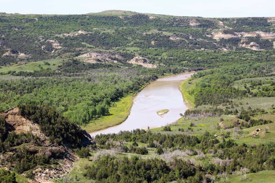
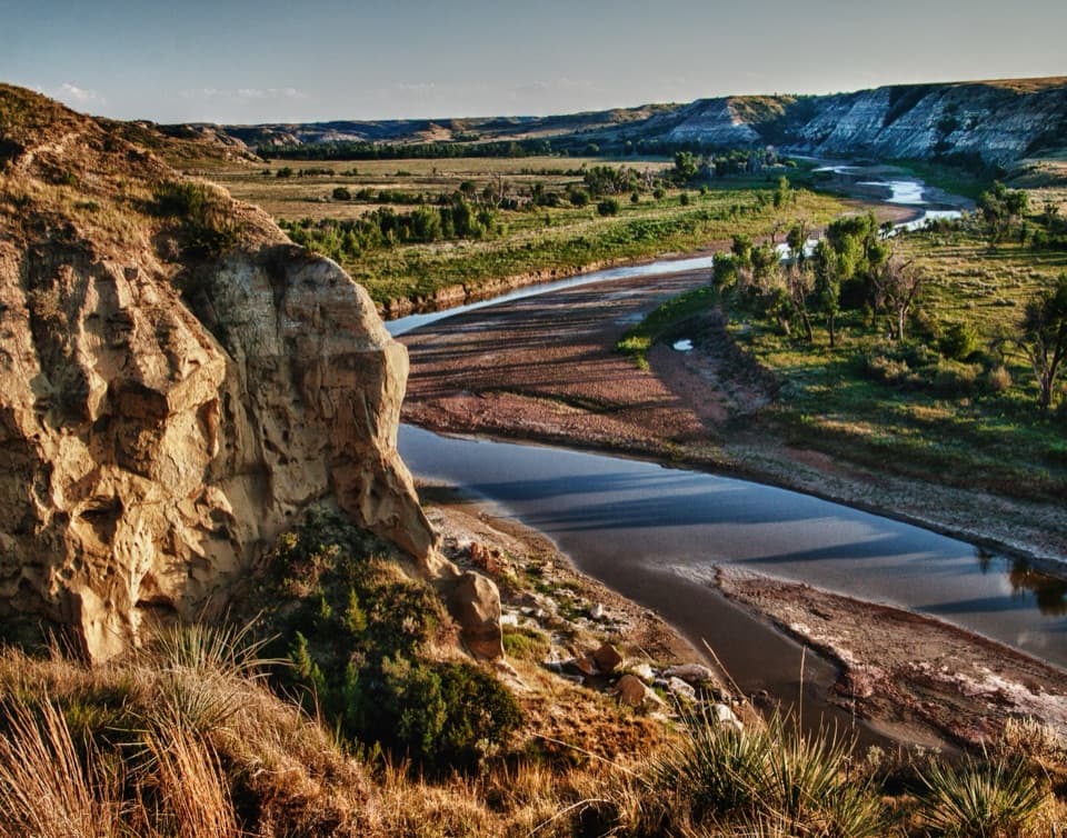
The wayside explains how the Little Missouri helped make the badlands. The plateau you’re standing on and the butte across the valley were once part of the same plain; the river wore away the material between them. Sediment washing down the hillsides clouds the river and gives it the nickname “The Little Muddy.” Buttes are remnants left behind as water erodes the surrounding rock.

Frame the viewFrom the seat, look south and west for the Little Missouri, cottonwoods along its banks, and…

From the seat, look south and west for the Little Missouri, cottonwoods along its banks, and the badlands buttes. The river and trees help show the valley’s scale; I-94 is visible below, so aim toward the hills if you want the landscape to lead in a photo. The overlook has parking, seating and interpretation, but no restroom or potable water is listed here. NPS lists accessible restrooms at other stops on the South Unit loop.

Wildlife

Wildlife in Theodore Roosevelt

All Theodore Roosevelt wildlife maps

Sighting maps show where each species has been reported across Theodore Roosevelt. Wildlife moves, so no sighting is guaranteed.

Keep exploring

Near Skyline Vista

See it all on the map

Trails nearby

More stops nearby

Parkwolf’s Theodore Roosevelt ranking

Top sights in Theodore Roosevelt

All 35 places
  1. 1River Bend OverlookSight
  2. 2Painted Canyon Overlook and Visitor CenterSight
  3. 3Maltese Cross CabinSight
  4. 4Oxbow OverlookSight
  5. 5Wind CanyonSight
  6. 6Elkhorn Ranch Cabin SiteSight

Take Parkwolf to Theodore Roosevelt.

The audio tour guide for the drive, plus offline maps, trails, and wildlife heatmaps for when the signal drops.

4.7 from 8,600+ ratings

Download Parkwolf on the App StoreGet Parkwolf on Google Play