
Overview
About Kvíárjökull Glacier
Why stop
- The glacier, young lagoon and terminal moraines make the retreating ice easy to read in the landscape.
Heads up
- Getting closer may mean a rough approach over rock, ice and mud rather than a quick overlook.
Map
Where it is

The highest, rockiest slopes around here are a summer buffet for grizzly bears.
Vatnajökull Tour Guide
Your drive to Kvíárjökull Glacier, narrated.
Parkwolf is a GPS audio tour guide for Vatnajökull National Park. As you drive, it chimes in with what’s ahead: hidden gems, upcoming stops, history, geology, and wildlife, right through your car’s speakers.
Recorded for this place
Kvíárjökull: Ridges Left by the Ice“You're approaching the access for Kvíárjökull Glacier. This is a good stop if you're interested in how ice reshapes the land: the big ridges of rock and debris mark the glacier's reach in the early nineteen hundreds.”
Plays as you drive up to Kvíárjökull Glacier in the Parkwolf Vatnajökull Tour Guide.
More stories near here in the app
- How a Seal Stays Under
- The Skua That Steals Supper
- A Seabird's Unusual Nose
- Múlagljúfur Canyon
- 298 audio storiesacross Vatnajökull’s roads, triggered by GPS as you drive
- Wildlife heatmapsfor Grey Seal, Harbor Seal, Caribou, and 13 more
- Works offlinemaps, 92 trails, 75 places, and audio download before you lose signal
- CarPlay readysimple controls built for the drive
“Fantastic app with many points of information… It’s great to just turn on while you’re driving and it gives you an audio tour of the national Park. We love it!!!!”


Guide
More about Kvíárjökull Glacier
A glacier and the landscape it left behindKvíárjökull is an outlet glacier descending the south side of Öræfajökull, with a small lagoon…
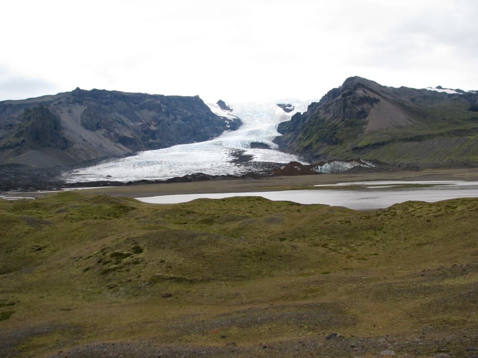
Kvíárjökull is an outlet glacier descending the south side of Öræfajökull, with a small lagoon forming in front of its edge and moraine hills across the valley. It’s a strong stop if you want to see the glacier and the land it has left behind in one view. Think of this as a land approach to the ice, rather than a built overlook.
Give the approach timeThe signed access is Kvíárjökull Bílastæði.
The signed access is Kvíárjökull Bílastæði. A quick roadside look and a walk toward the lagoon are different visits: the approach can take longer than expected, and accounts describe rough rock, ice and mud. Don’t count on a short, level stroll to the glacier. No food, toilets or potable water were verified at this stop, so plan around nearby services.
Hills that record older iceThe eastern moraine, Kambmýrarkambur, is about 129 metres high; Kvíármýrarkambur on the west is…
The eastern moraine, Kambmýrarkambur, is about 129 metres high; Kvíármýrarkambur on the west is about 150 metres. Their front marks how far the glacier reached in the early 1900s. Those big ridges make the glacier’s retreat visible in the shape of the valley.
Frame the whole valleyFor a photo, include the gray lagoon and low moraine foreground beneath the glacier.
For a photo, include the gray lagoon and low moraine foreground beneath the glacier. The wider view shows the relationship between the ice and the land it has reshaped; mist can hide part of the glacier.
Wildlife
Wildlife in Vatnajökull
 23 sightingsGrey SealMost seen around 5 AMSighting map
 260 sightingsHarbor SealMost seen around 11 AMSighting map
 184 sightingsCaribouMost seen around 7 PMSighting map
 62 sightingsArctic FoxMost seen around 8 PMSighting map
 169 sightingsWhooper SwanMost seen around 5 PMSighting map
 68 sightingsAtlantic PuffinMost seen around 7 PMSighting map
Sighting maps show where each species has been reported across Vatnajökull. Wildlife moves, so no sighting is guaranteed.






