Dettifoss

Europe’s most powerful falls, an easy walk with epic spray
Dettifoss, Vatnajökull National Park
InsideVatnajökull National Park

Overview

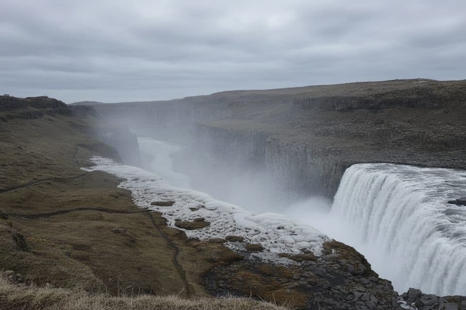
Dettifoss is the headline act of North Iceland—a 100 m wide torrent plunging 45 m into Jökulsárgljúfur canyon. Fed by the glacial Jökulsá á Fjöllum river, the water runs a dramatic grey from sediment, and you’ll often feel the ground hum with its power. It’s raw, loud, and unforgettable.

Which side to choose

  • West bank (Route 862): Paved road, large parking, and toilets. From the lot, it’s roughly a 10–15 minute, mostly straightforward walk on marked paths to multiple viewpoints and decks. Expect more people here but easier logistics.
  • East bank (Route 864): Gravel, rougher, and commonly closed in winter/spring thaws. Fewer crowds and a closer, wilder feel to the falls. Note there’s no bridge near the waterfall; switching sides is a ~60 km drive.

Trails and nearby highlights

From either side, you can tack on a short riverside walk upstream to Selfoss (about 400 m from the junction on signed trails). Downstream, Hafragilsfoss is another big, moody cascade with separate viewpoints. Plan 1–2 hours for Dettifoss alone, or 3–4 hours if you add Selfoss and Hafragilsfoss.

What to expect

Spray is a constant—sometimes visible from far off—so bring waterproof layers and protect your camera. Paths near the rim can be wet and slick, and winds are often strong. The canyon’s black basalt and the river’s milky color are a great visual combo for photos.

Best time to visit

  • Season: June–September offers the most reliable road access and safer trails. Winter can be spectacular but brings ice, closures, and tricky driving; traction devices help.
  • Time of day: Mornings mean softer light and lighter crowds. Midday is brighter—but busier.

Practicalities and safety

There’s no entrance fee. West-side facilities include parking and toilets, and in season a small food stand sometimes appears by the lot. Stay on signed paths, keep well back from slick edges, and don’t approach the river—currents are lethal. Authorities may temporarily close paths or roads after landslides or during freeze-thaw; check conditions before you go.

Pros

  • Paved west-side access with parking and toilets
  • Short walk (about 10–15 minutes) to big viewpoints
  • Multiple perspectives from both banks; Selfoss and Hafragilsfoss nearby

Cons

  • East-side road (864) is gravel and often closed outside summer
  • Heavy spray makes paths slick; occasional viewpoint closures from landslides
  • West bank can feel crowded at peak hours

Tips

  • Choose your side: west for easier access, east for a closer, wilder feel.
  • There’s no bridge between banks; driving side-to-side is about 60 km.
  • Check road conditions and closures before you go, especially in winter/spring.
  • Bring waterproof layers and a lens cloth; mist is constant near the viewpoints.
  • Add Selfoss upstream and Hafragilsfoss downstream if you have 3–4 hours.
The Parkwolf tour guide sitting on a phone mounted in a car

Parkwolf Tour Guide

Like a tour guide in your car.

Save the places you found around Vatnajökull, then let Parkwolf guide the drive between them.Download Parkwolf on the App Store