
Place
Moderate
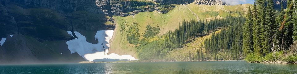
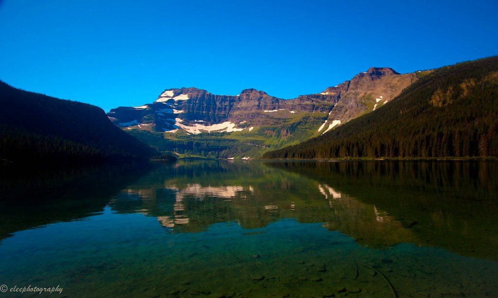
Wall Lake is a mellow, rewarding out-and-back to a turquoise lake tucked beneath dramatic headwalls. You’ll hike through regenerating forest from the 2017 Kenow Wildfire, which opens up surprising views before the trail drops into the basin. It’s less hectic than Waterton’s headline hikes, and the cross‑province border marker on route adds a quirky highlight.
From the Akamina Pass parking area along Akamina Parkway (about 15 km from the Waterton townsite), the trail climbs noticeably at the start, then eases into mostly gentle grades on a well‑maintained path. Expect mixed shade and sunny breaks where the burn opened the canopy, plus a couple of avalanche paths with big headwall views. You’ll pass a provincial border marker before the final approach to the lake. Total distance is about 6.5 miles round trip (out and back), with a moderate feel despite the punchy opening climb.
At the shore, Wall Lake is a serene spot for a snack and photos. Toilets are available at Akamina Creek (near the trailhead) and again at the lake. The trail is shared—hikers, and often bikes—so keep an ear out and step aside where needed. Families do well here, though smaller kids may grumble on the first hill.
This is a living lesson in disturbance and recovery. The Kenow Fire scars are obvious, but so is the regeneration—watch for young forest reclaiming the slopes and expanded vistas through standing snags. Moose have been spotted along the route, and the big rock walls above the lake dominate the scene once the valley opens.
If you want classic Waterton scenery without a sufferfest, Wall Lake hits the sweet spot: a moderate effort, quieter vibes, and a photogenic finish under towering headwalls.
Park at the Akamina Pass parking area along Akamina Parkway, about 15 km from Waterton townsite.
Shared trail with bikes; carry bear spray. Expect exposure in burned sections and along avalanche paths. Weather shifts quickly at the lake. Signage beyond Wall Lake is only average—bring a map if extending.
Place
Place
Place
Place
Challenging
Challenging
Challenging
Moderate

Parkwolf Tour Guide
