Bagley Ice Field

Vast, remote icefield best seen by flightseeing
Bagley Ice Field, Wrangell-St. Elias National Park
InsideWrangell-St. Elias National Park

Overview

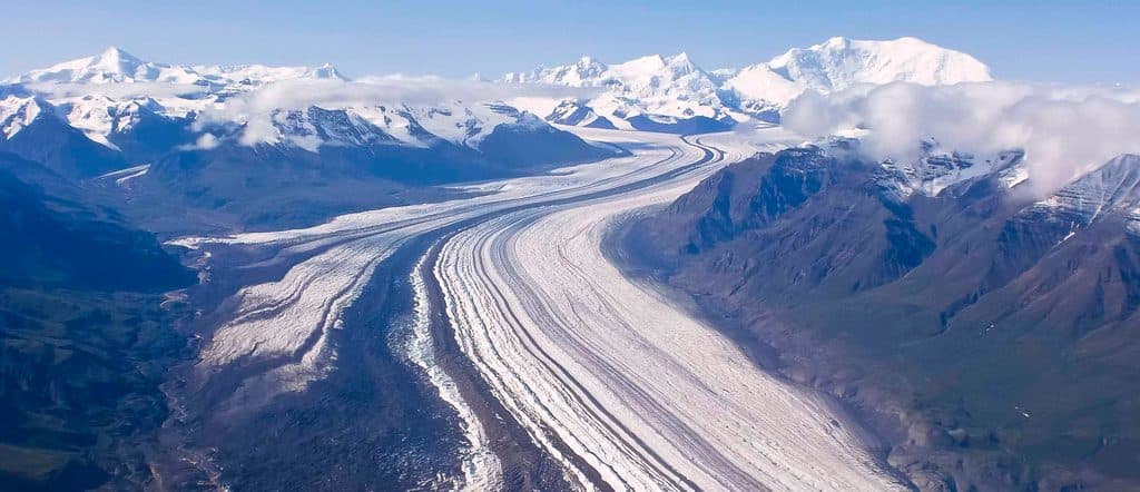
Bagley Icefield is the park’s sprawling heart of ice—about 127 miles long, roughly 6 miles wide, and up to 3,000 feet thick. It feeds many outlet glaciers that pour down the Saint Elias Mountains, sculpting valleys and fueling braided rivers with summer melt. It sits within one of North America’s most active geologic regions, where mountain building and glaciation are on full display.

Access & How to See It

There’s no drive‑up access, parking, or marked trailhead here. The realistic way to experience Bagley is by air: flightseeing gives you the scale and drama you can’t get from the ground. In suitable conditions, some operators can make ski‑plane landings on the ice. Expect zero infrastructure on the icefield itself—any services you use will be back in gateway communities and airstrips (think places like McCarthy/Kennecott or Yakutat) before you fly out.

What You’ll See

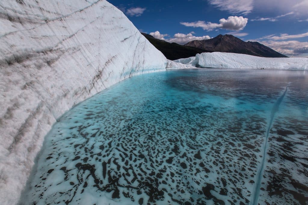
From the air you’ll trace “rivers of ice” flowing off the main icefield, with broken icefalls, crevassed margins, and long moraines banding the surface. Downstream, outwash plains carry heavy sediment loads across braided channels—a living lesson in how glaciers shape landscapes.

Safety Essentials

Glacier surfaces, margins, and any ice caves are dynamic and hazardous. Do not travel on glacier ice or enter ice caves without proper training, equipment, and current local guidance. If you’re contemplating anything beyond an overflight, talk with park staff and consider a permitted guide. Weather turns quickly here—even in summer—so plan conservatively and build in contingency time.

Wildlife & Conservation Context

This is a largely intact, glaciated mountain ecosystem that supports extensive wildlife populations. You’re visiting a globally significant ice‑dominated landscape that forms part of a massive transboundary protected area.

Best Time to Visit

There are no hours or crowds to worry about—your real constraint is weather. Aim for a stable forecast window and keep buffer days; flights are weather‑dependent. Even in summer, expect cold and wind once you’re near the ice, and remember there are no shelters or restrooms out there.


Planning Tips

  • Decide whether you want a scenic overflight or to attempt a glacier landing—the requirements and risks are different.
  • Pack for alpine conditions (cold, wind) even on sunny days.
  • Discuss any on‑ice plans with park rangers; many trips here are expedition‑level.
  • Bush planes are the norm for accessing remote corners of this park; be flexible and patient with weather delays.

Pros

  • Spectacular flightseeing over a ~127‑mile icefield
  • Ski‑plane landings are possible with authorized operators and good conditions

Cons

  • No roads, trailheads, or facilities—true wilderness
  • On‑foot glacier travel is technical and risky without training and gear

Tips

  • Book flightseeing with buffer days—weather drives everything here.
  • Clarify overflight versus glacier landing; requirements and risks differ.
  • Dress for cold and wind even in mid‑summer conditions.
  • There are no facilities on the icefield; plan for total self‑reliance.
  • Discuss any glacier travel plans with park rangers and consider a guide.
The Parkwolf tour guide sitting on a phone mounted in a car

Parkwolf Tour Guide

Like a tour guide in your car.

Save the places you found around Wrangell-St. Elias, then let Parkwolf guide the drive between them.Download Parkwolf on the App Store