Kennicott Glacier

A debris-striped glacier you can actually walk on from Kennecott
Kennicott Glacier, Wrangell-St. Elias National Park
InsideWrangell-St. Elias National Park

Overview

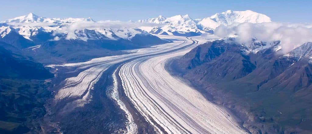
Kennicott Glacier is the big, “dirty-looking” river of ice you see spilling toward the Kennecott valley—dirty because its surface is mantled with rocks and soil carried by tributary glaciers. Those debris bands merge into striking stripes (medial moraines) you can see from near town. Beneath that rubble, the ice is thick and powerful—and changing fast. Studies show the glacier lowered by roughly 115–330 feet between 1957 and 2007 and is still thinning by about 6–23 feet per year in many places.

It’s also impressively long—about 26 miles—fed high on the flanks of Mount Blackburn before merging with Gates and Root Glaciers and sliding past the historic Kennecott mill townsite. The glacier ends in a broad, rock-armored snout with meltwater streams that become the Kennicott River.

What You’ll See

  • Debris stripes and towering moraines that tell the story of many tributary ice flows.
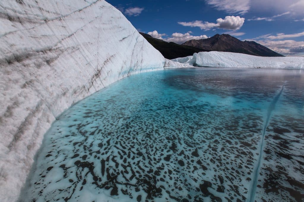
  • On guided glacier walks, expect sculpted ice, vivid blue pools, and surface streams.
  • Big-picture perspective: flightseeing shows just how ice-dominated this landscape is (about 35% of the park is glaciated).

Access & Logistics

Most visitors experience Kennicott via its neighbor, Root Glacier. Park near the McCarthy Footbridge at the end of McCarthy Road, cross on foot, and take the local shuttle to Kennecott (no public vehicle access over the footbridge). From Kennecott, it’s about a 1.5-mile walk on the Root Glacier Trail to step onto the ice.

Seasonal basics cluster around Kennecott: vault toilets are typically available at the Kennecott Visitor Center area, the General Store area, and the Root Glacier Trailhead in the main summer season. Expect very limited cell coverage, no public park WiFi, and no fuel in McCarthy/Kennecott—top off well before turning down the Edgerton Highway. Food and store hours are seasonal.

Safety Essentials

Glacier travel is serious. Crampons/traction, appropriate boots, and know-how are musts; many visitors hire a local guide. Even rubble-covered ice gets extremely slick when wet. Beautiful ice caves can form—and collapse without warning—so don’t enter them without proper training, equipment, and current local knowledge. Typical hazards here include swift glacial rivers, rockfall, mudslides, avalanches, bugs, bears, and volatile weather. Speak with rangers about conditions and your plans. In glaciated regions, sudden outburst floods can occur—stay alert around proglacial lakes and streams and verify conditions before committing to crossings.

Best Time to Visit

Summer is prime for on-foot glacier experiences and when most facilities operate. After rain, both clean and debris-covered ice become treacherously slick. Expect high, silty meltwater flows in summer; winter flows typically drop and clear, but on-ice travel then demands winter skills and gear.

Why It’s Special

Few big valley glaciers are this easy to approach. The debris mantle creates dramatic patterns you can appreciate from overlooks, trails, and the townsite—while the Root Glacier gives confident hikers a practical, close-up way to experience the ice.

Pros

  • Reachable on foot via the Root Glacier Trail from Kennecott (about 1.5 miles to the ice)
  • Photogenic debris-striped ice with broad medial moraines and blue pools/streams

Cons

  • Real glacier travel demands proper gear/skills or a guide; debris-covered ice is slick and ice caves are unstable
  • Access logistics: park at McCarthy Footbridge and shuttle to Kennecott; services are limited and seasonal

Tips

  • Park at the McCarthy Footbridge, walk across, and ride the shuttle to Kennecott—build in extra time.
  • Bring traction (crampons or microspikes) for glacier ice or go with a guide.
  • Avoid ice caves unless properly trained and equipped; they can collapse at any time.
  • After rain, debris-covered ice becomes extremely slick—adjust plans accordingly.
  • No fuel or reliable cell service in McCarthy/Kennecott; stock up and confirm seasonal restrooms.
The Parkwolf tour guide sitting on a phone mounted in a car

Parkwolf Tour Guide

Like a tour guide in your car.

Save the places you found around Wrangell-St. Elias, then let Parkwolf guide the drive between them.Download Parkwolf on the App Store