Chittenden Road–Mount Washburn Trail in Yellowstone National Park

#13 of 167 trails in Yellowstone

Yellowstone National Park, WY · MT · ID

Chittenden Road–Mount Washburn Trail

A steady climb to Yellowstone’s working fire lookout.

Photo: Public Domain
Length
5.8mi
Time
4hr
Elev. change
1,430ft
Difficulty
Moderate
  • No dogs
  • High point 10,148 ft

Hear the audio tour

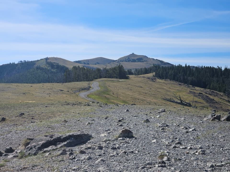
Mount Washburn from Chittenden Road

Overview

About Chittenden Road–Mount Washburn Trail

Why go

  • The shortest documented route to Mount Washburn’s summit
  • A broad road to wide views and the fire lookout shelter
  • July wildflowers and frequent bighorn sheep sightings

Heads up

  • A steady climb at high elevation
  • Limited trailhead parking and no water along the route

Map & elevation

The route

Loading the Yellowstone map
Full map
Elevation8,717–10,148 ft
TrailheadChittenden Road / Mount Washburn North Trailhead (2K6)44.82425, -110.44463
Keep this map with you offline in the Parkwolf app

Plan your hike

Before you go

Parking

Start at the Chittenden Road / Mount Washburn North Trailhead (2K6), 10.3 miles north of Canyon Village on Chittenden Road. Parking is limited; the trailhead has an information kiosk and composting toilet. Road access is seasonal, so check current park status before driving up.

Best time to go

This is a summer-and-fall hike, but access depends on Chittenden Road’s seasonal opening. Check current park road status before setting out. Grizzlies use Mount Washburn’s slopes in fall to feed on whitebark pine nuts; the park advises against hiking this trail in September and October. If you hike at another time, follow the park’s bear guidance: go in a group of three or more, make noise, and carry bear spray. Above treeline, lightning is a specific hazard, and there is no water to refill along the route.

Safety

There is no water along the route, and lightning is a hazard above treeline. Grizzlies frequent Mount Washburn in fall; the park advises against hiking this trail in September and October and recommends groups of three or more, making noise, and carrying bear spray at other times.

5 active Yellowstone alerts

  • ClosureBiscuit Basin closed after hydrothermal explosionBiscuit Basin’s parking lot, boardwalk, and Firehole River are closed to all travel.Official details
  • ClosureMost Yellowstone roads close to regular vehicles November 1Most Yellowstone roads and the West, South, and East entrances are scheduled to close to regular vehicles November 1, 2026, as the park prepares for winter operations.Official details
See all 5 alerts
A park ranger sits on a dash-mounted phone, talking, as Parkwolf’s Tour Guide plays “Army Cutworm Moths: A Grizzly Bear Buffet” on Grand Loop Road below Dunraven Pass in Yellowstone
Parkwolf Tour GuideThe highest, rockiest slopes around here are a summer buffet for grizzly bears.

Yellowstone Tour Guide

Hear Yellowstone as you drive it.

Parkwolf is a GPS audio tour guide for Yellowstone National Park. As you drive, it chimes in with what’s ahead: hidden gems, upcoming stops, history, geology, and wildlife, right through your car’s speakers.

See the Yellowstone audio tour

Recorded for this trailhead

Mount Washburn from Chittenden Road
0:00 / 0:30
“You're approaching Mount Washburn's north trailhead at Chittenden Road.”

Plays as you drive up to this trailhead in the Parkwolf Yellowstone Tour Guide.

More stories near here in the app

  • The Army Arrived on Bicycles
  • Pink Life in the Snow
  • How Bighorns Hold On
  • The Rock Beneath the Flowers
  • 243 audio storiesacross Yellowstone’s roads, triggered by GPS as you drive
  • Wildlife heatmapsfor Wolf, Grizzly Bear, Bison, and 13 more
  • Works offlinemaps, 167 trails, 192 places, and audio download before you lose signal
  • CarPlay readysimple controls built for the drive
★★★★★
“First time driving through a national park. We used the Yellowstone tour on grand loop Road and it’s just like having a tour guide in your car with you.”
Jyg5001App Store review
Download Parkwolf on the App StoreGet Parkwolf on Google Play

4.7 from 8,600+ ratings

Trail guide

Hiking Chittenden Road–Mount Washburn Trail

Is this the hike you want?Chittenden Road–Mount Washburn is a 5.

Chittenden Road–Mount Washburn is a 5.8-mile out-and-back to Yellowstone’s 10,219-foot Mount Washburn summit. It is the shorter of the two hiking routes to the peak, and a good pick if reaching the lookout is your main goal. Plan on three to five hours. The climb is steady for almost the whole way, and the elevation makes it a moderately strenuous day even though the trail is broad. This is the north-side approach from Chittenden Road; the Dunraven Pass trail is a separate route from the south.

A steady road climbThe route starts in forest on a wide gravel service road, then keeps climbing until the trees…

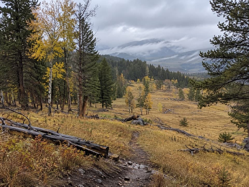
The route starts in forest on a wide gravel service road, then keeps climbing until the trees thin and the track crosses open alpine slopes. There are no named side destinations on this approach; the summit is the payoff. The road-like surface is easier to follow than a narrow tread, but it does not make the grade disappear. Bicycles and occasional service vehicles also use the road, so keep to the established route and give them room. Alpine plants are fragile, and there is no water along the trail.

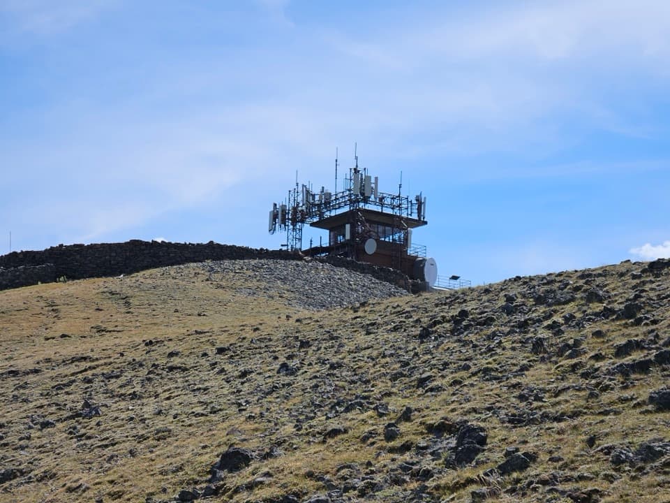
At the lookoutAt the top, a shelter at the base of the fire lookout holds interpretive exhibits.

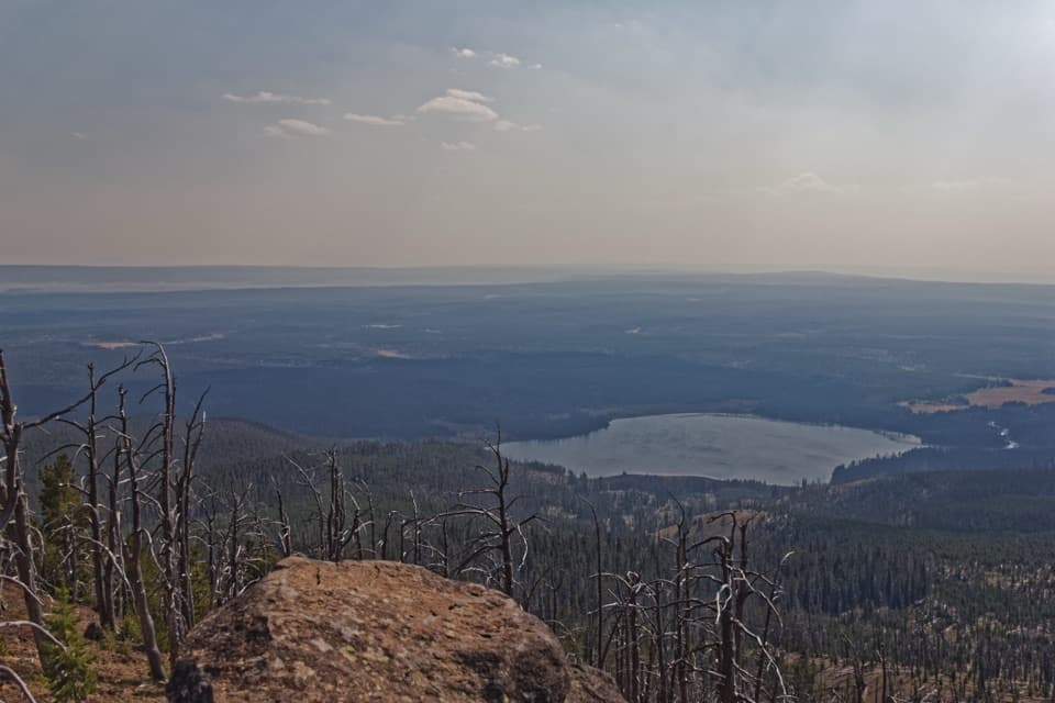
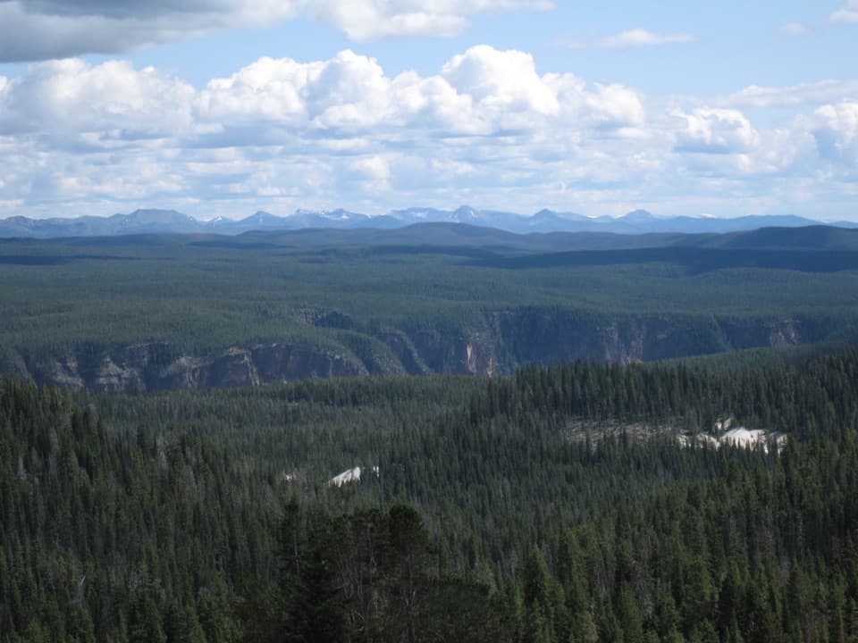
At the top, a shelter at the base of the fire lookout holds interpretive exhibits. Step outside for the wide summit view; on a clear day, sightlines can reach 20 to 50 miles across Yellowstone. The lookout is one of the park’s three fire stations, staffed from mid-June until the fire season ends. Firefighters live there through the summer to spot smoke, locate fires, and report changes. It is a working post as well as the hike’s destination.

A mountain cut in halfMount Washburn is a remnant of the Absaroka Volcanics, formed about 50 million years ago.

Mount Washburn is a remnant of the Absaroka Volcanics, formed about 50 million years ago. A later eruption, 631,000 years ago, cut the original volcano in half. The part left standing is the northern half you climb today. From the summit, the size of the view makes that story easier to picture: the mountain is one high point in a much larger volcanic landscape.

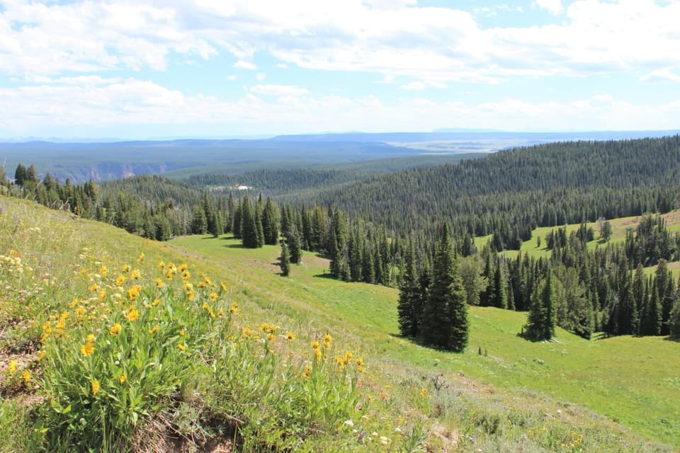
Wildflowers and wildlifeIn July, wildflowers carpet the slopes, and bighorn sheep are often seen near the trail.

In July, wildflowers carpet the slopes, and bighorn sheep are often seen near the trail. Keep your eyes on the open hillsides as well as the path, but treat a sighting as a bonus rather than a promise. The route crosses their habitat, so stay on the road and leave animals room.

Getting to the north trailheadStart at the Chittenden Road / Mount Washburn North Trailhead, 10.

Start at the Chittenden Road / Mount Washburn North Trailhead, 10.3 miles north of Canyon Village. Parking is limited; there is an information kiosk and a composting toilet at the lot. No reservation or separate trail activity fee is required, though Yellowstone’s entrance fee may apply. Pets are not allowed. Allow time for the return walk to the same parking area.

Wildlife

Wildlife in Yellowstone

All Yellowstone wildlife maps

Sighting maps show where each species has been reported across Yellowstone. Wildlife moves, so no sighting is guaranteed.

Keep exploring

Near Chittenden Road–Mount Washburn Trail

See it all on the map

Trails that start nearby

Places near the trailhead

Parkwolf’s Yellowstone ranking

Top-rated trails in Yellowstone

All 167 trails
  1. 1Old Faithful to Morning Glory Pool TrailEasy · 2.7 mi
  2. 2Grand Prismatic Overlook TrailEasy · 1.6 mi
  3. 3Dunraven Pass–Mount Washburn TrailChallenging · 7 mi
  4. 4Midway Geyser Basin TrailEasy · 0.7 mi
  5. 5Brink of the Lower Falls TrailChallenging · 0.7 mi
  6. 6Fairy Falls TrailEasy · 4.5 mi

Take Parkwolf to Yellowstone.

The audio tour guide for the drive, plus offline maps, trails, and wildlife heatmaps for when the signal drops.

4.7 from 8,600+ ratings

Download Parkwolf on the App StoreGet Parkwolf on Google Play