Fairy Falls Trail in Yellowstone National Park

#6 of 167 trails in Yellowstone

Yellowstone National Park, WY · MT · ID

Fairy Falls Trail

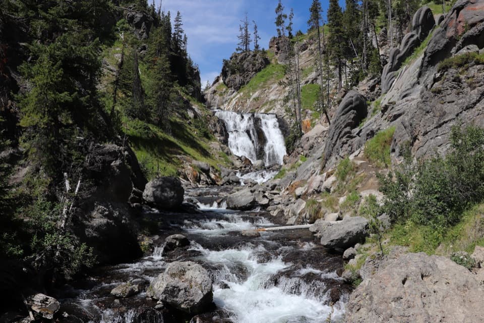
An easy forest walk to a 200-foot waterfall.

Photo: National Park Service
Length
4.5mi
Time
3hr
Elev. change
49ft
Difficulty
Easy
  • No dogs
  • High point 7,293 ft

Hear the audio tour

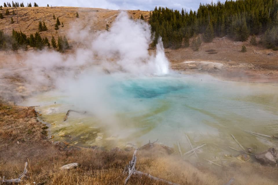
Grand Prismatic Overlook and Fairy Falls

Overview

About Fairy Falls Trail

Why go

  • An easy, mostly level route to a 200-foot waterfall.
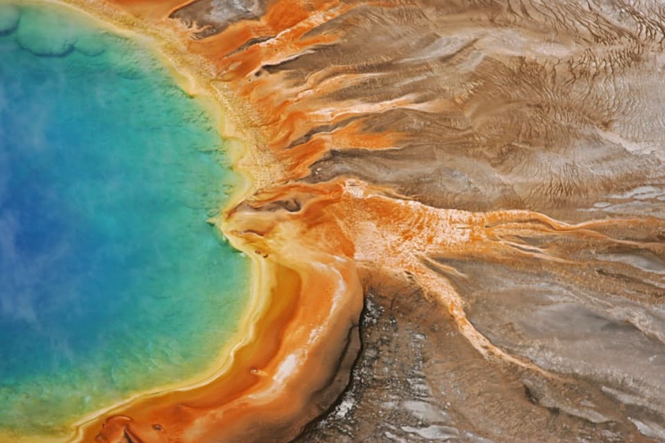
  • Grand Prismatic Overlook is a separate short walk from the same lot.

Heads up

  • Parking at Fairy Falls Trailhead is very limited.
Fairy Falls Trail is an easy, mostly level 4.5-mile out-and-back from Fairy Falls Trailhead (OK5) to the base of Fairy Creek’s 200-foot plunge and back. Allow about 2–3 hours. The waterfall is the payoff; the approach is a longer walk through lodgepole pine forest. The mileage on park pages varies: the OK5 trailhead page gives 4.5 miles for the standalone falls hike, while another page lists longer itineraries with multiple starts and extensions. This description follows the OK5 route and leaves out the Grand Prismatic Overlook climb and the geyser extension. Pets aren’t allowed.
Parkwolf’s verdictIs this the hike for you?

Map & elevation

The route

Loading the Yellowstone map
Full map
Elevation7,244–7,293 ft
TrailheadFairy Falls Trailhead (OK5)44.51562, -110.83261
Keep this map with you offline in the Parkwolf app

Plan your hike

Before you go

Parking

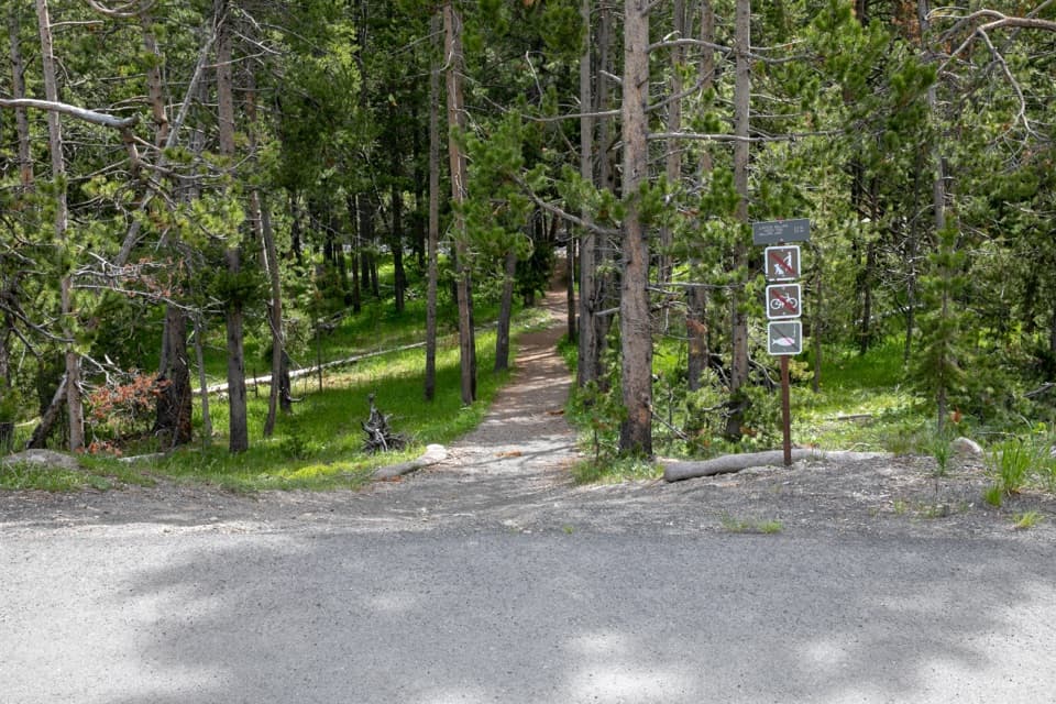
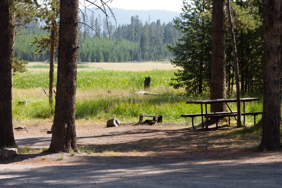
Park at Fairy Falls Trailhead (OK5), south of Midway Geyser Basin. The small lot also serves the Grand Prismatic Overlook route, and NPS describes parking as very limited. A kiosk and bulletin board are at the trailhead; a guide reports no drinking water or toilets at the lot.

Safety

The ground around the falls is wet and uneven; stay on the established path. Pets are not allowed on this trail.

5 active Yellowstone alerts

  • ClosureBiscuit Basin closed after hydrothermal explosionBiscuit Basin’s parking lot, boardwalk, and Firehole River are closed to all travel.Official details
  • ClosureMost Yellowstone roads close to regular vehicles November 1Most Yellowstone roads and the West, South, and East entrances are scheduled to close to regular vehicles November 1, 2026, as the park prepares for winter operations.Official details
See all 5 alerts
A park ranger sits on a dash-mounted phone, talking, as Parkwolf’s Tour Guide plays “Army Cutworm Moths: A Grizzly Bear Buffet” on Grand Loop Road below Dunraven Pass in Yellowstone
Parkwolf Tour GuideThe highest, rockiest slopes around here are a summer buffet for grizzly bears.

Yellowstone Tour Guide

Hear Yellowstone as you drive it.

Parkwolf is a GPS audio tour guide for Yellowstone National Park. As you drive, it chimes in with what’s ahead: hidden gems, upcoming stops, history, geology, and wildlife, right through your car’s speakers.

See the Yellowstone audio tour

Recorded for this trailhead

Grand Prismatic Overlook and Fairy Falls
0:00 / 0:26
“You're approaching the Fairy Falls trailhead, the starting point for Grand Prismatic Overlook as well as the waterfall hike.”

Plays as you drive up to this trailhead in the Parkwolf Yellowstone Tour Guide.

More stories near here in the app

  • Midway Geyser Basin and Grand Prismatic
  • A New Rack Every Spring
  • A Research Boat on Grand Prismatic
  • Great Fountain Geyser
  • 243 audio storiesacross Yellowstone’s roads, triggered by GPS as you drive
  • Wildlife heatmapsfor Wolf, Grizzly Bear, Bison, and 13 more
  • Works offlinemaps, 167 trails, 192 places, and audio download before you lose signal
  • CarPlay readysimple controls built for the drive
★★★★★
“First time driving through a national park. We used the Yellowstone tour on grand loop Road and it’s just like having a tour guide in your car with you.”
Jyg5001App Store review
Download Parkwolf on the App StoreGet Parkwolf on Google Play

4.7 from 8,600+ ratings

Trail guide

Hiking Fairy Falls Trail

Start at Fairy Falls TrailheadThe Fairy Falls lot sits south of Midway Geyser Basin and serves the separate Grand Prismatic…

The Fairy Falls lot sits south of Midway Geyser Basin and serves the separate Grand Prismatic Overlook route too. Parking is very limited, so it’s the main practical constraint. There’s an information kiosk and bulletin board. A guide reports no toilets or drinking water at the lot; bring water from elsewhere. No trail reservation or activity fee is listed, though normal park entry requirements apply.

Follow the main pathCross the Firehole River bridge onto a wide dirt path.

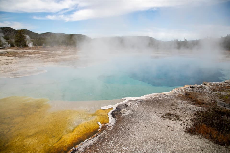
Cross the Firehole River bridge onto a wide dirt path. About half a mile from the lot, a left branch climbs gradually to Grand Prismatic Overlook, 0.6 mile each way and about 105 feet above the start. It’s a separate 1.2-mile out-and-back; take it if you want the basin view, then return to the junction. Continue on the main path. About another half mile later, turn left onto a narrower natural trail that heads west beside the Madison Plateau’s high rock wall. Young lodgepole pines line much of the walk. The grade stays gentle, with a final easy rise toward the falls. Return the way you came.


At the fallsFairy Creek drops over the edge of the Madison Plateau in a single plunge about 200 feet high.

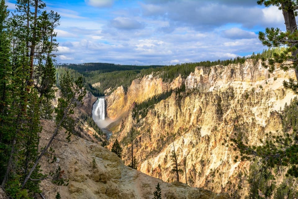
Fairy Creek drops over the edge of the Madison Plateau in a single plunge about 200 feet high. The stream narrows at the top and spreads over rock on its way to the pool below. Wet, uneven ground is reported around the falls; stay on the established path. No official swimming or wading area is identified. For a photo, include the pool and the full cliff around the fall so the height reads clearly.

A forest growing backMuch of the route crosses ground burned in 1988.

Much of the route crosses ground burned in 1988. Rather than continuous old forest, you’ll see younger lodgepole pine and open patches where grasses and wildflowers have returned. That new growth supports small animals and birds, although no trail-specific species list was found. The regrowth is part of the walk’s story, not just background scenery.

The name and a longer optionMembers of the 1871 Hayden Survey named Fairy Falls for the graceful drop of the stream.

Members of the 1871 Hayden Survey named Fairy Falls for the graceful drop of the stream. If you want a longer day, the route continues 0.6 mile beyond the falls toward Spray and Imperial geysers; walking out and back adds 1.2 miles. Those geysers are a separate extension beyond the waterfall, and the park’s longer mileage totals don’t clearly say which approach or add-on each includes. Check the current park map before extending your hike.

Wildlife

Wildlife in Yellowstone

All Yellowstone wildlife maps

Sighting maps show where each species has been reported across Yellowstone. Wildlife moves, so no sighting is guaranteed.

Keep exploring

Near Fairy Falls Trail

See it all on the map

Trails that start nearby

Places near the trailhead

Parkwolf’s Yellowstone ranking

Top-rated trails in Yellowstone

All 167 trails
  1. 1Old Faithful to Morning Glory Pool TrailEasy · 2.7 mi
  2. 2Grand Prismatic Overlook TrailEasy · 1.6 mi
  3. 3Dunraven Pass–Mount Washburn TrailChallenging · 7 mi
  4. 4Midway Geyser Basin TrailEasy · 0.7 mi
  5. 5Brink of the Lower Falls TrailChallenging · 0.7 mi
  6. 7North Rim TrailModerate · 7 mi

Take Parkwolf to Yellowstone.

The audio tour guide for the drive, plus offline maps, trails, and wildlife heatmaps for when the signal drops.

4.7 from 8,600+ ratings

Download Parkwolf on the App StoreGet Parkwolf on Google Play