
Place
Moderate
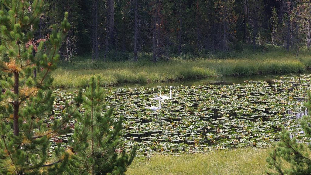
This is the lake‑to‑lake section of the historic Howard Eaton Trail, running roughly 11.6 miles one way from the Canyon side to near Norris Campground. Expect gentle, rolling singletrack through lodgepole forest, broad meadows, and marshy stretches, with a net descent toward Norris. It’s a classic Yellowstone walk that trades crowds for solitude—and swaps boardwalks for true backcountry flavor.
From a pullout just west of Canyon Junction, the trail passes Cascade Lake and continues by Grebe, Wolf, and Ice Lakes. Between Grebe and Ice, it follows the upper Gibbon River and fords it multiple times, then fords Solfatara Creek near the Norris end. A subtle hydrologic divide early on separates waters flowing to the Yellowstone River from those heading west via the Gibbon to the Madison and Missouri. The final ~4.4 miles drop about 450 feet toward Norris across open meadow country. One‑way lake distances from the Canyon side: Cascade (2.6 mi), Grebe (4.5 mi), Wolf (6.3 mi), Ice (10.7 mi).
Overall difficulty sits at “moderate” thanks to length, wet tread, and river fords rather than steep grades. Early and mid‑summer bring mud in the meadows and marshy sections, plus intense mosquitoes—plan for both. The corridor is prime grizzly and bison habitat; give wildlife space, carry bear spray, and stay alert. In a few middle miles the tread can fade or braid with game paths—competent navigation is a plus.
You can hike this corridor May through October, but it shines in late July and August when mud recedes and bugs taper. Earlier in the season, higher water makes fords trickier and feet wetter. Morning light is lovely across the meadows and lakes; afternoons can be warm and buggy in open stretches.
This is a point‑to‑point—set a shuttle or be ready to retrace your steps. Start on the Canyon side from a pullout about 0.25 mile west of Canyon Junction on the Norris–Canyon Road; the route finishes near Norris Campground via the Solfatara Creek junction. Expect multiple true fords (Gibbon River and Solfatara Creek)—pack footwear that tolerates soaking and consider sandals for crossings. Dogs aren’t allowed. Anglers will find better prospects at Grebe and Wolf than Ice (check park regulations). If you want a shorter taste, out‑and‑back to any of the four lakes is rewarding. For a very different vibe on the same historic trail system, there’s also a separate Howard Eaton segment near Old Faithful to Lone Star Geyser.
Primary start is a signed pullout ~0.25 mile west of Canyon Junction on the Norris–Canyon Road; the Norris end finishes near Norris Campground (about 0.5 mile away via the Solfatara Creek junction). Stage a shuttle for the one‑way hike.
Expect several true fords of the Gibbon River plus Solfatara Creek; early‑season flows, mud, and heavy mosquitoes add difficulty. This is prime bear and bison country—carry bear spray, keep distance, and be prepared for faint tread in the middle miles.
Place
Place
Place
Place
Easy
Easy
Moderate
Moderate

Parkwolf Tour Guide
