
Place
Moderate
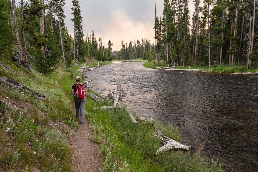
If you like serene water, birdlife, and big-lake views without big elevation, this one delivers. Most hikers experience the Lewis River Channel as a 10.8–11.0 mile loop by returning on the Dogshead Trail. It’s largely flat, rated moderate, and typically takes around 3 hours 45 minutes—many parties take longer if they linger at the water. There’s also a rewarding short outing: an easy 2.8-mile round trip to a sandy lakeshore on Lewis Lake.
You’ll stroll through pine forest and meadows to the crystal-clear Lewis River Channel, which links Lewis Lake to Shoshone Lake. Expect tranquil river bends, lily-pad flats near the lake, and frequent raptor fishing shows—osprey and bald eagles patrol the channel. Along the shore of Lewis Lake, you’ll find pleasant beach spots and broad views; in places you can still notice the mosaic of forest affected by the 1988 fires.
From the signed “Lewis Channel – Dogshead” parking area just north of Lewis Lake, pick the left-hand path for the Lewis River Channel Trail (the straight, gravel, road-like path is Dogshead). Clockwise is popular: follow the north shore of Lewis Lake, then up the east bank of the Lewis River to Shoshone Lake, and return via the Dogshead Trail to avoid backtracking. The channel side is more scenic and varied; Dogshead is faster and more direct, but flatter, more enclosed, and notably less scenic. Primitive restrooms are at the trailhead. Note: there’s an unbridged drainage crossing on the short lakeshore out-and-back; it’s usually straightforward by late season.
This is excellent raptor and waterfowl habitat—keep an eye out for osprey dive-bombing trout and bald eagles cruising the corridor; ravens are common, and elk show up at times. You may see backcountry paddlers too: this is the rare Yellowstone river stretch where non-motorized boats are allowed.
June through September is the sweet spot for clear tread and easier crossings. Early summer can be buggy, especially in the meadows and near still water—mornings with a light breeze help. Start early for solitude and to give yourself time to enjoy the water’s edge and Shoshone Lake outlet.
Overall: underrated for how peaceful and wildlife-rich it is, with minimal climbing. If you want a punchier, more dramatic day in the park, there are flashier options; if you want a quiet, watery wander with a backcountry feel, this is a great call.
Signed “Lewis Channel – Dogshead” lot on the west side of South Entrance Road, just north of Lewis Lake and about 5 miles south of the Grant Village intersection; primitive restrooms available.
Bugs can be intense early summer; expect an unbridged drainage crossing near the lakeshore, average signage at junctions, and seasonal wet areas on the Dogshead side.
Place
Place
Place
Place
Easy
Easy
Moderate
Moderate

Parkwolf Tour Guide
