Parking
Begin at the Marsh Lane access in Longton near Preston and finish at Gayle Moor near the source. This is a point-to-point route, so arrange staged accommodation or transport rather than relying on one trailhead car park.
Yorkshire Dales National Park, EN
Follow the Ribble from tidal marsh to moorland source over 70 miles
Overview
The Ribble Way is a point-to-point long-distance walk of 70 miles (about 113 km) one way, traced from the tidal river mouth at Longton near Preston to the source area at Gayle Moor near Ribblehead. Mapped route data comes out slightly under that figure, at roughly 112 km, but 70 miles is the established convention and the honest planning number. Difficulty rates 7 out of 10, driven by distance, cumulative ascent and the logistics of a multi-day trip rather than by technical ground.
Map & elevation
Plan your hike

The highest, rockiest slopes around here are a summer buffet for grizzly bears.
Yorkshire Dales Tour Guide
Parkwolf is a GPS audio tour guide for Yorkshire Dales National Park. As you drive, it chimes in with what’s ahead: hidden gems, upcoming stops, history, geology, and wildlife, right through your car’s speakers.
“Fantastic app with many points of information… It’s great to just turn on while you’re driving and it gives you an audio tour of the national Park. We love it!!!!”


Trail guide
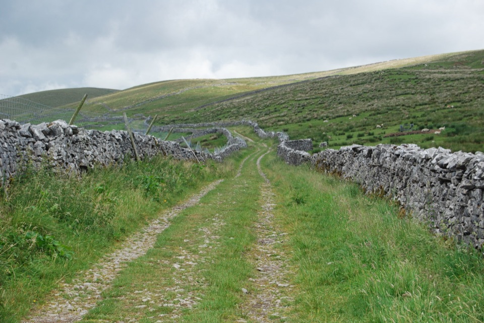
The southern miles are lowland and tidal: saltmarsh, embankments and a broad river corridor around Longton and Preston, including a public footpath connector at the start. The middle stretch settles into riverside paths and lanes through Ribchester, Clitheroe and other Ribble valley villages. Further north the valley narrows into limestone country around Settle, Stainforth, Helwith Bridge and Horton-in-Ribblesdale. The final section climbs into open moorland at Gayle Moor, with views toward the Yorkshire Three Peaks and the Ribblehead Viaduct.
Independent route descriptions put the full walk at roughly 25 to 32 walking hours across 3 to 6 days. Faster schedules mean long days with few natural breaks; longer schedules let you match stages to villages. This is a sustained undertaking, not a casual day hike, and the accumulated mileage matters more than any single climb.
Expect a mix of public footpaths, grassy tracks, surfaced paths, farm lanes and some road walking, with frequent gates and stiles. Ground can be uneven, wet or muddy, and limestone underfoot is awkward when damp. The route is waymarked with blue-and-white RW wave markers, but carry a current OS map or GPX: long-distance decision points, field crossings and local path diversions are easier to handle with your own navigation. Check current access information before you set out.
Because the route runs one way, plan transport or accommodation between stages before you start. Longton is the traditional southern start and Gayle Moor is the northern finish; neither should be treated as a dedicated trailhead with parking. Several valley settlements along the way have public transport, but do not assume a continuous transport solution links every stage end. No special permit is established for the route.
Some northern sections are remote and exposed, particularly on the moors near the finish, where shelter and escape options thin out. Elsewhere the durable concerns are stream and river crossings, boggy ground, stiles and slippery limestone. There are stretches of narrow road without pavement near Ribchester where traffic awareness matters. The route crosses working farmland, so dogs need close control and should be leashed around livestock.
A day out in Ribblesdale, around Settle, Stainforth or Horton-in-Ribblesdale, samples the most scenic limestone miles with easy returns and a single village base. It is a genuinely different experience from the full route, which is defined by the transition from tidal estuary to upland source and by the multi-day commitment that transition demands.
Wildlife
 10 sightingsEurasian OtterMost seen around 7 PMSighting map
 11 sightingsAtlantic SalmonMost seen around 7 AMSighting map
 12 sightingsShort-eared OwlMost seen around 7 PMSighting map
 22 sightingsWestern Barn OwlMost seen around 6 AMSighting map
 27 sightingsTawny OwlMost seen around 7 PMSighting map
 34 sightingsCommon KingfisherMost seen around 7 AMSighting map
Sighting maps show where each species has been reported across Yorkshire Dales. Wildlife moves, so no sighting is guaranteed.
Parkwolf’s Yorkshire Dales ranking

The audio tour guide for the drive, plus offline maps, trails, and wildlife heatmaps for when the signal drops.





