Pros & cons
PROS
- Wilderness permits and trip-planning help for the CA-120 corridor
- Clean restrooms and quick orientation stop
- Small Yosemite Conservancy bookstore
CONS
- Closed mid-October to late May; no canister rentals when closed
- Parking can be limited and crowded at peak times
- No food service on-site
Overview
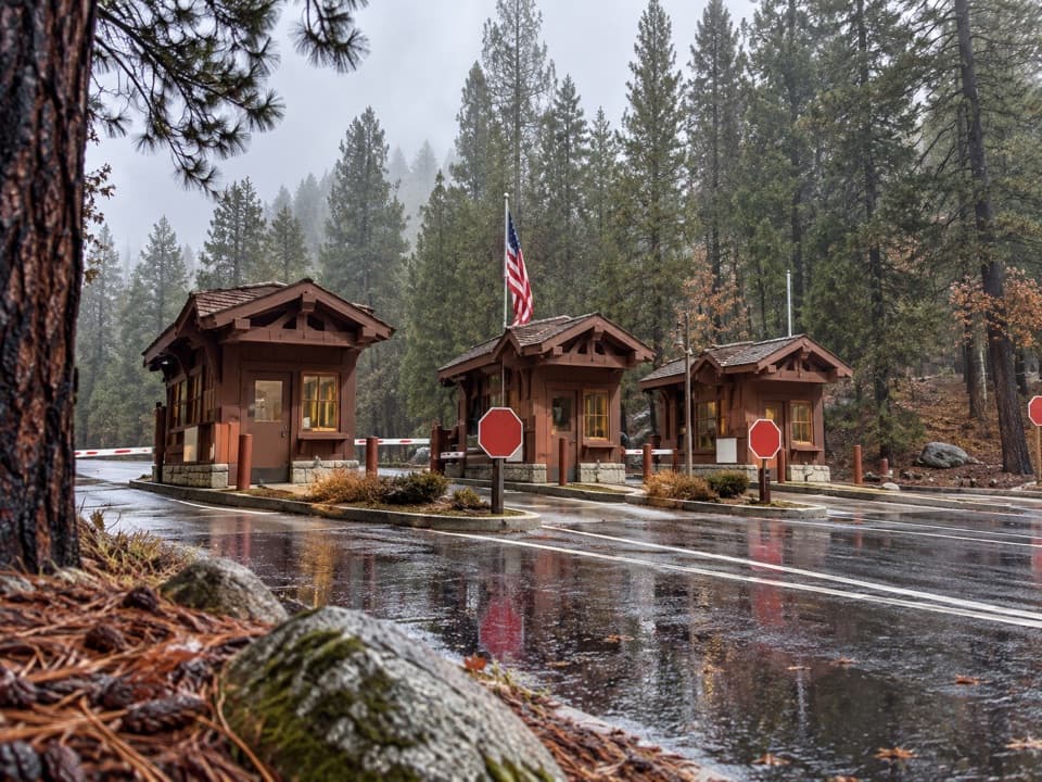
Just inside the Big Oak Flat (Highway 120) entrance, this compact info station is the first smart stop for maps, current conditions, and permits. Rangers here are great at tuning your plan to the day’s realities—road status, trail conditions, smoke or fire updates—so you don’t waste time backtracking. Expect a small Yosemite Conservancy bookstore, posted trip ideas, and clean restrooms. Plan 15–20 minutes if you’re efficient.
What You’ll Find
- Information desk with rangers for trip advice, road/trail conditions, and orientation across the Highway 120/Tioga Road corridor and beyond.
- Wilderness permit desk plus bear canister rentals when open; maps and a small bookstore/gift area.
- Restrooms and large orientation boards you can photograph if paper maps run out.
Permits and Seasonal Operations
- Open season typically runs daily 8 am–5 pm. It closes seasonally from roughly mid-October through late May.
- When closed, self-registration wilderness permits for Crane Flat and Tioga Road trailheads may be available on the porch—bring your own bear canister during this period.
- Trailhead quotas apply for overnight trips; day hikes generally don’t need permits (special cases exist). Ask a ranger to confirm.
Best Times to Visit
- Aim for right at opening (8 am) or after 3 pm for the smoothest experience. Mid-morning to early afternoon is the crunch, especially Saturdays.
- Weekdays are typically easier than weekends for both parking and desk time.
Handy Logistics
- There’s no food here. Top off supplies before entering or continue to Yosemite Valley.
- No gas at the entrance or station; the nearest is Crane Flat inside the park or in Groveland to the west.
- Cell service can be spotty—have your plan sketched out and take photos of posted maps.
Wildlife and Safety Basics
- Store all food and scented items properly and never feed wildlife.
- Drive cautiously at dawn/dusk when animals are most active; keep your distance and use a zoom for photos.
Where it is
37.8001, -119.8755Big Oak Flat Information Station
Tips for Big Oak Flat Information Station
- 01Arrive at 8 am or after 3 pm to avoid the mid-day crunch.
- 02If visiting in the off-season, bring your own bear canister for self-issued permits.
- 03Top off fuel before entering; nearest gas is at Crane Flat or in Groveland.
- 04Snap a photo of the big orientation boards in case paper maps run out.
- 05Ask about Tioga Road status, trail conditions, and air quality before finalizing plans.
Amenities
Near Big Oak Flat Information Station
All places →All trails →
0 mi awayBig Oak Flat Entrance StationWest-side gateway with quick access and a handy info stopEntrance Station
0.5 mi awayHodgdon Meadow CampgroundYear-round basecamp near Big Oak Flat, with flush toilets and shadeCampground · Restroom
1.1 mi awayCarlon Falls TrailShaded river stroll to a swim-friendly waterfall near Hwy 120Easy · 3.8 mi · 1.5 hr
1.8 mi awayCarlon FallsShaded river hike to a swim-friendly waterfallTrailhead · Parking
3.2 mi awayMerced Grove TrailQuietest giant sequoias—short hike, big trees, big calm.Moderate · 3 mi · 2.5 hr
4.1 mi awayCrane Flat LookoutHistoric fire lookout with wide-open views above Crane FlatTrailhead · Parking
4.8 mi awayTuolumne Grove Nature TrailA quieter sequoia grove with a steep climb back to the carModerate · 2.5 mi · 1.5 hr
8.3 mi awayPoopenaut Valley TrailYosemite’s steepest trail to a wild Tuolumne River meadowChallenging · 2.5 mi · 3.5 hr