Brent Crater Observation Tower in Algonquin Provincial Park

#9 of 28 sights in Algonquin

Sight · Algonquin Provincial Park

Brent Crater Observation Tower

See a meteorite crater from the tower or on a forested walk.

Type
Sight
Nearest trail
5 km
Audio stories
3 nearby
  • Parking
  • Exhibit
  • Scenic viewpoint

Hear the audio tour

Brent Crater Observation Tower

Overview

About Brent Crater Observation Tower

Why stop

  • The tower gives you the view; the loop adds a crater-floor perspective.

Heads up

  • Most of the crater is wooded, so its outline can be subtle from above.
The crater takes its name from the nearby village of Brent, once a divisional point on the Canadian National Railway's transcontinental line.
Parkwolf’s verdictWhy it's called Brent

Map

Where it is

Loading the Algonquin map
Full map
SightBrent Crater Observation Tower46.06651, -78.45824
Keep this map with you offline in the Parkwolf app

Plan your stop

Before you go

4 active Algonquin alerts

  • ClosureProvoking Falls Bridge ClosedThe Provoking Falls bridge on the Highland Backpacking Trail is closed because of safety concerns; the bridge has been removed. - Use the posted reroute, which adds 2.5 km.Official details
  • CautionLow Water on Backcountry Canoe RoutesOntario Parks currently lists low-water alerts for six backcountry canoe-route sections: - Varley Lake from Carl Wilson Lake - Latour Creek north of Rosebary Lake - Carcajou Creek north towards…Official details
See all 4 alerts
A park ranger sits on a dash-mounted phone, talking, as Parkwolf’s Tour Guide plays “Army Cutworm Moths: A Grizzly Bear Buffet” on Grand Loop Road below Dunraven Pass in Yellowstone
Parkwolf Tour GuideThe highest, rockiest slopes around here are a summer buffet for grizzly bears.

Algonquin Tour Guide

Your drive to Brent Crater Observation Tower, narrated.

Parkwolf is a GPS audio tour guide for Algonquin Provincial Park. As you drive, it chimes in with what’s ahead: hidden gems, upcoming stops, history, geology, and wildlife, right through your car’s speakers.

See the Algonquin audio tour

Recorded for this place

Brent Crater Observation Tower
0:00 / 0:30
“Up ahead is Brent Crater's observation tower, where you can look into the remains of a meteorite impact. I'd stop for the tower even if you don't want a hike; it has its own small roadside parking area.”

Plays as you drive up to Brent Crater Observation Tower in the Parkwolf Algonquin Tour Guide.

More stories near here in the app

  • A Beaver's Underwater Pantry
  • Count the Carry, Too
  • Drilling into Brent's Past
  • Brent and Cedar Lake
  • 107 audio storiesacross Algonquin’s roads, triggered by GPS as you drive
  • Wildlife heatmapsfor Moose, Eastern Wolf, Black Bear, and 13 more
  • Works offlinemaps, 39 trails, 66 places, and audio download before you lose signal
  • CarPlay readysimple controls built for the drive
★★★★★
“Fantastic app with many points of information… It’s great to just turn on while you’re driving and it gives you an audio tour of the national Park. We love it!!!!”
JMJamesApp Store review
Download Parkwolf on the App StoreGet Parkwolf on Google Play

4.7 from 8,600+ ratings

Guide

More about Brent Crater Observation Tower

A quick view or a 2 km loopThe Brent Crater Observation Tower is a raised viewpoint over the wooded rim of Algonquin's…

The Brent Crater Observation Tower is a raised viewpoint over the wooded rim of Algonquin's impact crater, with interpretive panels about how it was found. I'd stop if you're already driving Brent Road through this part of the park; the tower has its own small roadside lot, so you can see the basin without walking the full route. The moderate 2 km loop descends to the crater's present floor and climbs back to the tower. The trail requires a valid park permit.

The tower lot is at Brent Road km 32, about 32 km south of Highway 17 and 8 km north of Cedar Lake–Brent Access Point. That's a long approach for one viewpoint, so it makes more sense as part of a drive through the park's northern interior than as a quick detour from the highway.

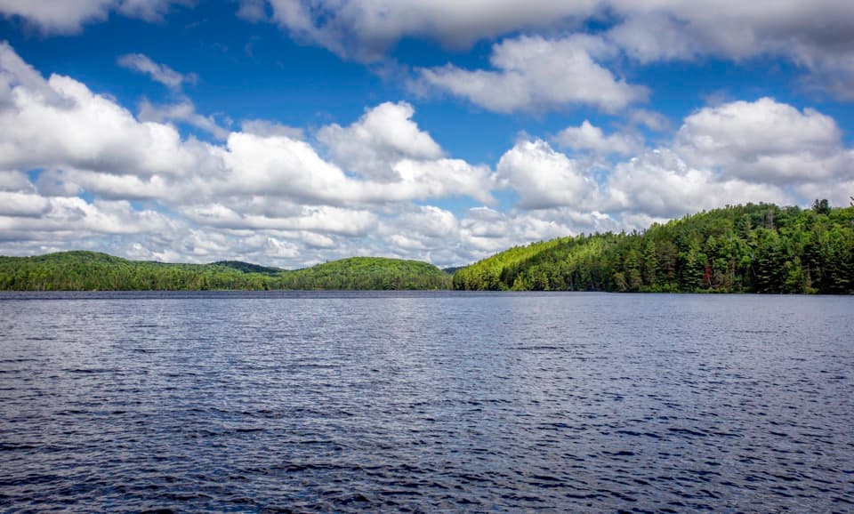
What the lookout showsThe crater remnant is a broad, forested basin, not a bare rock bowl.

The crater remnant is a broad, forested basin, not a bare rock bowl. Trees soften its circular outline, so the shape can be subtle from the tower. Tecumseh and Gilmour lakes form a semicircle within the depression, a clue to the crater's outline from above.

For a photo, keep the timber rail and some foreground canopy in the frame. They anchor the distant rim and make it clear you're looking out from the tower.

Found in the airAviation-company owner John A.

Aviation-company owner John A. Roberts first recognized the circular landform in high-altitude aerial photographs in 1951. Gilmour and Tecumseh lakes made a curved mark inside it. After he brought the pattern to astronomers and geologists, field teams studied the site over ten seasons, drilling 12 holes and recovering more than 5,000 metres of core.

A landscape reshapedThe original impact bowl has been heavily eroded and partly filled with sediment.

The original impact bowl has been heavily eroded and partly filled with sediment. Later, glacial ice removed much of that cover and gouged low areas that filled with water as the ice retreated about 11,000 years ago. Those depressions became Gilmour and Tecumseh lakes.

Wildlife

Wildlife in Algonquin

All Algonquin wildlife maps

Sighting maps show where each species has been reported across Algonquin. Wildlife moves, so no sighting is guaranteed.

Parkwolf’s Algonquin ranking

Top sights in Algonquin

All 66 places
  1. 1Barron Canyon LookoutSight
  2. 2Algonquin Logging MuseumSight
  3. 3Lake Opeongo Access Point and Opeongo StoreSight
  4. 4Canoe Lake Access Point and Portage StoreSight
  5. 5Booth's Rock LookoutSight
  6. 6LookoutSight

Take Parkwolf to Algonquin.

The audio tour guide for the drive, plus offline maps, trails, and wildlife heatmaps for when the signal drops.

4.7 from 8,600+ ratings

Download Parkwolf on the App StoreGet Parkwolf on Google Play