
Place
Moderate
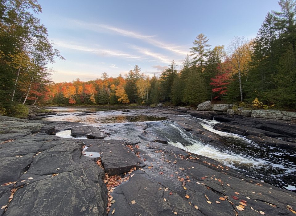
This is the classic day hike to Algonquin’s famed natural waterslide on the Barron River. The path winds through mixed forest to broad, water‑polished granite slabs that pour into deep, calm pools. Expect an easy–moderate walk with a short rocky, bouldery finale near the water. Standard distance is about 5.6 miles total (out and back); a shorter variant exists but the full out‑and‑back is the better experience if you’ve come for the slide and views.
You’ll follow a generally clear forest trail with roots and rocks, gentle grades, and some elevation changes. Near the end, the terrain shifts to granite bedrock and large boulders as you reach the slide area; take your time here. In low water, you can rock‑hop across the river in a few spots for different vantage points. Markings can be weak—download an offline map before you go.
The payoff is classic Canadian Shield scenery: the Barron River doglegs over smooth granite into sunny pools ideal for lounging and, when flows are right, sliding. The actual High Falls are downstream and worth a look from safe viewpoints; the waterslide and the brink of the main falls are distinct features. On longer trips via the Eastern Pines Backpacking Trail you’ll encounter impressive glacial boulders and more shield bedrock.
April through November is prime; summer brings warm water and the best sliding, along with the biggest crowds. Go mid‑week or shoulder season for quieter rock terraces and easier parking. Start early for softer light on the granite and more room at the pools. Roads to the Achray side can be seasonally gated—check access and build in extra time if gates are closed.
The waterslide is moving water: scout for hazards, supervise kids, and consider a compact PFD for sliding—especially for children. Do not swim near the main High Falls, which is roughly 100 meters downstream from the slide. Poison ivy is common along trails and shorelines; learn to spot it. Mosquitoes can be abundant—pack repellent. A day‑use vehicle permit is required; reservations are recommended in peak season. Backcountry campsites sit a short walk from the slide, with more interior sites on nearby lakes and developed sites at Achray if you’d rather frontcountry camp.
Drive Barron Canyon Road past Sand Lake Gate; about 13 km beyond the gate, turn left on a short dirt road just past the Brigham Lake access to reach the trail parking. If navigation apps struggle, search for “Achray Access Point.” Important: there’s another “High Falls” in the South Algonquin area on the York River—that’s a different place entirely.
Yes. It’s one of the park’s most fun day hikes: pleasant forest walking plus unique river‑over‑granite scenery and a natural waterslide. Go prepared and you’ll have a memorable day. If you want more mileage and solitude, link time here with the Eastern Pines Backpacking Trail.
From Sand Lake Gate, drive ~13 km on Barron Canyon Road and turn left on a short dirt road just past the Brigham Lake access to a small lot. A day‑use vehicle permit is required; some visitors report straightforward parking and occasional facilities. If your GPS struggles, search for “Achray Access Point.”
Treat the waterslide like moving water—scout first, supervise children, and consider PFDs for sliding. Do not swim near the main High Falls (~100 m downstream). Watch for poison ivy, slick granite, bouldery footing near the end, mosquitoes, and occasional weak trail markings. Seasonal gates can add approach distance.
Place
Place
Place
Place
Easy
Challenging
Moderate
Moderate

Parkwolf Tour Guide
