Pros & cons
PROS
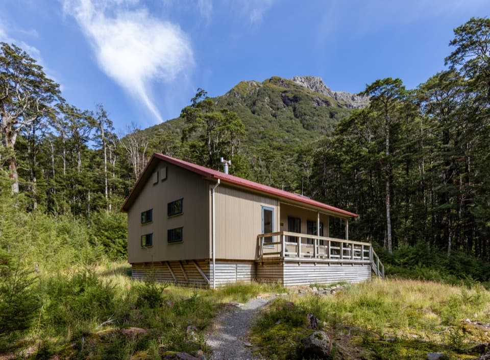
- Clean, modern 20‑bunk hut with two bunk rooms and a wood stove
- Big valley views and a relatively gentle 9–10 km approach in good conditions
CONS
- Multiple river crossings that become hazardous after rain
- No running water indoors; treat or boil water from the outdoor tank tap
Overview
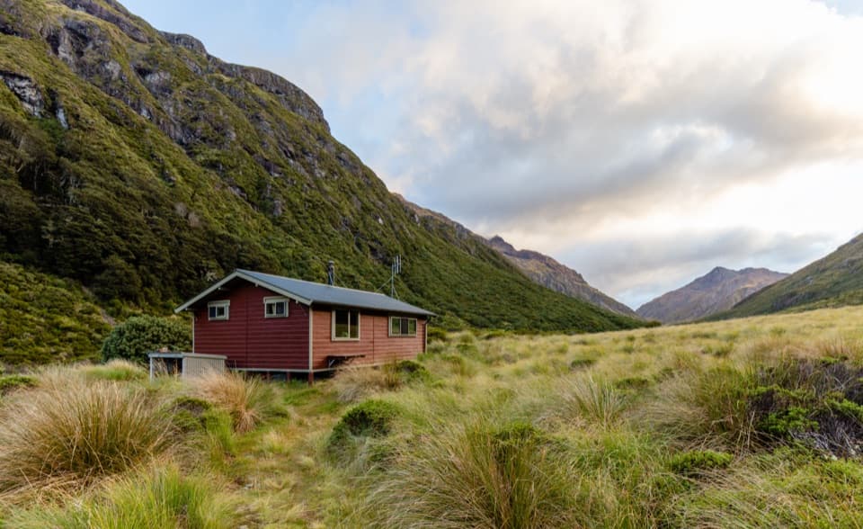
Hawdon Hut is a newer, serviced backcountry hut set on open river flats with big views up the Hawdon Valley. It replaced an older hut that burned down and now serves as a comfortable base with 20 bunks, making it a popular first hut for families and newer trampers in settled weather.
The Walk In
Most parties start from Hawdon Shelter and follow the valley floor to the hut. Expect multiple compulsory river crossings; in low flows it can feel straightforward and relatively flat, but rising water quickly changes the game. Reported travel times range from about 2 hours for fast trampers to roughly 3–4 hours for typical parties, and around 5.5 hours return for a brisk day trip.
Facilities
Inside you’ll find 20 bunks with mattresses split across two bunk rooms, a spacious kitchen–dining area, and a closed fire/wood stove with a woodshed. There are toilets on site. Water is roof‑collected into a tank with a tap outside (there’s no running water inside), so plan to treat or boil it. A hut radio links to the Arthur’s Pass Visitor Centre.
Wildlife
This valley is important habitat for the endangered kākāriki/orange‑fronted parakeet. You’ll see various coloured tapes and markers used for conservation work—ignore those and follow only the standard orange track markers.
Safety & Planning
Rivers and side streams here rise fast. Do not attempt the trip during or right after heavy rain. Be ready to walk upstream or downstream from markers to find the safest ford, and carry extra food in case high water strands you at the hut. Treat water, and arrive with layers for cold nights; in winter, a damp wood supply can make heating less effective.
Classic Options
- Out‑and‑back to Hawdon Hut: a rewarding overnight or solid day trip in settled weather.
- Hawdon–Edwards through‑route (advanced): via Walker Pass and Tarn Col to Edwards Hut before exiting the Edwards Track; steep, rough terrain and river travel make this one for experienced parties only.
Best Time to Visit
Aim for a settled spell. Early February has been reported with low river levels (even rock‑hoppable in places), while winter can be very cold and harder to heat. Fine weather days draw more people—on busy days the trailhead car park can fill with a dozen cars or more.
Where it is
-42.9111, 171.7327Tips for Hawdon Hut
- 01Check the forecast and skip this trip during or right after heavy rain.
- 02Follow orange DOC markers only; ignore pink, yellow and blue conservation tapes.
- 03Carry extra food in case rising rivers delay your exit.
- 04Treat or boil the tank water and don’t expect an indoor tap.
- 05In low summer flows some crossings may be rock‑hoppable, but be prepared to ford.
Amenities
Near Hawdon Hut
All places →All trails →
2.4 mi awayHawdon RiverAlpine river valley with big scenery and serious crossingsTrailhead · Parking
4.2 mi awayWoolshed HillQuick, steep climb to sweeping Hawdon and Waimakariri viewsTrailhead · Parking
4.5 mi awayLake MavisHigh alpine lake above Goat Pass with rewarding wild campingTrailhead · Restroom
4.7 mi awayEdwards HutClassic 16‑bunk hut reached via river crossings and tussock flatsLodging · Restroom
5.3 mi awayWoolshed Hill TrackSteep beech forest climb to big valley views and a topside tarn.Challenging · 5 mi · 5 hr
8.8 mi awayTemple Basin TrackShort, steep climb to big alpine views and a quirky ski basin shelterModerate · 3.1 mi · 2.8 hr
8.8 mi awayEdwards Hut RouteRugged river-valley tramp to a classic backcountry hutChallenging · 5.9 mi · 5 hr
8.8 mi awayOld Coach RoadQuick beech-forest loop on the 1860s road over Arthur’s PassEasy · 0.9 mi · 30 min