Ōtira Gorge Rock Shelter Lookout in Arthur's Pass National Park

#6 of 17 sights in Arthur's Pass

Sight · Arthur's Pass National Park

Ōtira Gorge Rock Shelter Lookout

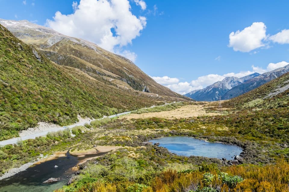
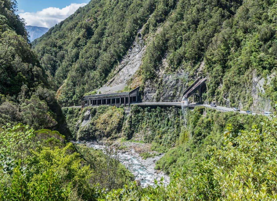
A quick pull-in for the rockfall shelter and Reid Falls aqueduct.

Photo: Wikimedia Commons
Type
Sight
Nearest trail
2 km
Audio stories
4 nearby
  • Parking
  • Scenic viewpoint

Hear the audio tour

Ōtira Gorge Rock Shelter Lookout

Overview

About Ōtira Gorge Rock Shelter Lookout

Why stop

  • An unusual close look at the engineering protecting SH73 through the gorge.

Heads up

  • The small highway-side pull-in can feel tight to enter or park in.

Map

Where it is

Loading the Arthur's Pass map
Full map
SightŌtira Gorge Rock Shelter Lookout-42.88098, 171.55561
Keep this map with you offline in the Parkwolf app

Plan your stop

Before you go

2 active Arthur's Pass alerts

  • CautionFlood damage and rockfall risk on Harper Pass RouteFlood damage and an active slip affect the Harper Pass Route below Kiwi Hut and near Locke Stream Hut.Official details
  • CautionFlood damage on route to Sudden Valley BivvySignificant flood damage makes the route to Sudden Valley Bivvy passable only when rivers are low.Official details

Arthur's Pass alerts
A park ranger sits on a dash-mounted phone, talking, as Parkwolf’s Tour Guide plays “Army Cutworm Moths: A Grizzly Bear Buffet” on Grand Loop Road below Dunraven Pass in Yellowstone
Parkwolf Tour GuideThe highest, rockiest slopes around here are a summer buffet for grizzly bears.

Arthur's Pass Tour Guide

Your drive to Ōtira Gorge Rock Shelter Lookout, narrated.

Parkwolf is a GPS audio tour guide for Arthur's Pass National Park. As you drive, it chimes in with what’s ahead: hidden gems, upcoming stops, history, geology, and wildlife, right through your car’s speakers.

Recorded for this place

Ōtira Gorge Rock Shelter Lookout
0:00 / 0:29
“Ōtira Gorge Rock Shelter Lookout is ahead, a quick pull-in for a closer look at how this road copes with the mountains.”

Plays as you drive up to Ōtira Gorge Rock Shelter Lookout in the Parkwolf Arthur's Pass Tour Guide.

More stories near here in the app

  • Ōtira Viaduct Lookout
  • Ōtira Valley Track
  • The Railway Through the Mountain
  • Temple Basin and Dobson Nature Walk
  • 42 audio storiesacross Arthur's Pass’s roads, triggered by GPS as you drive
  • Wildlife heatmapsfor Kea, New Zealand Falcon, Blue Duck, and 13 more
  • Works offlinemaps, 49 trails, 59 places, and audio download before you lose signal
  • CarPlay readysimple controls built for the drive
★★★★★
“Fantastic app with many points of information… It’s great to just turn on while you’re driving and it gives you an audio tour of the national Park. We love it!!!!”
JMJamesApp Store review
Download Parkwolf on the App StoreGet Parkwolf on Google Play

4.7 from 8,600+ ratings

Guide

More about Ōtira Gorge Rock Shelter Lookout

A roadside look at the gorge engineeringThis is a short roadside viewpoint on State Highway 73, looking across Ōtira Gorge to the…

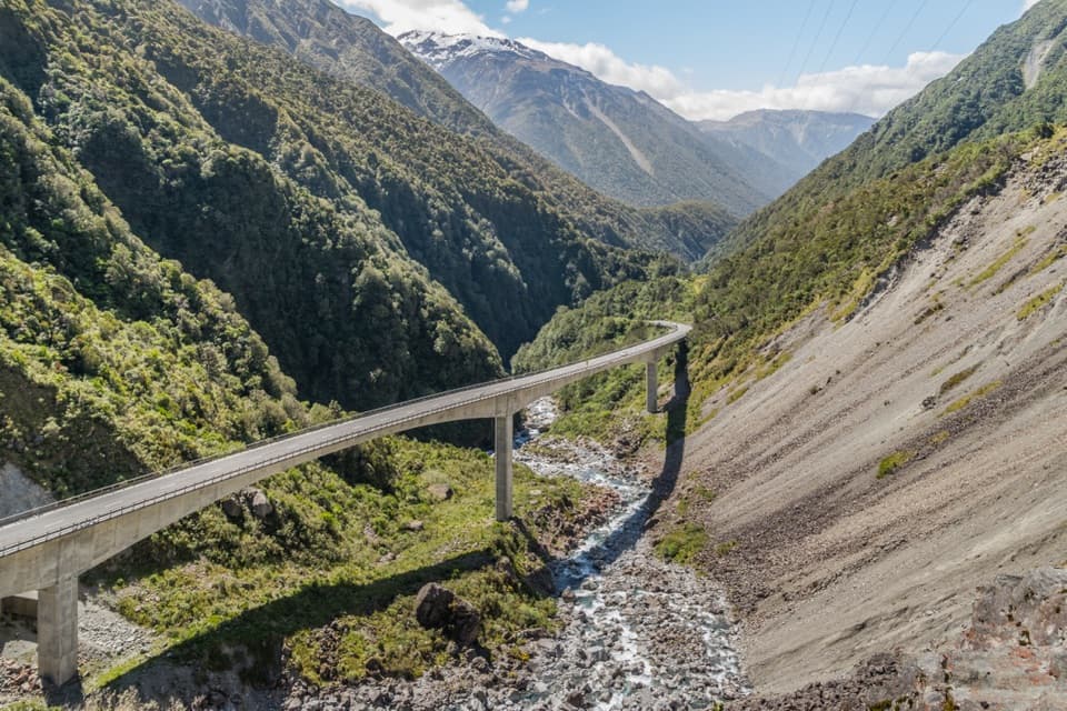
This is a short roadside viewpoint on State Highway 73, looking across Ōtira Gorge to the rockfall shelter and Reid Falls aqueduct. It’s a quick pull-in rather than a walk. Stop if you’re curious about the structures built into this narrow stretch of road; the nearby Deaths Corner lookout is a separate stop for the viaduct and old road.

Make the pull-in workThere’s a small surface parking area beside the highway.

There’s a small surface parking area beside the highway. A few visitors describe the turn-in or parking as tight, so keep this as a brief stop and take care as you enter and leave. Treat it as a view stop: toilets and drinking water weren’t documented at the pull-in.

Why the road needs a shelterRockfall has threatened this route since the road was first built in the 1860s.

Rockfall has threatened this route since the road was first built in the 1860s. The long shelter catches and deflects falling material; thick foam pads beneath its roof absorb impacts, while fines and scree accumulated inside help send debris down into the gorge.

The 1994 earthquakeThe earthquake made the rockfall problem worse.

The earthquake made the rockfall problem worse. Debris blocked the highway and dammed the Ōtira River, a vivid reminder of how quickly slope movement can affect this narrow corridor.

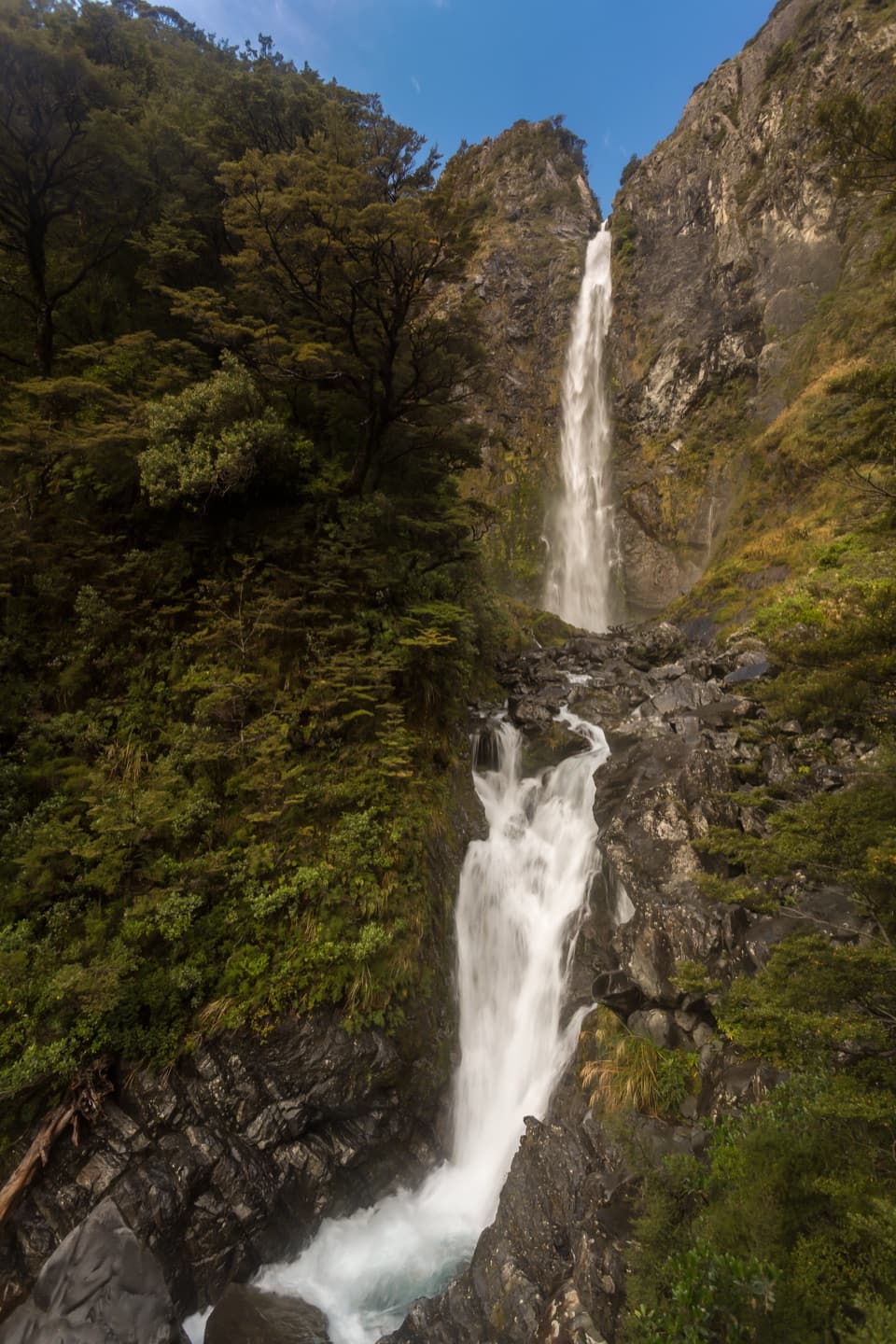
Reid Falls and the aqueductThe aqueduct carries heavy-rain water away from the road.

The aqueduct carries heavy-rain water away from the road. A vertical screen was later added because wind could blow water from Reid Falls onto the highway, where it could freeze in winter.

Wildlife

Wildlife in Arthur's Pass

All Arthur's Pass wildlife maps

Sighting maps show where each species has been reported across Arthur's Pass. Wildlife moves, so no sighting is guaranteed.

Keep exploring

Near Ōtira Gorge Rock Shelter Lookout

See it all on the map

Trails nearby

More stops nearby

Parkwolf’s Arthur's Pass ranking

Top sights in Arthur's Pass

All 59 places
  1. 1Devils Punchbowl FallsSight
  2. 2Ōtira Viaduct LookoutSight
  3. 3Avalanche PeakSight
  4. 4Jacks HutSight
  5. 5Arthur’s Pass ChapelSight
  6. 7Bridal Veil Falls LookoutSight

Take Parkwolf to Arthur's Pass.

The audio tour guide for the drive, plus offline maps, trails, and wildlife heatmaps for when the signal drops.

4.7 from 8,600+ ratings

Download Parkwolf on the App StoreGet Parkwolf on Google Play