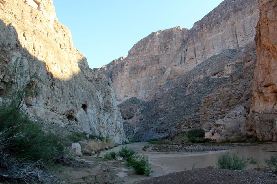
Camel Experiment Exhibit in Big Bend National Park

Sight · Big Bend National Park

Camel Experiment Exhibit

A roadside sign tells a surprisingly practical camel story.

Photo: National Park Service
Type
Sight
Nearest trail
Right here
Audio stories
3 nearby
  • Pullout
  • Exhibit
  • Parking
  • Scenic viewpoint

Hear the audio tour

Dog Canyon and the Camel Experiment

Overview

About Camel Experiment Exhibit

Why stop

  • A vivid Army-camel story tied to the exact route through Big Bend.

Heads up

  • The exhibit is a brief roadside stop on its own.

Map

Where it is

Loading the Big Bend map
Full map
SightCamel Experiment Exhibit29.62260, -103.14293
Keep this map with you offline in the Parkwolf app

Plan your stop

Before you go

2 active Big Bend alerts

  • ClosureWeather-related road closuresDo not use these closed roads; NPS lists the closures as in effect until further notice.Official details
  • InfoBoquillas Crossing schedule changeBoquillas Crossing is open Friday through Monday, 9:00 a.m.–4:00 p.m.; NPS says it will not change to winter hours at this time. Check current park conditions before planning a crossing.Official details

Big Bend alerts
A park ranger sits on a dash-mounted phone, talking, as Parkwolf’s Tour Guide plays “Army Cutworm Moths: A Grizzly Bear Buffet” on Grand Loop Road below Dunraven Pass in Yellowstone
Parkwolf Tour GuideThe highest, rockiest slopes around here are a summer buffet for grizzly bears.

Big Bend Tour Guide

Your drive to Camel Experiment Exhibit, narrated.

Parkwolf is a GPS audio tour guide for Big Bend National Park. As you drive, it chimes in with what’s ahead: hidden gems, upcoming stops, history, geology, and wildlife, right through your car’s speakers.

See the Big Bend audio tour

Recorded for this place

Dog Canyon and the Camel Experiment
0:00 / 0:31
“Up ahead is the Dog Canyon pullout and Camel Experiment Exhibit, a quick stop with an unusual bit of Army history.”

Plays as you drive up to Camel Experiment Exhibit in the Parkwolf Big Bend Tour Guide.

More stories near here in the app

  • Candelilla’s Wax Trade
  • Lechuguilla’s One Bloom
  • Persimmon Gap Visitor Center
  • The Smell of Desert Rain
  • 110 audio storiesacross Big Bend’s roads, triggered by GPS as you drive
  • Wildlife heatmapsfor Black Bear, Collared Peccary, White-tailed Deer, and 13 more
  • Works offlinemaps, 45 trails, 64 places, and audio download before you lose signal
  • CarPlay readysimple controls built for the drive
★★★★★
“Fantastic app with many points of information… It’s great to just turn on while you’re driving and it gives you an audio tour of the national Park. We love it!!!!”
JMJamesApp Store review
Download Parkwolf on the App StoreGet Parkwolf on Google Play

4.7 from 8,600+ ratings

Guide

More about Camel Experiment Exhibit

A quick stop with a real storyThe Camel Experiment Exhibit is a roadside wayside about the U.S.

The Camel Experiment Exhibit is a roadside wayside about the U.S. Army’s camel expeditions through Big Bend. It stands 4.5 miles south of Persimmon Gap Entrance, on the road to Panther Junction. The sign and open desert view make this a short stop on their own; the pullout also serves the separate Dog Canyon and Devil’s Den trailheads. NPS suggests the half-day Dog Canyon hike from here during cooler months.

Why the Army brought camelsAt Jefferson Davis’s urging, the Army brought camels to Texas in 1856 to test whether they…

At Jefferson Davis’s urging, the Army brought camels to Texas in 1856 to test whether they could carry supplies across the dry, rough Southwest. The Big Bend account gives them an impressive résumé: loads of more than 400 pounds, at least 72 hours without water, and creosotebush for food. Lieutenant Edward Hartz reported days of 20 to 34 miles over difficult ground, taking about 60 percent of the time men and horses needed.

Two expeditions through Big BendIn 1859, Lieutenants William Echols and Edward Hartz traveled south from Camp Stockton through…

In 1859, Lieutenants William Echols and Edward Hartz traveled south from Camp Stockton through Persimmon Gap and down Tornillo Creek to the Rio Grande. They spent a week exploring between Boquillas and Mariscal canyons. The second survey, in 1860, crossed by Fort Davis, Presidio del Norte and Santa Elena Canyon before reaching Alamo Creek, where Echols chose a site for a fort. The Civil War and a growing railroad brought the camel experiment to an end.

Look beyond the signThe view faces east across flat desert toward a mountain ridge about two miles away, split by a…

The view faces east across flat desert toward a mountain ridge about two miles away, split by a canyon. On the left cliff face, look for a pale limestone scar left by a 1987 rockfall. For a photo, keep the sign low in the frame with the ridge and canyon behind it; that shows both the exhibit and the country the camels crossed.

Wildlife

Wildlife in Big Bend

All Big Bend wildlife maps

Sighting maps show where each species has been reported across Big Bend. Wildlife moves, so no sighting is guaranteed.

Parkwolf’s Big Bend ranking

Top sights in Big Bend

All 64 places
  1. 1Santa Elena CanyonSight
  2. 2Sotol VistaSight
  3. 3Fossil Discovery ExhibitSight
  4. 4Window ViewSight
  5. 5Boquillas CanyonSight
  6. 6Langford Hot SpringsSight

Take Parkwolf to Big Bend.

The audio tour guide for the drive, plus offline maps, trails, and wildlife heatmaps for when the signal drops.

4.7 from 8,600+ ratings

Download Parkwolf on the App StoreGet Parkwolf on Google Play