
Place
Challenging
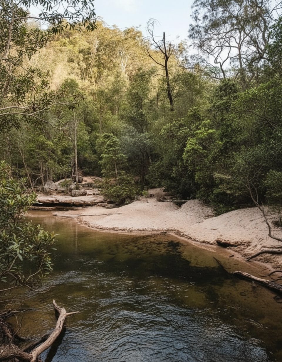
A lush, creek-hugging bushwalk, the Sassafras Gully Loop is a 10.5 km (6.5 mi) total loop from Springwood that trades big views for intimate rainforest ambience. Expect cool shade, sandstone overhangs, cascades, and constant birdsong. If you’re after an immersive Blue Mountains gully experience rather than cliff-top vistas, this is a gem.
The loop strings together Sassafras Gully Track, Victory Track and Magdala Gully Track, with a return climb often taken via Wiggins Track. You’ll follow Sassafras Creek (at times keeping it on your left), cross several creek junctions, pass a clearing beneath powerlines, and visit a waterfall named for Sir Henry Parkes’ first wife. A tranquil pool along Victory Track makes a fine wild-swim stop. Navigation is generally straightforward but pay attention at intersections—signage can be limited and not every junction explicitly says “loop.”
Rated Grade 4 (hard), this track is rough and steep in long stretches, with roughly 319 m of total ascent and descent, natural surfaces, exposed roots and rock, and unbridged creek crossings. Expect a few fallen trees or obstacles and unfenced edges. Phone signal is spotty down in the gully, so download a map and don’t bank on reception.
It’s a year‑round walk, and the dense canopy makes it ideal in warm weather. After rain, crossings and rocks get slick—beautiful, but slower and more serious. Go early for the best chance to spot lyrebirds and enjoy quieter tracks. If you’re night‑adapted and prepared, sections reveal glow worms after dark—but only attempt this with proper lights, navigation, and a confident group.
Wear sturdy footwear and pack enough water; the creeks aren’t for drinking. Mind the signposts at junctions and avoid the Faulconbridge turn-off unless you’re committing to the through‑walk variant. Bring a towel if you’re tempted by the swim; in cool weather, a warm layer is essential—the gully stays shaded and damp. Facilities are limited on track; plan toilets and supplies in Springwood.
You’re walking a slice of Springwood track‑building history. Wiggins Track dates to the late 1870s (reconstructed in 1907), and Sassafras Gully Road was added in 1890 to create a round‑trip—today’s loop echoes that early ambition. The scenery is classic Blue Mountains sandstone: weathered overhangs, creek‑cut gullies, and moisture‑loving rainforest that thrives in the sheltered valley.
Park at the end of Sassafras Gully Rd in Springwood, or arrive by train and walk from Springwood Station.
Grade 4 hard: steep, rough, minimally signed; unfenced edges and unbridged creek crossings that become slippery after rain; limited phone signal in the gully.
Place
Place
Place
Place
Challenging
Moderate
Challenging

Challenging

Parkwolf Tour Guide
